Rufabgo waterfalls. Organization of independent travel. Guide to cities and countries. Rufabgo waterfalls: practical information and photos.
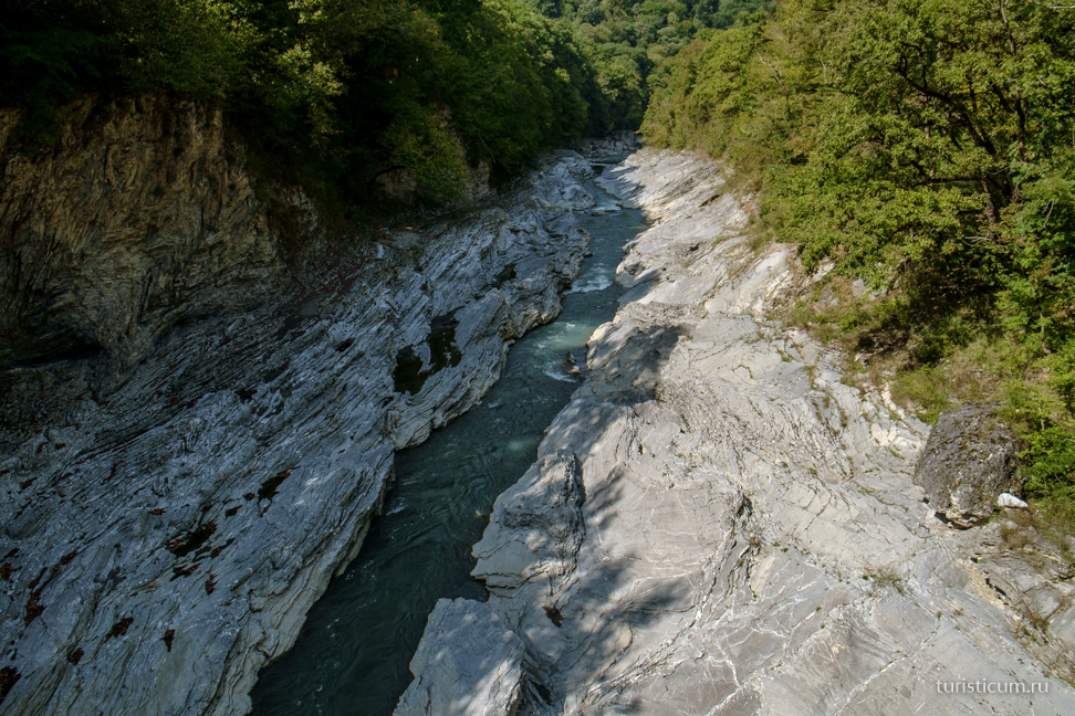
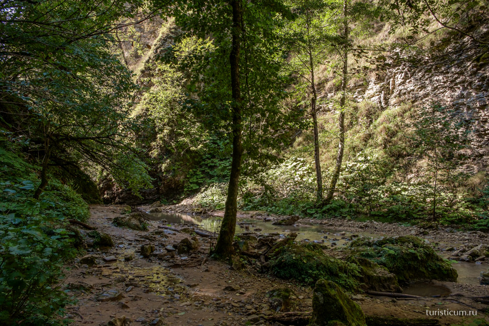
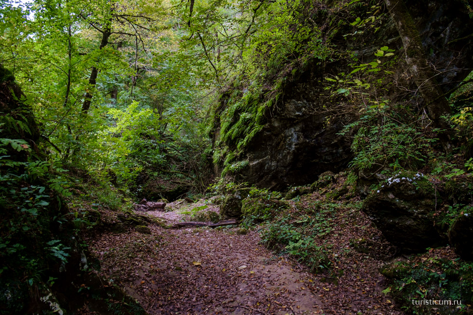
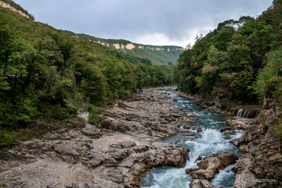
Rufabgo waterfalls are located in the gorge of the Rufabgo River, one of the tributaries of the river. These waterfalls are one of the most picturesque and famous attractions of the Republic of Adygea. In the lower part, the river flows in a deep gorge, surrounded by steep slopes, which at the top end in inaccessible sheer walls of rocks - it is this section of Rufabgo that is of greatest interest to tourists coming to Adygea. A few kilometers from here stands the village of Kamennomostsky, also known as Khadzhokh. This is where it starts most of tourist routes of the republic, including excursions to Rufabgo.
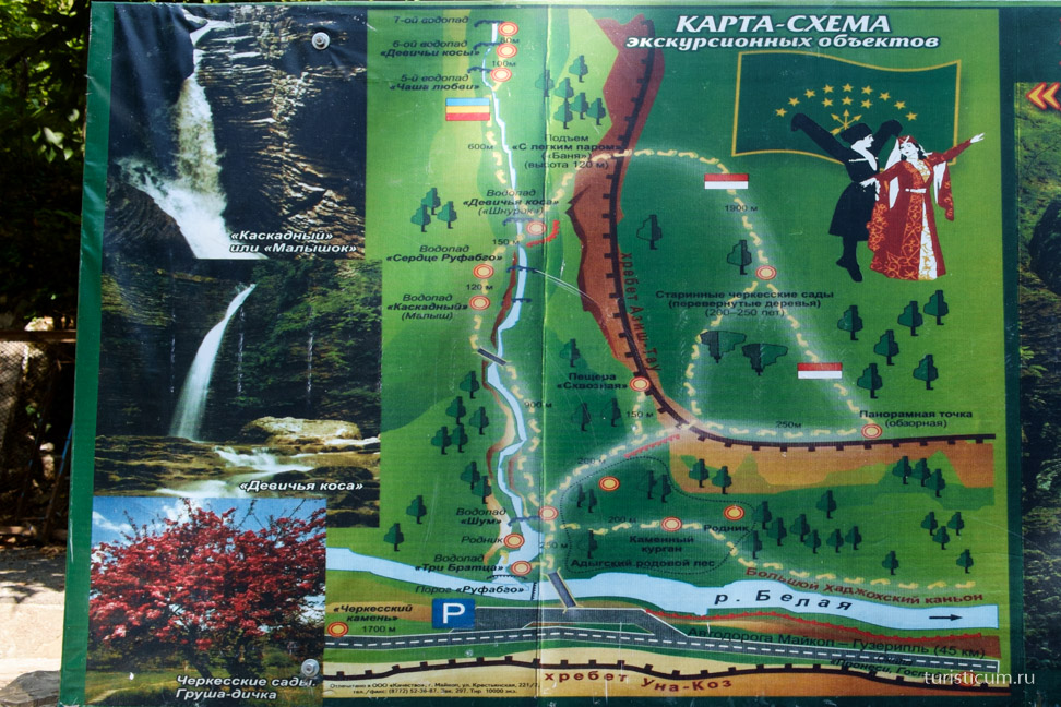
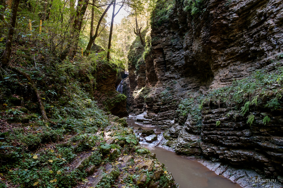
The section of the Rufabgo River that flows through a deep gorge surrounded by rocky slopes, which become inaccessible cliffs as the height increases, is extremely popular among tourists. There are a dozen waterfalls here, the most picturesque of which are such waterfalls as Lace, Bowl of Love, Heart of Rufabgo, Maiden Braids, Noise and Cascade.
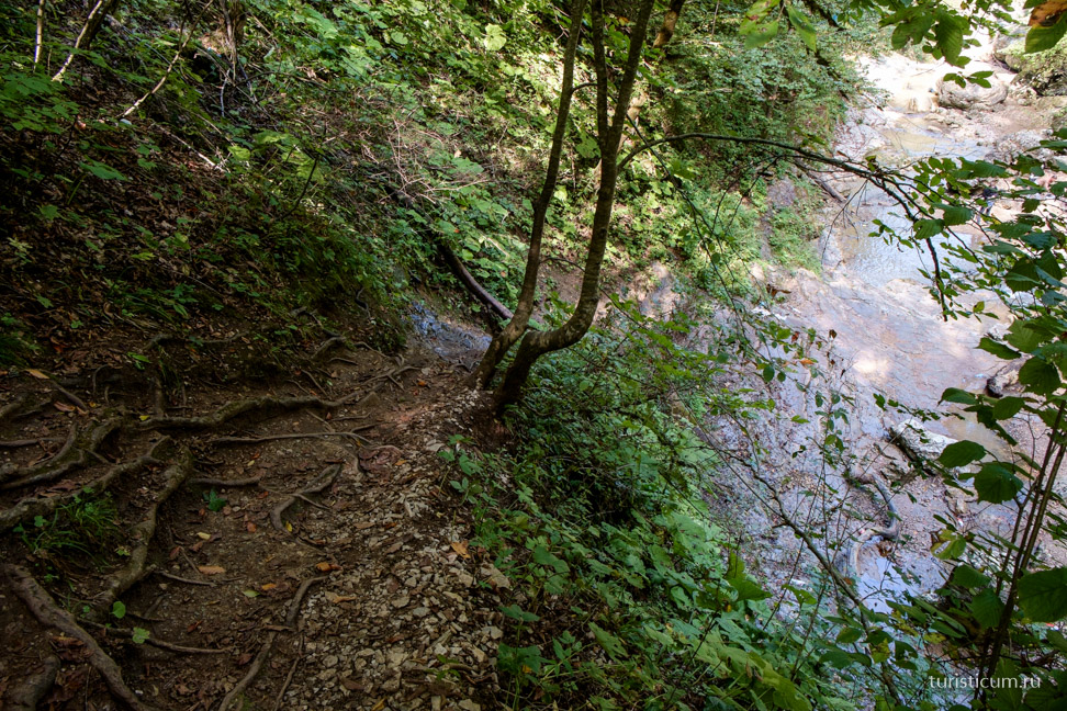
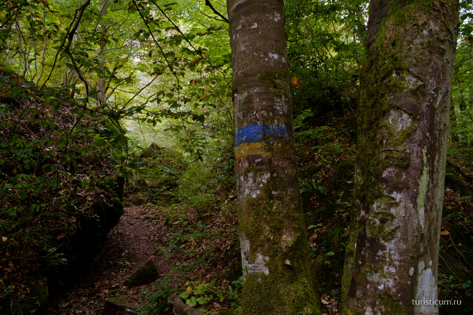
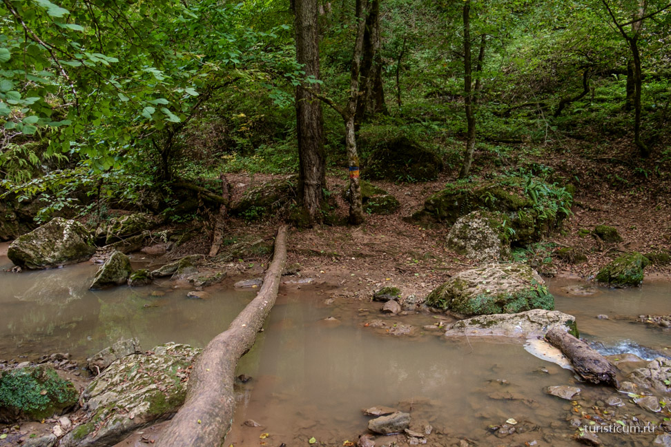
Along the stream to the fifth from the bottom waterfall “Maiden Spit” there is a excursion route. To its beginning, located at the mouth of the Big Rufabgo stream, leads pedestrian bridge, in front of which there is a parking lot along the highway on the bank of Belaya. There is a fee to cross the bridge. Those who want to explore the waterfalls for free can walk from the village of Kamennomostsky along the left bank of the river. In this case, they will also be introduced to other attractions of the area: the Turkish Bazaar, the Ancient Circassian Gardens and the Skvoznaya Cave. A marked path along a rather steep descent leads to the beginning of the excursion route.
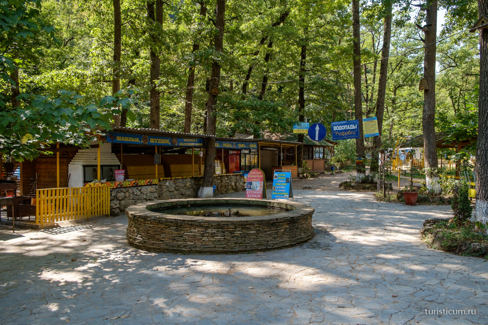
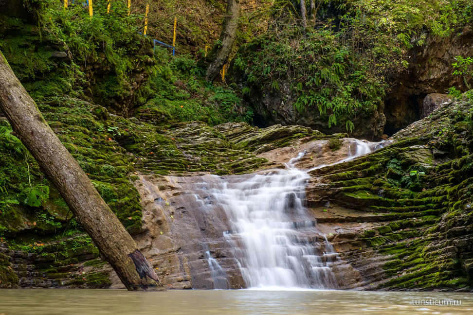
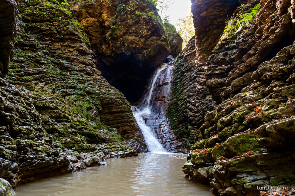
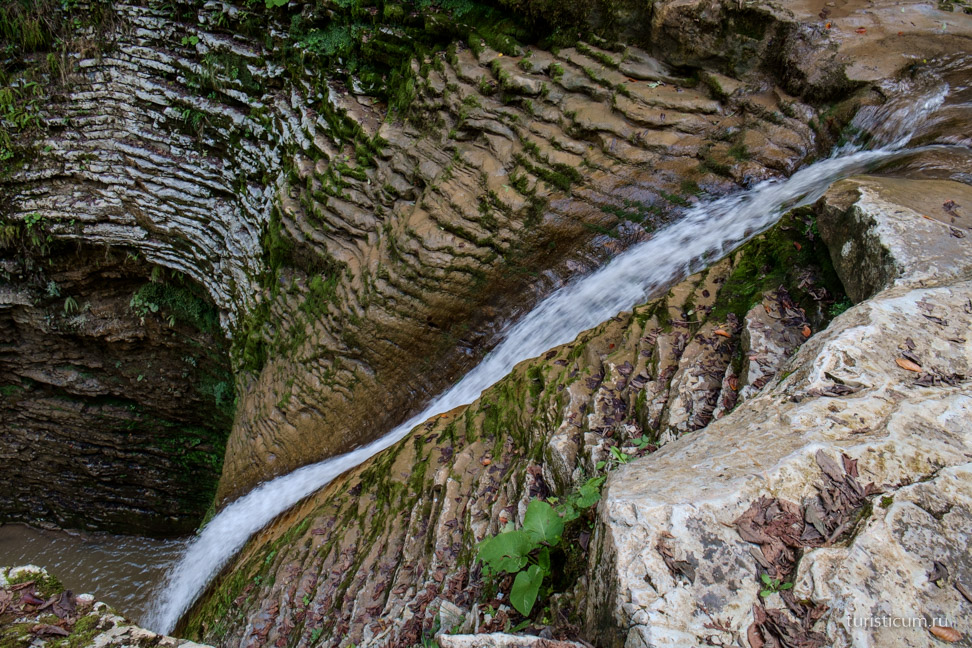
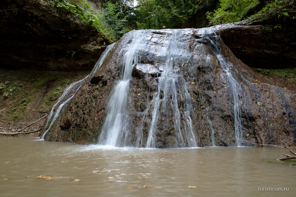
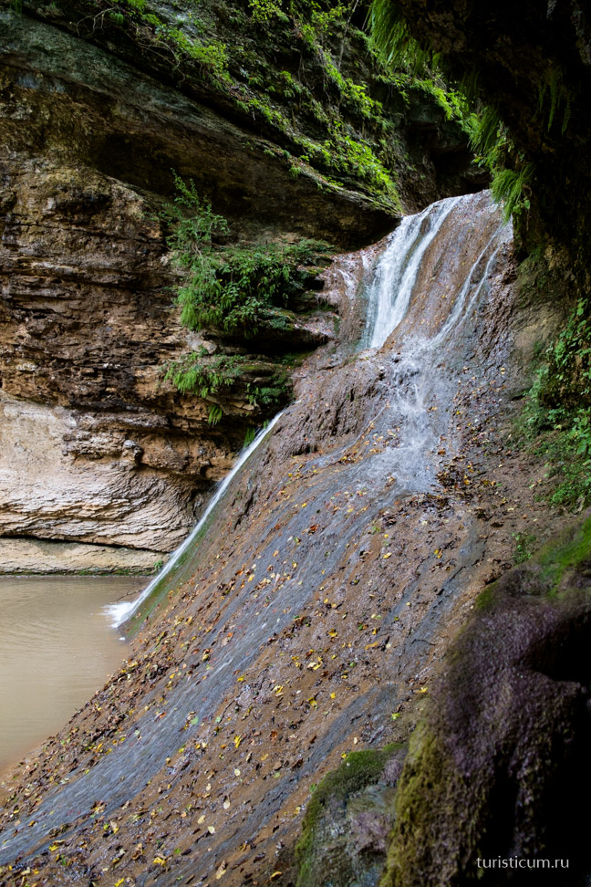
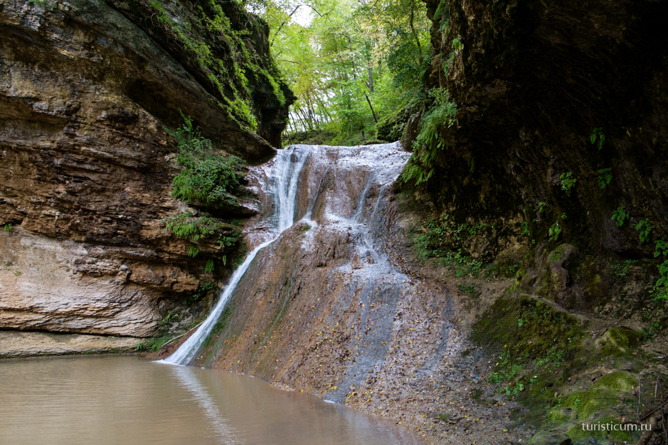
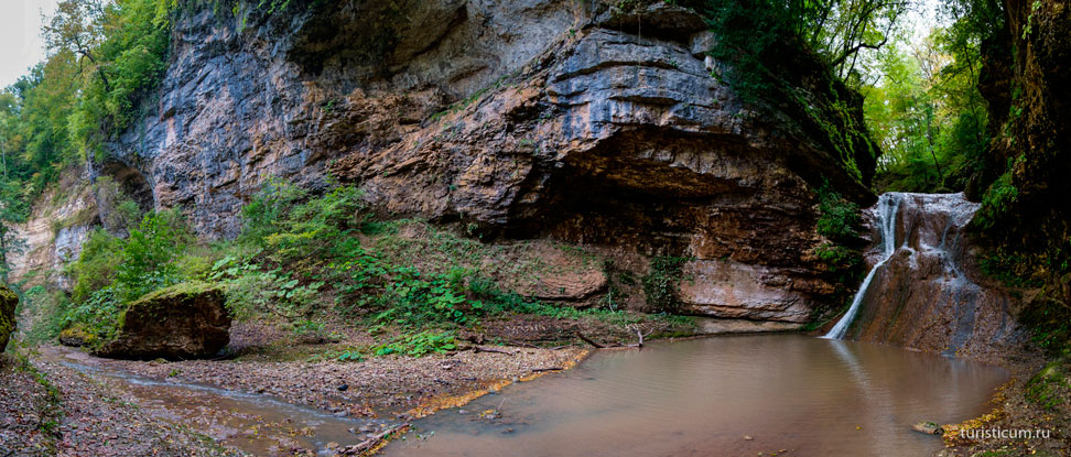
People usually don’t know about the first “Three Brothers” waterfall and pass by. The waterfall is located on the edge of the gorge, from which the Rufabgo stream falls down into Belaya. “Three Brothers” can be seen from the bridge (paid option). Behind this waterfall there is a cozy clearing with gazebos, souvenir shops, cafes and attractions. After passing through the clearing, you will see the first of the ten main waterfalls - the “Noise” waterfall. The waterfall can be heard from a distance. Dropping from a height of more than 6 meters, it forms a bowl of water, a resting place for tourists. The descent to the waterfall is equipped with a metal staircase with handrails. As you continue walking, you will soon hear a continuous stream of water falling from the slope, and then you will see the picture itself. It's small but extraordinary beautiful waterfall“Cascade”, consisting of several small steps. Undoubtedly, the most majestic of all the Rufabgo waterfalls is the third waterfall of the gorge, called the “Heart of Rufabgo”. It received this name for the shape of the rock, from under which a huge stream of cold water falls.
Here the section of the trail equipped for visitors ends and to see the rest of the waterfalls, you will have to climb 900 meters along a not so convenient trail. For those who overcome the difficult climb, the reward will be two waterfalls at once - “Maiden Braids” and “Cup of Love”. In this place, streams of the purest water flow from a height of five meters from the rocks into a bowl created by nature itself. And literally 40 meters from the “Chalice”, flowing in gentle curves, the waters of the river intertwine into the beautiful “Maiden Braids”. Next is another waterfall – “Lelkin”, but to get there you need to be a truly prepared tourist.
In total, the stream formed 16 waterfalls and many rapids of varying heights in the gorge, but not everyone decides to continue the route along an unequipped trail. The highest of the listed waterfalls, “Maiden Spit,” falls in a narrow stream from a height of about 15 m. The water cauldron under it is up to 10 meters wide, and the depth at the foot is up to 2 meters. In this bowl, the water is agitated and slowly spins, then reaches the edge of the underlying ledge and cascades down along the edges of thin layers of limestone. The Sukhoi and Grandiozny waterfalls reach a height of 20 and 15 meters, respectively. To complete the route and overcome the waterfalls, minimal climbing equipment is enough.
The Legend of Rufabgo and Hadjokh. Like any tourist attraction, Rufabgo waterfalls have their own beautiful legend. It says that in former times the valley of the Belaya River was chosen by an evil giant named Rufabgo, who possessed considerable physical and witchcraft strength. There lived a giant sorcerer in the Skvoznaya cave, located not far from the first waterfall. Here he drew his strength and maintained contact with evil spirits, thanks to which he managed to enslave many settlements in the Belaya River valley. From each village the evil giant Rufabgo took away the most beautiful girl, and he brutally dealt with the young men who tried to free them. So in one of the villages there lived a brave and slender young man Khadzhokh, who had a beloved girl. Khadzhokh knew that very soon Rufabgo would come for her.
To avoid this, the young man went to the mountains of Adygea in search of the good wizard Mezmay. Having found him, Khadzhokh learned that there is only one way to defeat the evil giant: by approaching the sorcerer from the windward side, you need to pour out the powder, the cloud that forms from it disorients the giant for a moment, and at that moment you need to take the heart out of his chest and throw it as far as possible. After listening carefully to the old man, the young man went to Rufabgo’s lair. Having found the giant, the hero invited him to fight, but the giant, hearing this, only laughed. Having ridden into the valley on his horse, the ferocious Rufabgo wanted to attack Khadzhokh, but got stuck in the ground, thoroughly saturated with heavy spring downpours. At that moment, the young man poured out the powder and immediately a cloud enveloped the giant. Without hesitating for a minute, the Adyghe youth cut open the villain’s chest, took out his heart and threw it as far as possible. Having fallen into the gorge, the heart of the evil giant Rufabgo turned into a huge stone, blocking the path of the fast-flowing stream. And the waterfall that was formed as a result began to be called Rufabgo waterfall.
After heavy spring rains, the stream instantly transforms: the water becomes cloudy and acquires a reddish tint due to deposits of red clay in the upper reaches of the stream, creating the impression that scarlet blood is gushing from Rufabgo’s heart in an endless stream.
| View others:
|
| Look |
| Go to page |
The river (or stream) Rufabgo is a left tributary of the Belaya River, about 17 km long. The Rufabgo originates on the northern slope of the Azishsky ridge and flows into the Belaya 2 km above the village of Kamennomostsky.
According to legend, Rufabgo was the name of a giant who once lived in these places. He was angry and fierce, and his name meant “mad, obstinate.” There is also a version that this is a distorted Adyghe word “syryfybg”, which is translated as “white hill (hill)”, due to the abundance of foaming (white) waterfalls. According to other sources, the name is altered from “gufabgo (gufebgu)”, which literally means “nine that fit side by side” - based on the number of nine main waterfalls.
To see Rufabgo you need to cross the bridge over the canyon of the Belaya River in the village of Kamennomostsky, turn left and climb along the bank upstream. From the gorge on the left you can hear the sound of water, and on the right there rises a steep wall hanging over the path.
Rufabgo is approximately 2 km from here. The path winds through a fairly dense forest in the shade of hornbeams, oaks, maples and elms entwined with vines and spitting.
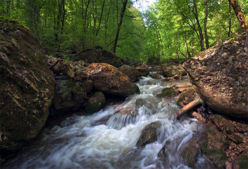
The stream is known primarily for its waterfalls, as well as the variety of rocks from different geological periods that emerge on the surface. Here you can see gray thin-slab marbleized limestones of the Lower Triassic, which were formed 180-170 million years ago. Upstream, pink granodiorites come to the surface. The upper parts of the valley slopes are composed of light gray and white Upper Jurassic limestones 130-120 million years old.
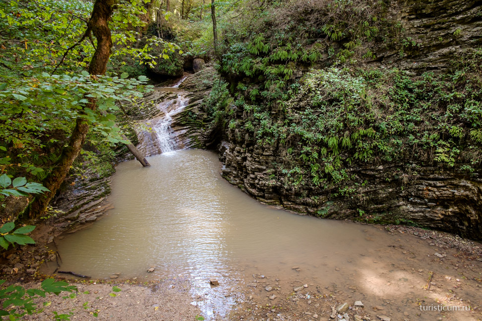
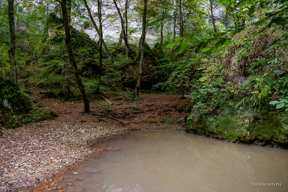
Due to the fact that Rufabgo crosses rocks of different hardness and bedding conditions on its way, the channel either expands or narrows, forming waterfalls of various shapes and heights. The river flows through a canyon, the depth of which near the mouth reaches 160 m.
The main attraction of these places, of course, are the waterfalls, of which there are 15 on Rufabgo. Most often, tourists visit the first five, which are the largest and most spectacular.
The first of the waterfalls, called “Noise,” is located just 15 minutes from the Hadzhokh (Kammenomostsky) - Dakhovskaya highway. Its name speaks for itself - from a height of about 5 m, streams of water fall noisily into a small lake.
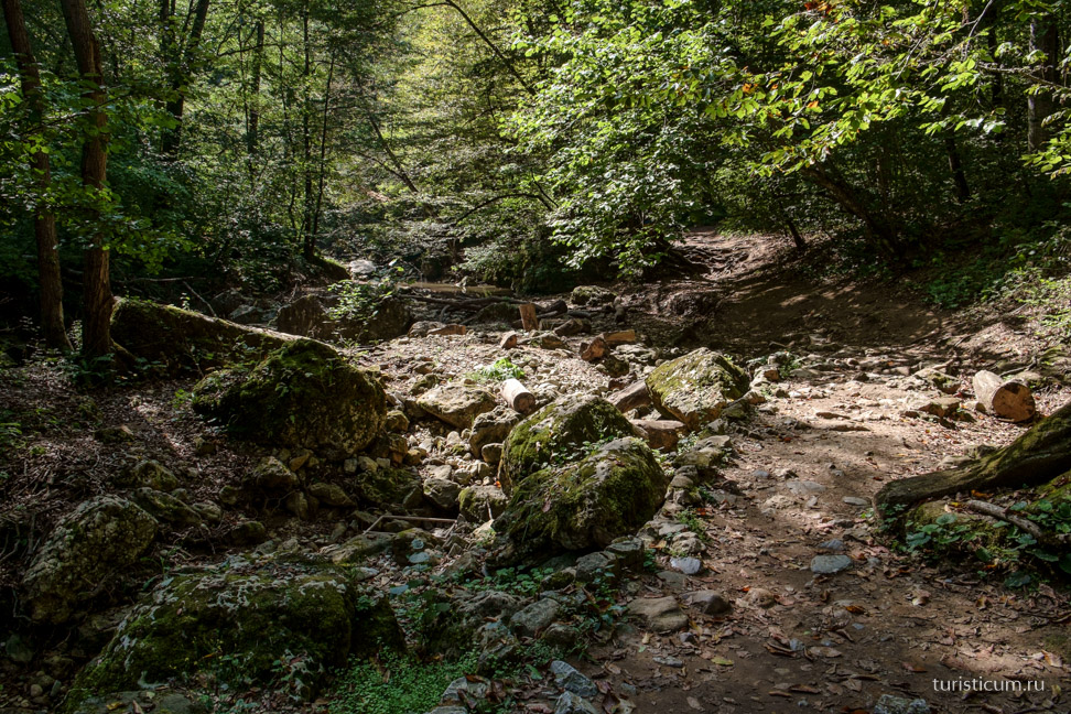
Further the trail wanders through a gorge, a forest thicket and rubble of stones. The second waterfall is more modest than the first; some people pass it without even noticing it. But it is no less beautiful and there are no crowds of tourists nearby.
But no one will pass by the third waterfall. The bed of the stream in this place is blocked by a huge block of stone, shaped like a human heart. On the right, a thin stream breaks into a deep gorge, the rocks of which are densely overgrown with moss and reflect a mysterious echo from any sound. This waterfall is called "Heart of Rufabgo". According to legend, the evil giant kept local residents in fear, and took the most beautiful girls as tribute. Many wanted to kill him, but this was impossible, since the severed hand or head immediately appeared again in the giant. But one day the brave and dexterous young man Khodzhokh met in the mountains a wise old man named Mezmay, who listened to him and gave him a leather bag of powder. The elder explained to the young man that he needed to approach Rufabgo from the windward side and pour out the powder from which a cloud would form. Once in this cloud, Rufabgo will no longer see, and at this moment it is necessary to cut open his chest, take out his heart and throw it as far as possible. This is how the brave Khojokh defeated the evil giant. And Rufabgo’s heart, abandoned in the gorge, petrified and turned into a huge boulder. After showers, the stream here turns brown-red from washed-out clay and it seems that blood is flowing from a huge heart
To the right of the Lace you can find a thick log with metal pins replacing steps. If you climb up, there is a path on the left with almost vertical ascents and slippery descents. This path will lead to the place where Rufabgo merges with its tributary - the Bachurin stream. In this place there is a high rock, surrounded on three sides by a stone monolith. At the top of the cliff you can see a practically destroyed fortress, and among the fragments of rocks and various stone piles there is a very beautiful two-tier waterfall “Maiden’s Braids”.
The next waterfall can be reached by several paths passing over boulders on both sides of the stream.
At the end of the path, the Cup of Love waterfall gurgles. A huge boulder hangs over this waterfall, forming a small niche in the lower part, in which you can even wait out the rain if necessary.
And since then it has been on the “must go someday” list. We’ll describe the advantages of this place later, but for me personally, one of the advantages was that from the Caucasian Biosphere Reserve, where the Lago-Naki plateau is located, it’s a stone’s throw to the Black Sea, which means you can walk in the mountains and in the sea swim, and travel is relatively close for a resident of the middle Volga region. About 2000 km. This is less than Baikal, for example! Where is the Caucasian Biosphere Reserve located, how to get there? So this is Adygea! What a wonderful region! Well, since we are going to Lago-Naki, we need to see what is nearby. And “nearby” is simply a mecca for tourists, both active and more relaxed - excursion. Kamennomostsky (or in other words Khadzhokh), Mezmay, Dakhovskaya. The names of settlements were full of sights, streams, gorges, caves, canyons, waterfalls. And then I realized that the allotted seven days for this region are very few. Well, that means we will definitely be back! In the meantime, let's get started!
We passed Maykop, beautiful city, with many, as it seemed to me, historical buildings. We approached Kamennomostsky, and then mountains began to appear temptingly in the distance in the blue haze. And my heart began to beat in anticipation. Here they are, getting closer and closer.
An interesting combination, not similar to Altai, the North Caucasus, or the Urals. It seems that there are already mountains on the horizon, but you are still driving along a plain with a typical Krasnodar landscape. 
We drove into Kamennomostsky. 
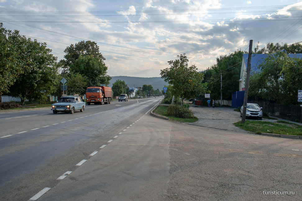
We won’t describe the history of this village; everything is in detail on Wikipedia; I’ll just briefly mention that on the site of the modern village there was the Adyghe village of Khodzhiko. He was famous for his long defense of Muhamed Amin, Naib Shamil, against Russian troops during the Caucasian War. Naib – means authorized, deputy. One of the threads also passed here Silk Road, a piece of which can be observed in the “Turkish Bazaar” - a small paved square on the outskirts of the village, where there was a slave or slave market. The village, by the way, is often called Khadzhokh. This must be kept in mind, since even on bus routes one or the other name may be indicated.
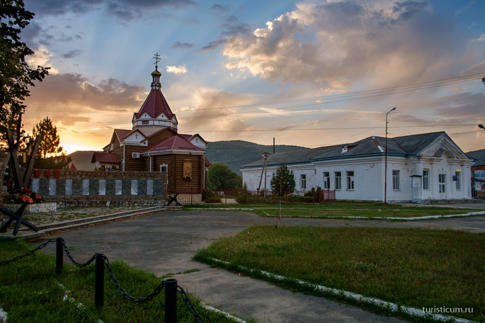
Nowadays, Kamennomostsky is one of the tourist centers of Adygea. There are many camp sites, guest houses, and private hotels. There is even a Tourism House. There are enough shops to purchase all the necessary products, and there is also a local food market. In the evening we went to the store and at the same time took a walk around the village. How beautiful the sunset in the mountains is. 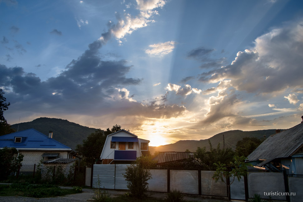
You can get to Kamennomostsky by car. From Maykop it is 38 kilometers. There are also regular and fixed-route buses from Maykop. And of course you can get here by train, this is the final station at Hadzhokh. We stayed at Camping “Uyut”. 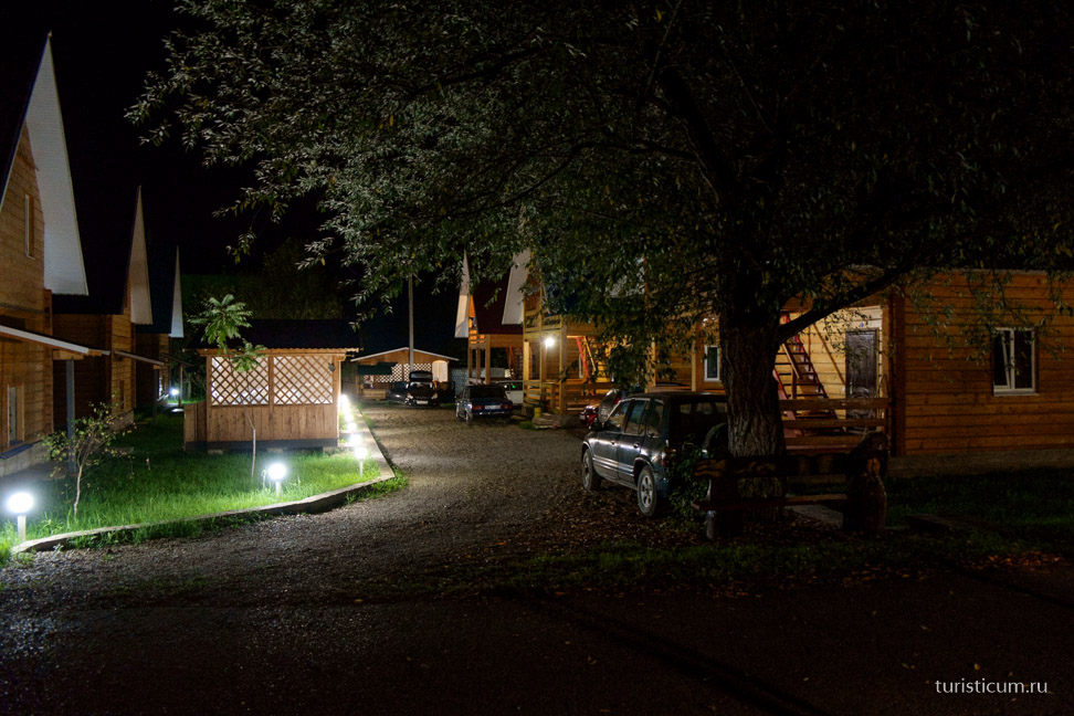
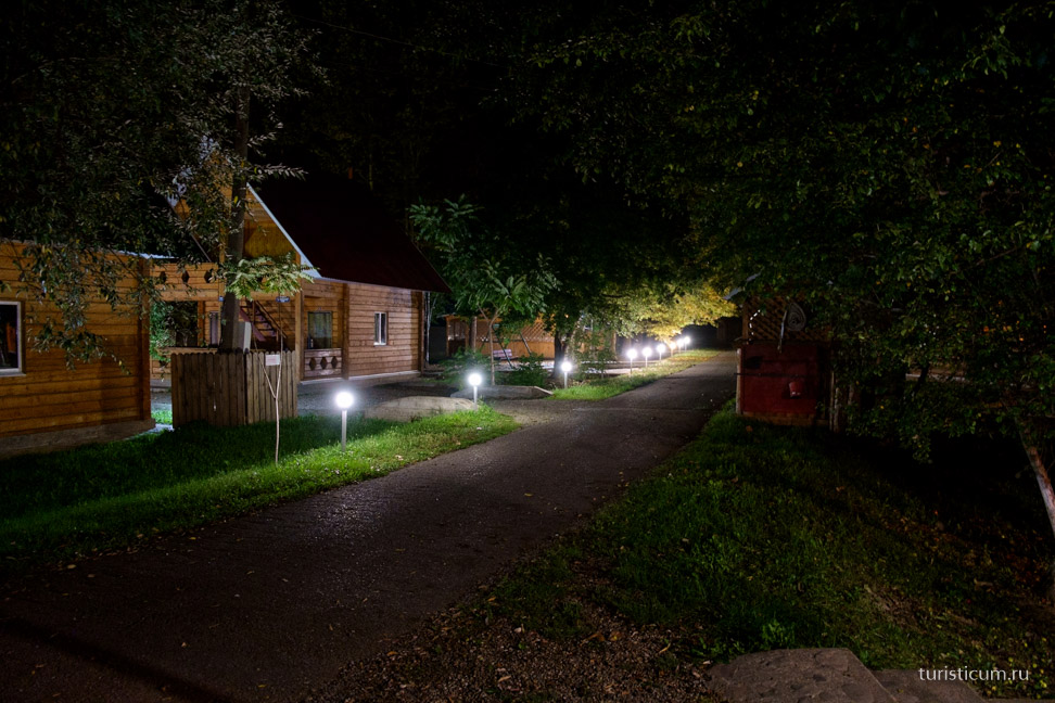
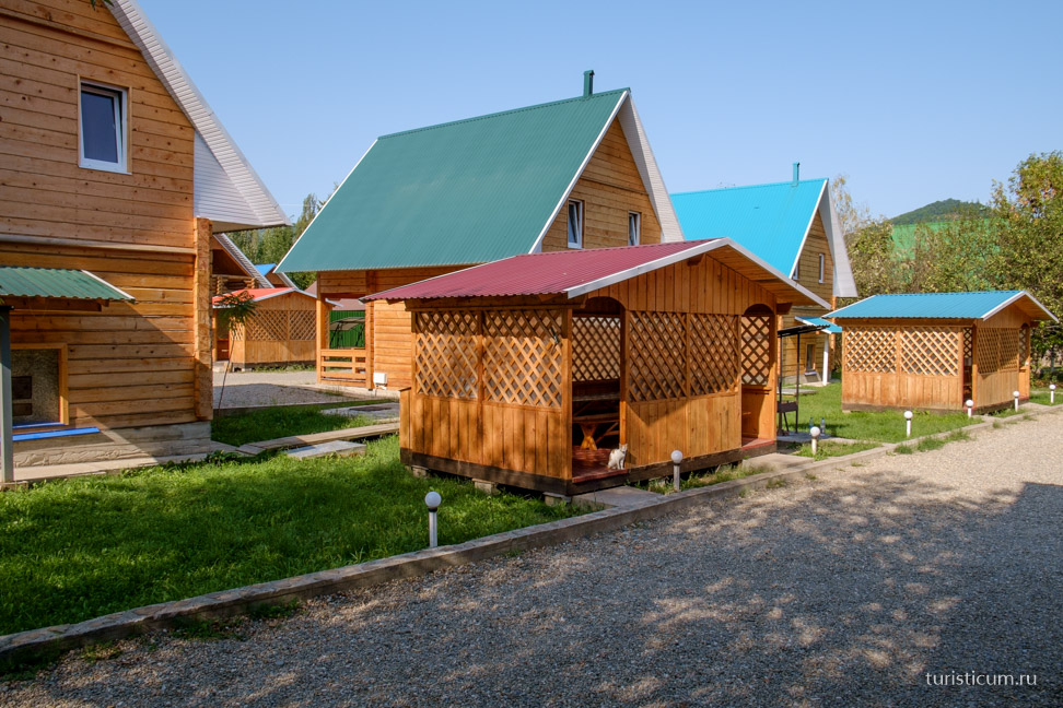
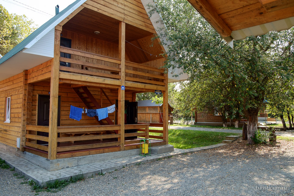
This place was recommended by a friend who has traveled to Lago-Naki several times, and now we can recommend it too. Prices are as on the website, reasonable. And the photographs of the rooms correspond to reality. The only negative is that the place is popular, and on weekends people come here for barbecue from Krasnodar, Rostov and beyond. Accordingly, music. And on other days - babble! Well, for silence you have to go to the mountains. While we were taking a break from the move, we were planning our route in the gazebo. We also decided that on the first day we would do a warm-up excursion to local attractions, and go to the mountains the next day.
Rufabgo waterfalls.
The choice fell on Rufabgo Falls. You can see where the waterfalls are on Wikimapia. The gorge of the Rufabgo River, which flows into the Belaya River. From the geological certificate it follows that this is a canyon composed of limestones of the Upper Jurassic period, broken through by granites. And, indeed, the water in the river at the waterfalls smells strongly of limestone, and the color is clay and limestone.
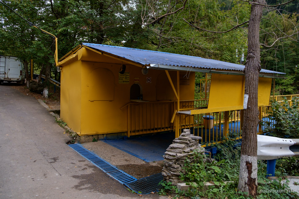
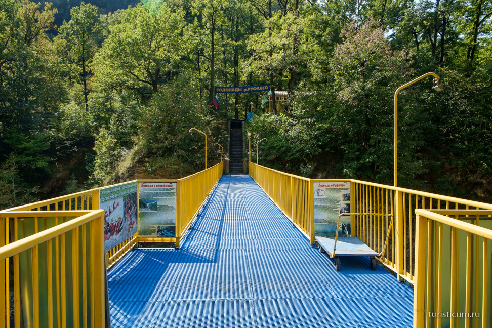
The pedestrian bridge over the Belaya River to the waterfalls is located two kilometers from Kamennomostsky along the highway to Dakhovskaya. The pass is organized as a visit to an attraction and cost 300 rubles in the summer of 2015. You can get there for free if you go from Kamennomostsky along the left bank of the Belaya through the Adygean ancestral forest, at the same time looking into the Skvoznaya cave. We took the first route. There are different ways to approach the phenomenon of a toll passage, but I think at present this is a good solution, since the place is looked after, garbage is removed, rest areas are created and paths are marked. And if the place was absolutely free to visit and no one was looking after it, then our man would fill it with mountains of garbage and break everything, no matter how sad it is. And so, at least, according to the theory of broken windows, where it is clean, there is less litter.
Parking, ticket office, bridge. 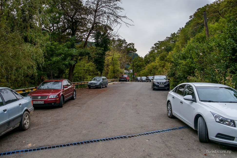
Rufabgo flows into Belaya at the place where the river bends slightly and a rapid begins. This is the smallest waterfall and it is called “Three Brothers”. We read about it later, but during our walk we didn’t even notice it. 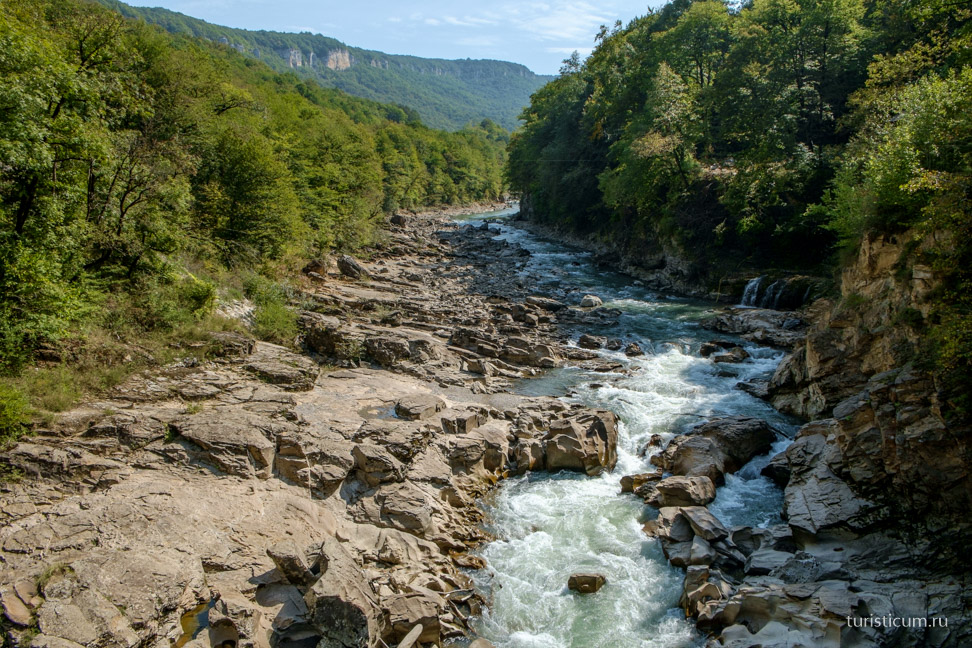
After the bridge we go out to small area with cafes and a mini market. When I saw this square, I tensed up a little, will it really continue to be like this? But everything is in order, then the forest and nature begin. 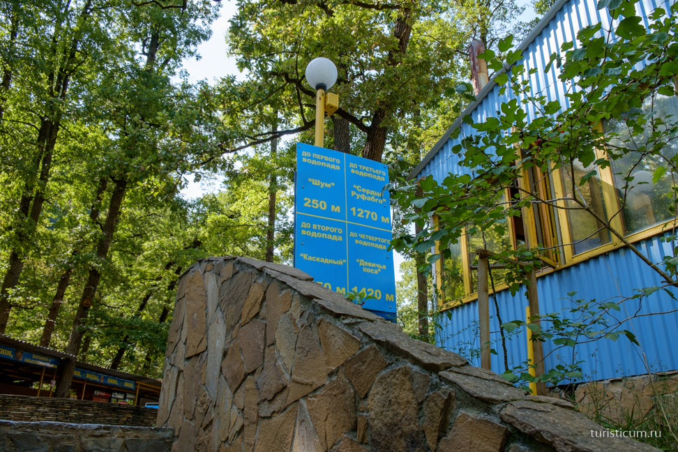
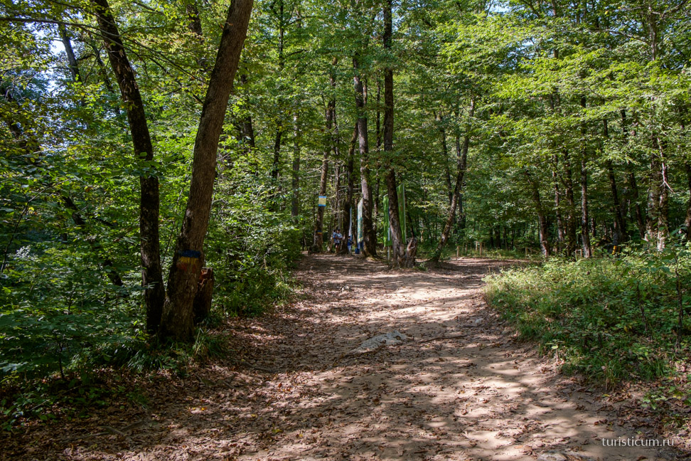
The trail touches the Adyghe ancestral forest. 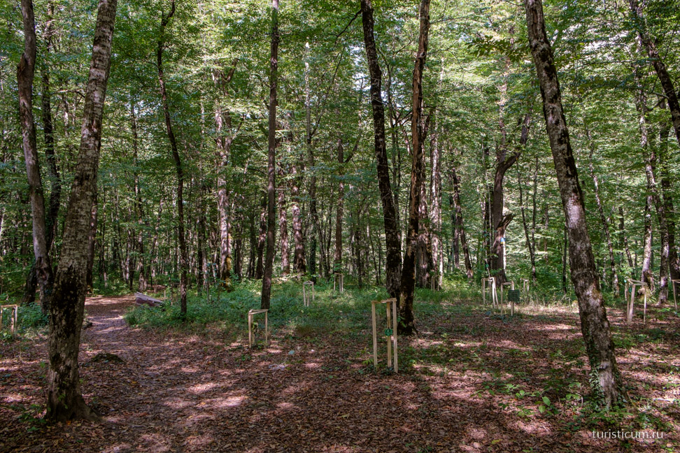
The Adygs (Circassians) were and remain very connected with nature. Groves and individual trees had important, sacred significance. They were worshiped, they were preserved. But the tree was perceived not as a detached divine being, but as part of the world, aboveground, earthly and underground. The Circassians especially revered the oak, a symbol of strength and power. Similar worship and respect for nature was found in Europe, among the Druids, and among the Finno-Ugric peoples, and among many peoples to the east. In Udmurtia they are still preserved sacred groves and forests. In 2008, a project to revive traditions began in Adygea. The forest is divided into sections according to clans and families. 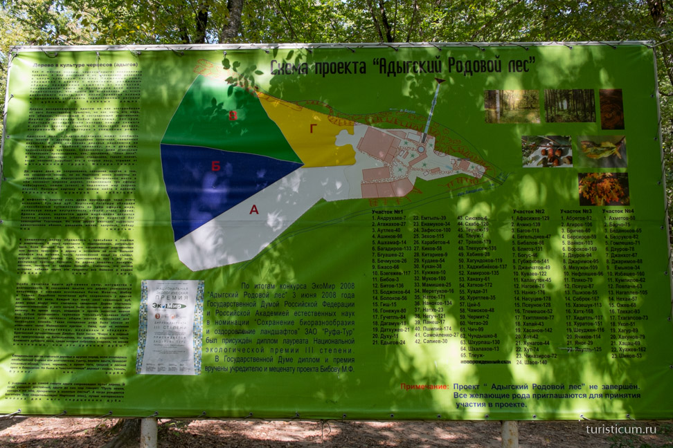
A new man is born, and a new oak tree is planted. A family sign, tamga, is hung on a young oak tree. Tamga was previously used as a family seal on products produced by a family or clan, as a brand for livestock, and could also be placed on entrance doors. 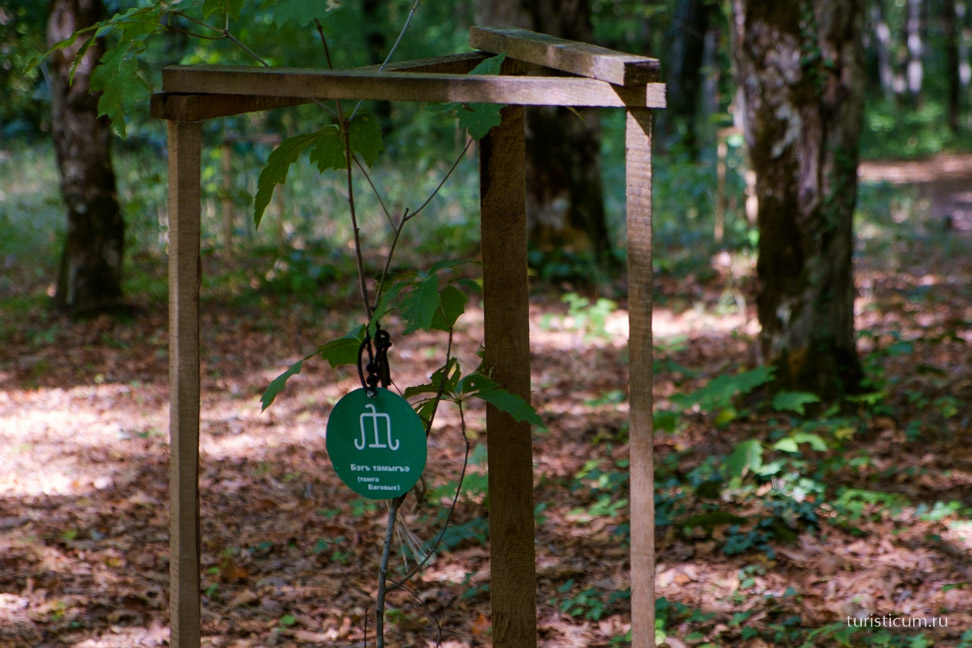
Walking a little further, the first of the waterfalls, called “Noise,” appears on the left. 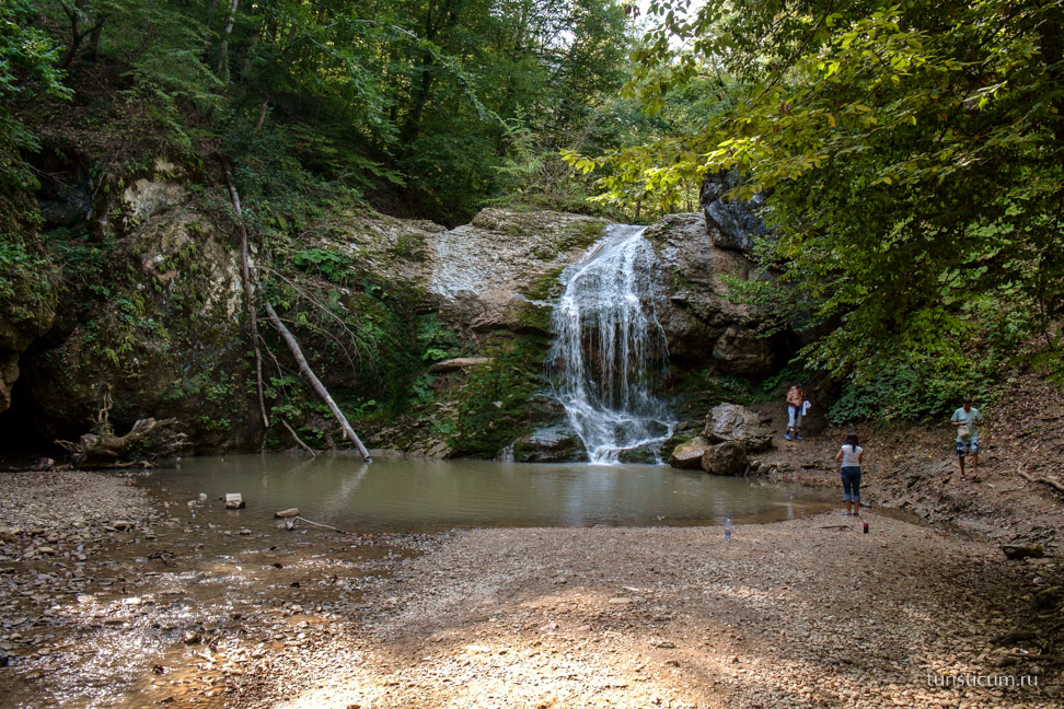
We move on to the next waterfall. The excursion trail is equipped in such a way that as you move along it, you retain the feeling of being in nature, and not in a park. 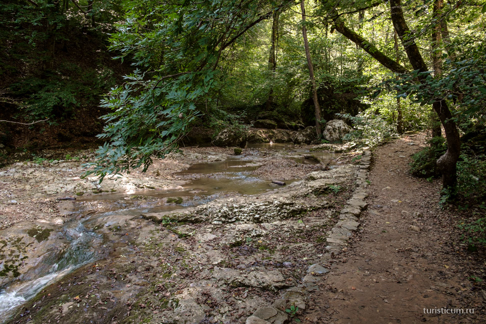
Some tourists are haunted by the creations of nature, and they add their own. However, they do not bring disharmony. 
The next waterfall that appears before us is “Cascade”. 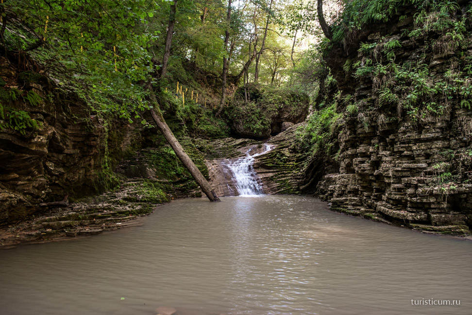
It is impossible not to pay attention to the layering and folding of rocks. Personally, I have always been amazed by such creations of nature. 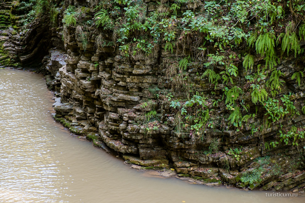
We are slowly approaching the first, as it seemed to me, really interesting waterfall- “The Heart of Rufabgo.” According to legend, the large stone that blocked the river’s path is the petrified heart of the evil giant Rufabgo, who was defeated by the brave young man Khadzhokh. 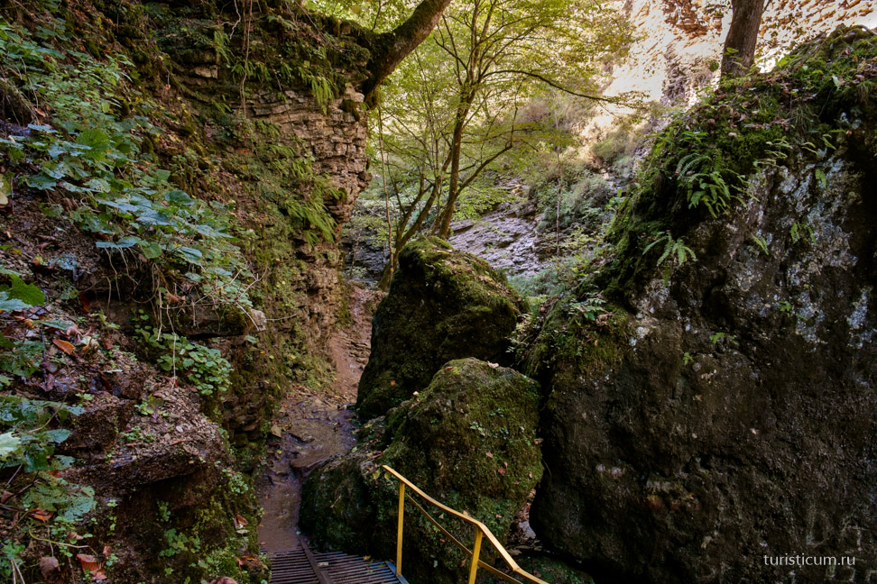
We went down to the water. 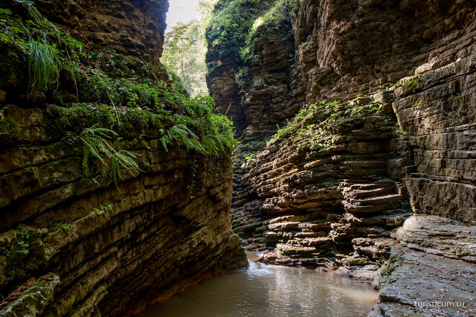
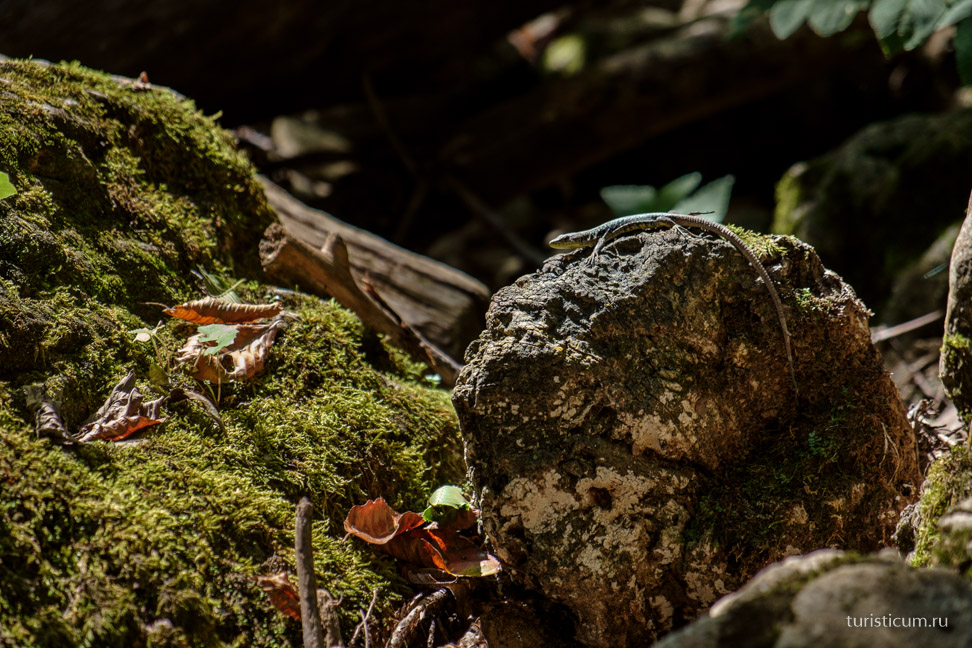
Lizards were everywhere that day. 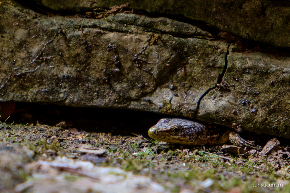
There was a desire to come closer, but I was tormented by doubts. And here, as in the proverb, a bad example worked, which turned out to be contagious. While I was taking pictures, a guy rushed forward on the left side. There are warning signs everywhere that going down there is life-threatening, and this is true. We had to walk on wet and moss-covered ledges formed in layers. And below there is water, how deep it is - it is not known. And there are still a few meters to it. In general, you need to be clearly aware of whether you are ready for this or not. What is your preparation, both physical and psychological, and what shoes do you wear? 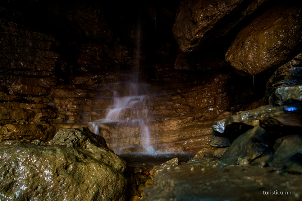
![]()
And this is the view from above. 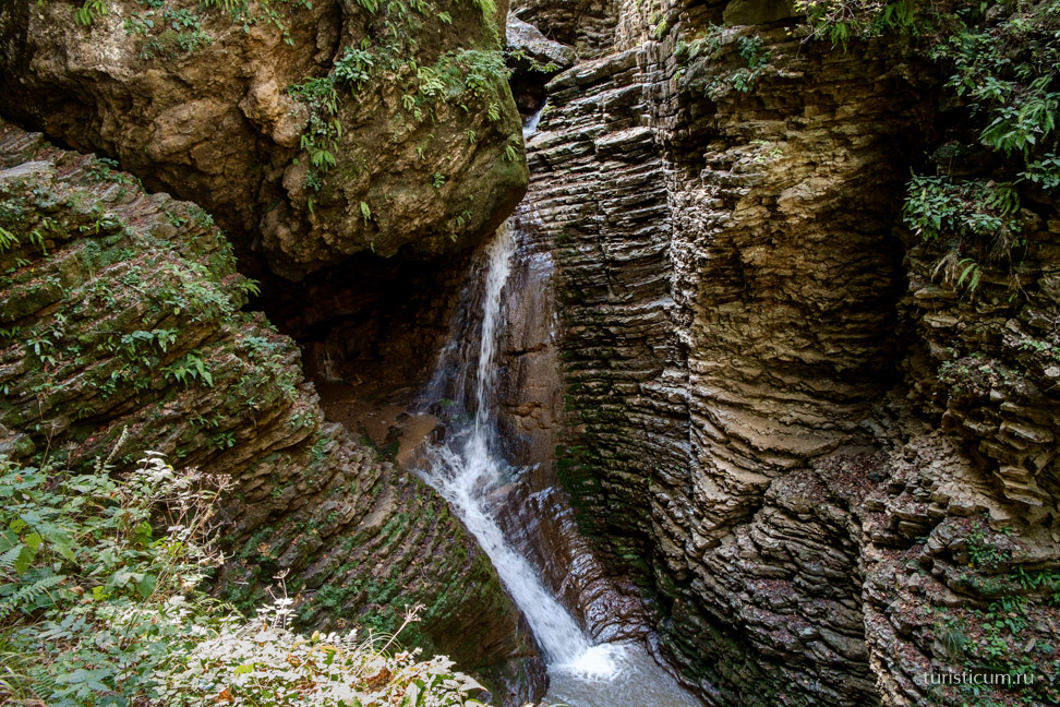
“Maiden’s Braid” or “Lace” is the last waterfall that most tourists usually reach. 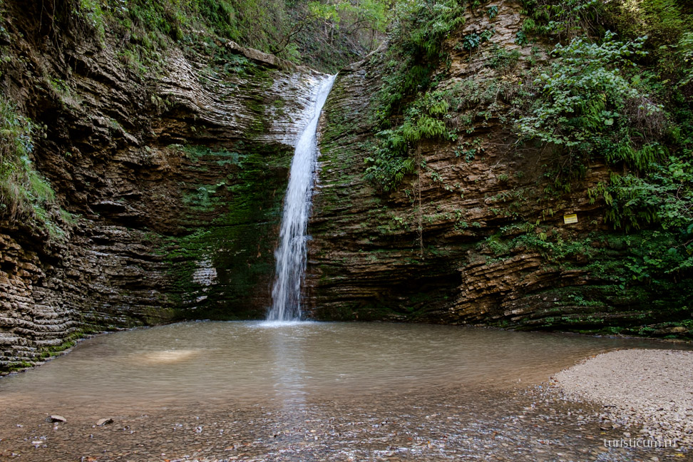
But then you need to go around it on the right and climb a rather steep and slippery slope. As I understand it, this rise stops many. 
But there is a reason to go up. The view is magnificent. 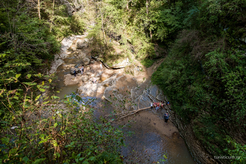
Immediately after a steep climb to the right of the waterfall, the trail goes up and to the right. 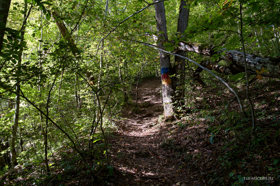
And despite the fact that it is marked in the same way as the path to the waterfalls, it does not lead to them at all. It seems quite logical that up is not the way to go, but we thought that she would come back. Didn't return. If you continue up the trail, there will be a climb called “Enjoy Your Bath.” You couldn’t imagine anything more precise, especially in the middle of the day when the sun is at its zenith. 
And then you go out to the Azish-Tau ridge. In general, there are no waterfalls there, which is logical. But we got some horses! 
After admiring the panorama from the ridge, we decided to go down to the gorge and try to find the right path to the next, sixth waterfall. 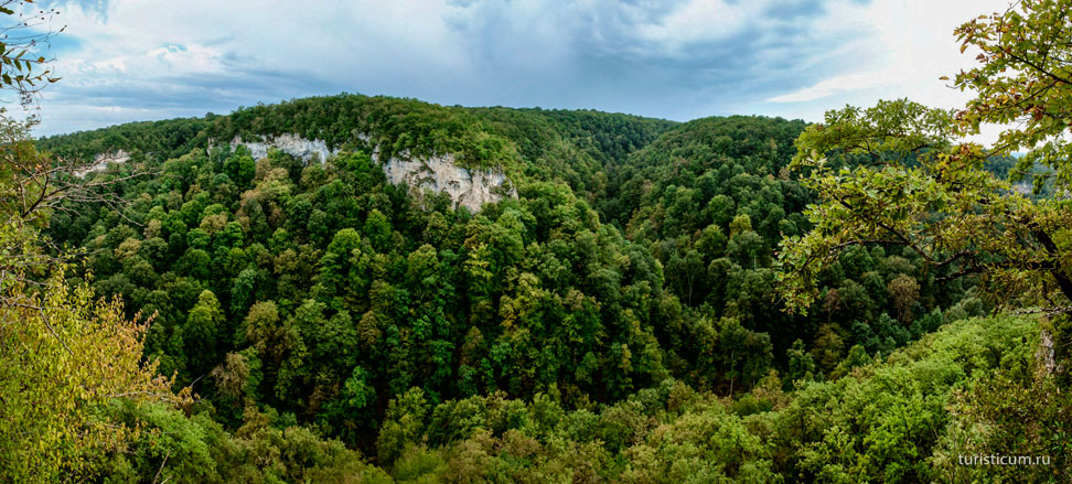
In general, moving further along the path, which occasionally, and sometimes not occasionally, gets lost, we got the impression that only the stubborn or curious go to the sixth waterfall, since even the marks on the trees became fewer and fewer. But still they are there, and you won’t get lost. 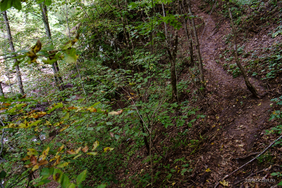
And now through the crowns of trees in the distance we see a huge rock! This is Sentinel Rock, and it seems that the goal is close! But where should we turn? We go across the stream to the left, following seemingly fresh tracks. And we seem to see similar marks on the trees, but such a natural composition of branches and fallen trees does not increase the confidence that we are going in the right direction. 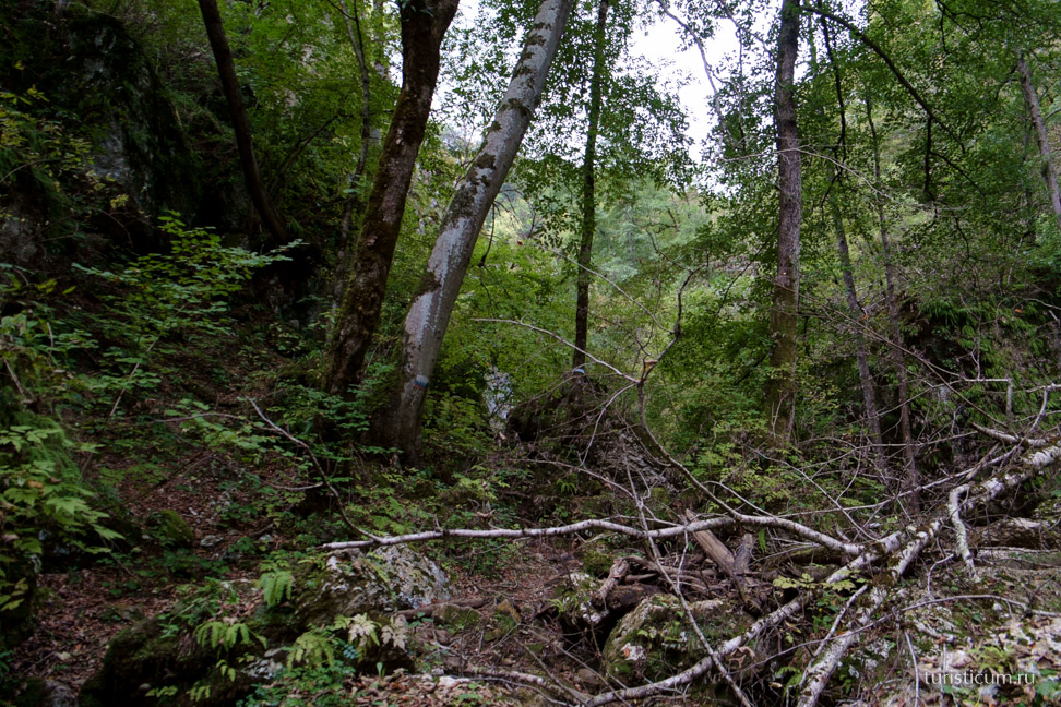
And now we find ourselves surrounded by giant boulders. And the path has disappeared somewhere. This is a dead end. As we later found out, this is the “Rockfall” waterfall. ![]()
I noticed a gap at the top. I didn’t hope that there was a right path there, but it was interesting to climb. Let's climb. 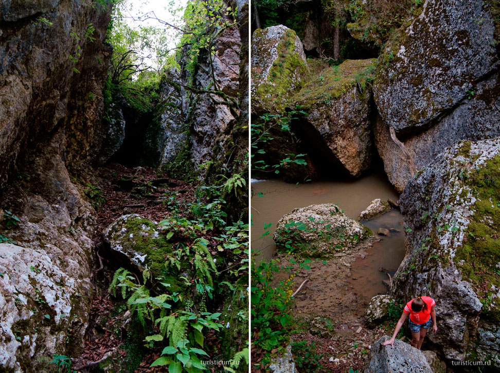
Oh, what a wonderful huge crack in the rock! 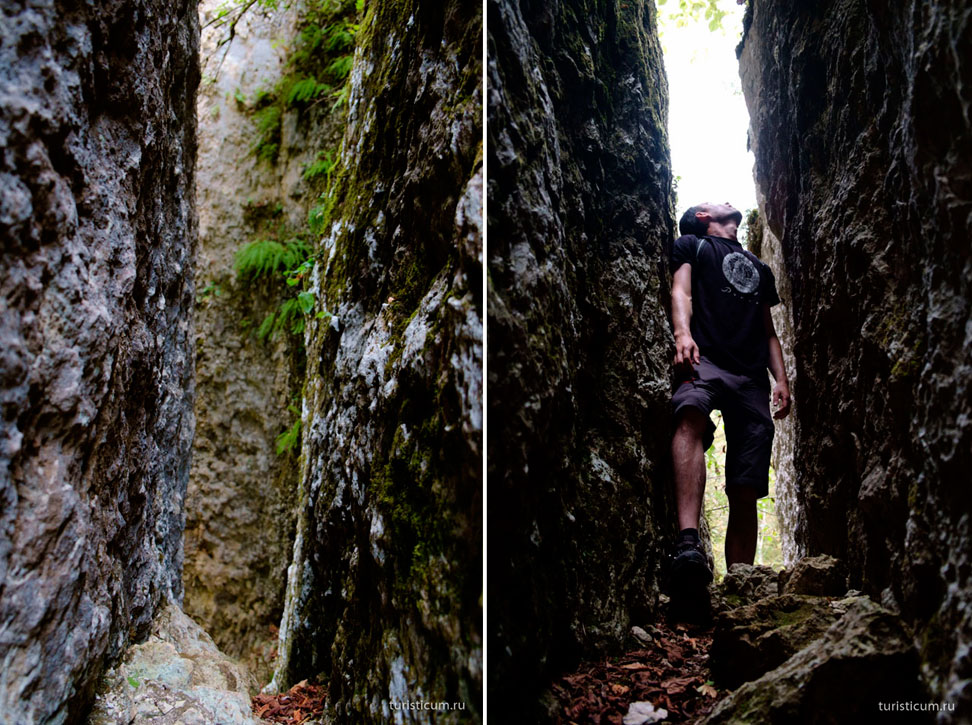
From there you can see the right path, but how to get there? 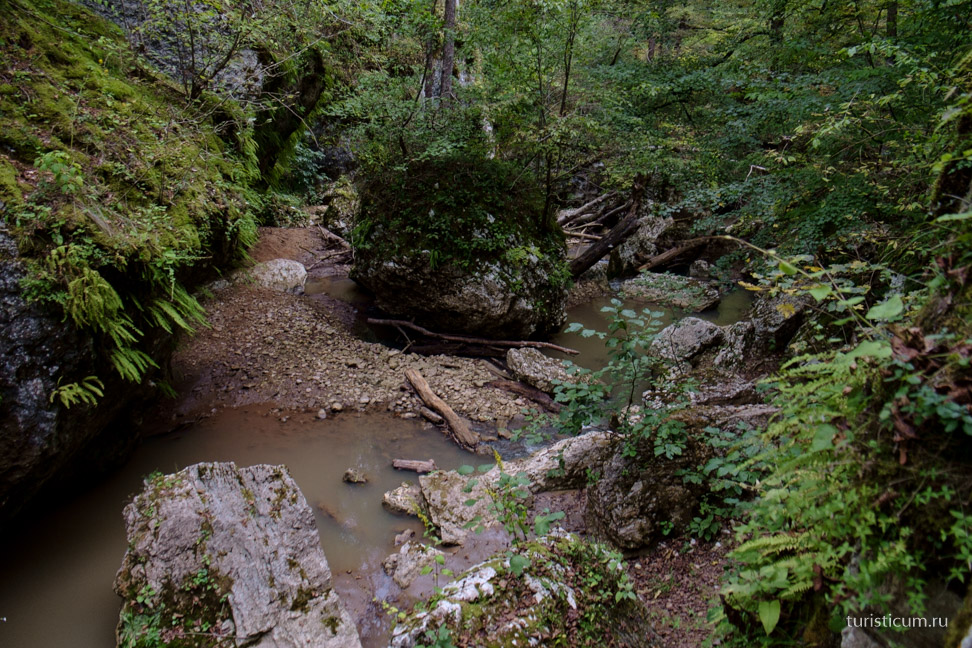
We get down and go around. At the same time, do not be surprised that you will need to go up and down, sometimes climbing over stones and logs, sometimes crossing streams and shallow rivers. This is the normal way, there is no other way. 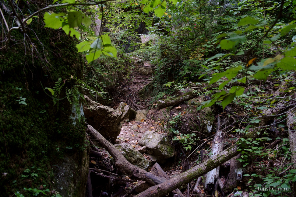
And here comes the Watchdog. As they say, the remains of an ancient fortress were found on it. We didn’t plan to check this information, just to find the sixth waterfall! We go around and go down again. 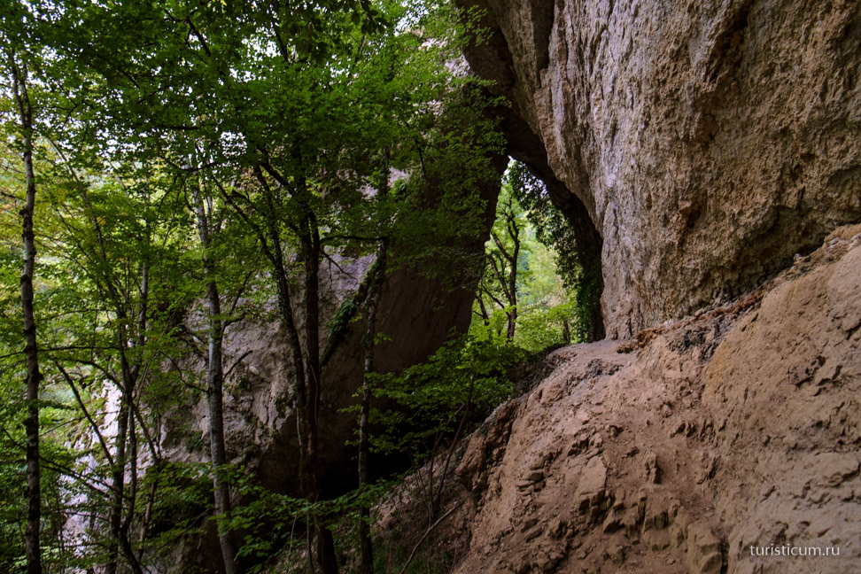
And now we found it! Or rather them. Since this is a cascade of two waterfalls. It was certainly worth it. The upper waterfall "Bowl of Love" turns into "Maiden's Braids". Do not confuse with the fifth waterfall "Maiden's Braid". 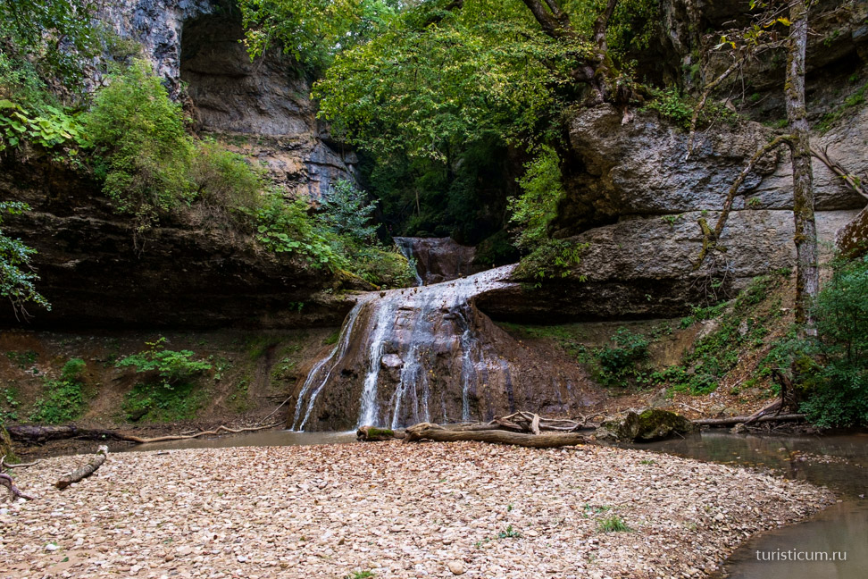
But how to get to the Cup of Love? Yep, looks like this is the only way! In principle, if you remember how often we climbed trees as children, it’s actually a piece of cake! 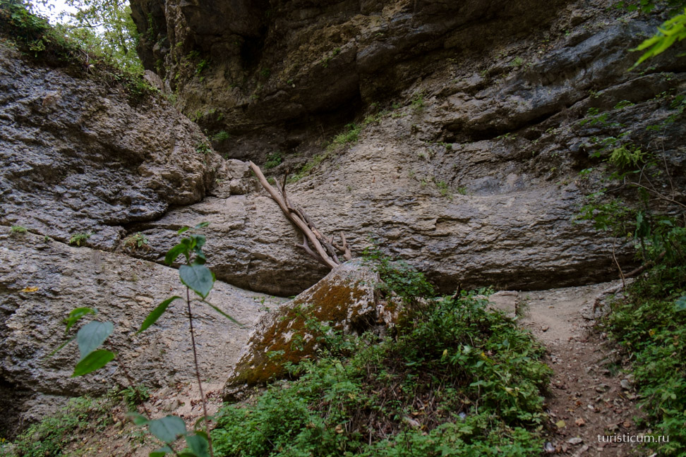
And this is actually the goal of our quest! lost World, and that's all. It seems that now a pterodactyl will appear somewhere in the sky. 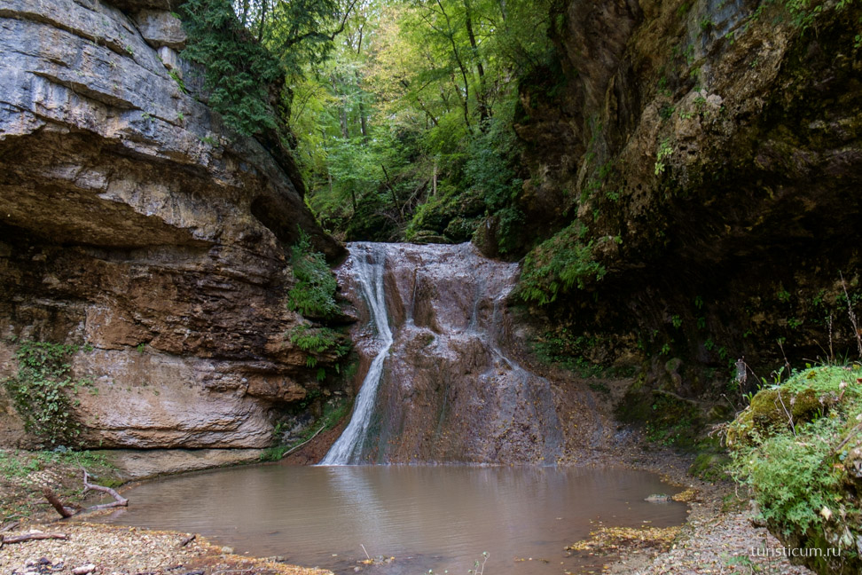
But this is called the “Cup of Love.” According to legend, if lovers drink from the cup together at the same time, their love will be strong and eternal! 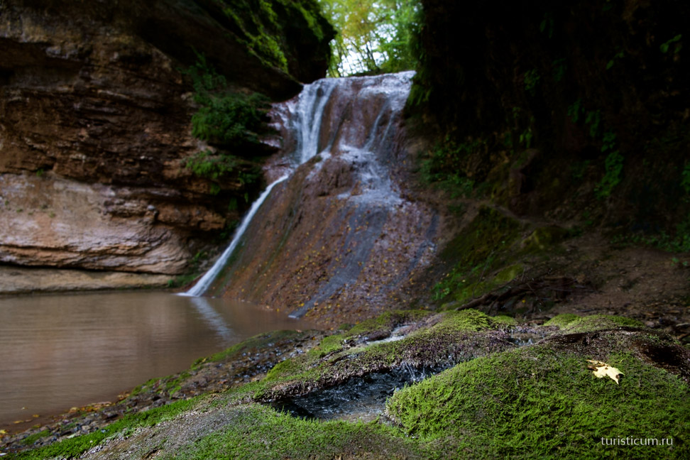
And it’s already half past five, and it’s time to get ready for the return journey; nevertheless, the path to the Cup of Love is tortuous and thorny. One last look at beauty and off we go. 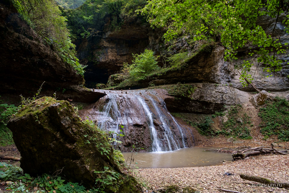
On the way back, we notice markers and other devices for those stubborn and inquisitive like us, who go to almost the last waterfall. Why almost? But because there is also a seventh waterfall. But at that time it was not clear how to get there, and time was running out. Because it will get dark soon. I suppose that it was necessary to go around the Watchtower rock along the Bachurin stream.
On the way back we go around the rock again and quickly walk towards the exit. About 2.5-3 kilometers. 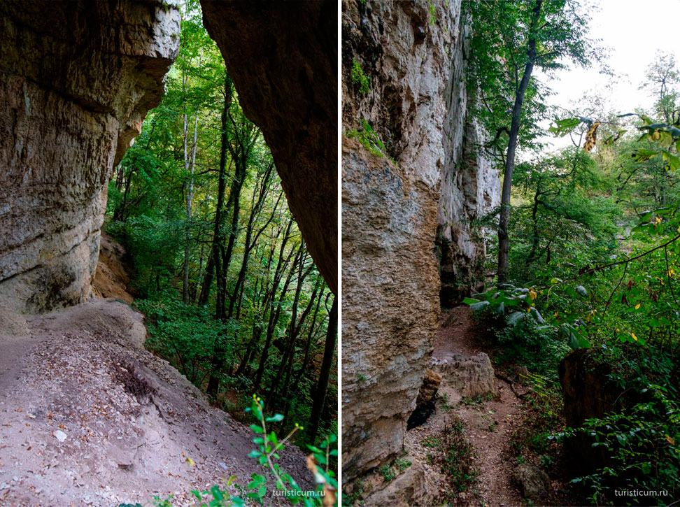
The walk took 5 hours. At the same time, we spent an hour turning towards the Azish-Tau ridge and climbing “With easy steam”. The next day we plan to go to the Caucasian Biosphere Reserve on the Lago-Naki plateau.
Posted Fri, 16/05/2014 - 07:29 by Cap
Mountain Adygea is a fairy-tale country, where rivers gurgle with water as clear as a tear, where eagles soar in the bottomless sky, where Mountain peaks wrapped in clouds. The mountains of Adygea are full of peace, tranquility and age-old wisdom. Smog big cities, stress and haste, traffic jams - all this remains somewhere far away, in another reality, when you are surrounded by the mountains of Adygea.
It is enough to escape to the mountains of Adygea for at least a few days to experience incredible uplift and renewal. The healing atmosphere of these places will strengthen the most tired person, give joy to life and faith in one’s strength. Mountain Adygea is great option for everyone, regardless of tastes and personal preferences. Moreover, the mountains of Adygea are a pleasure available to everyone today. What can you do when you arrive in Adygea? Anything! You can go to the canyons of mountain rivers. The gorges of the Sakhray, Tsitsa, Mishoko, Belaya rivers present stunning pictures - wild and beautiful at the same time.
Rufabgo Falls
One of the most popular and picturesque natural attractions of Adygea is the Rufabgo waterfalls. This unique monument is located in the gorge of the Rufabgo River - one of the tributaries of the Belaya River. Not far from the waterfalls, just a couple of kilometers, is the village of Kamennomostsky, from which most tourist routes begin, including excursions to Rufabgo.
In the lower part, the river flows in a deep gorge, surrounded by steep slopes, which at the top end in inaccessible sheer walls of rocks - it is this section of Rufabgo that is of greatest interest to tourists coming to Adygea. 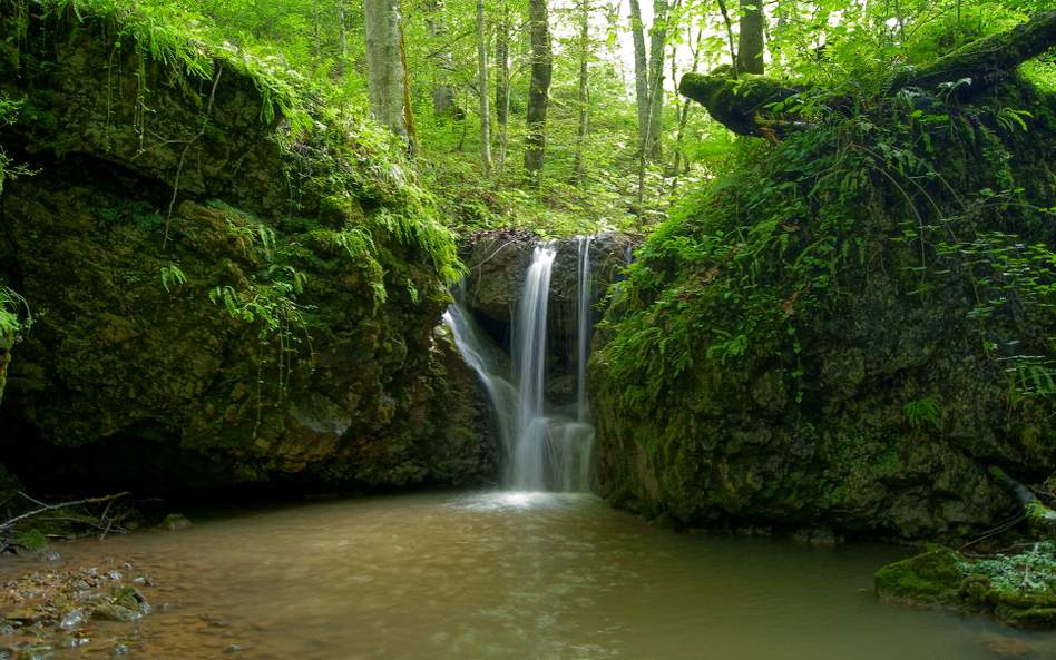
In total, there are 10 waterfalls in the gorge of this river, but the most colorful and largest waterfalls are Shum, Cascade, Heart of Rufabgo, Lace (Maiden Braid), Cup of Love and Maiden Braids. Part of the route, in particular to the Shnurok waterfall, is fully equipped for tourists with paths, platforms and the necessary fences.
You can get to the Rufabgo waterfalls (Adygea) through a toll bridge, from which you can see a small waterfall called “Three Brothers” - the zero Rufabgo waterfall, or by walking along the path along the bank of the Belaya River from the Khadzhokh Gorge.
Behind it there is a small clearing with a cafe, gazebos for relaxation, souvenir shops and attractions. The next waterfall that opens up to the visitor’s gaze is the “Noise” waterfall.
Walking a little forward, you can hear the sound of falling water: it is the Cascade waterfall falling from the slope in a continuous stream. It consists of three small cascades and is quite small in size. Because of its miniature size, the Cascade waterfall has another name - “Baby”.
The most important and picturesque third waterfall of the gorge is the “Heart of Rufabgo” waterfall. From under a huge block of stone, similar to a human heart, a stream of icy water continuously rushes, forming a waterfall of amazing beauty.
The “Heart of Rufabgo” is followed by an equally picturesque picture: from a high cliff, a narrow white ribbon winds the waterfall “Lace” (“Maiden’s Braid”). Among all the Rufabgo waterfalls (Adygea), it is the highest: the length of the “Lace” reaches 20 meters.
Rufabgo waterfall in winter 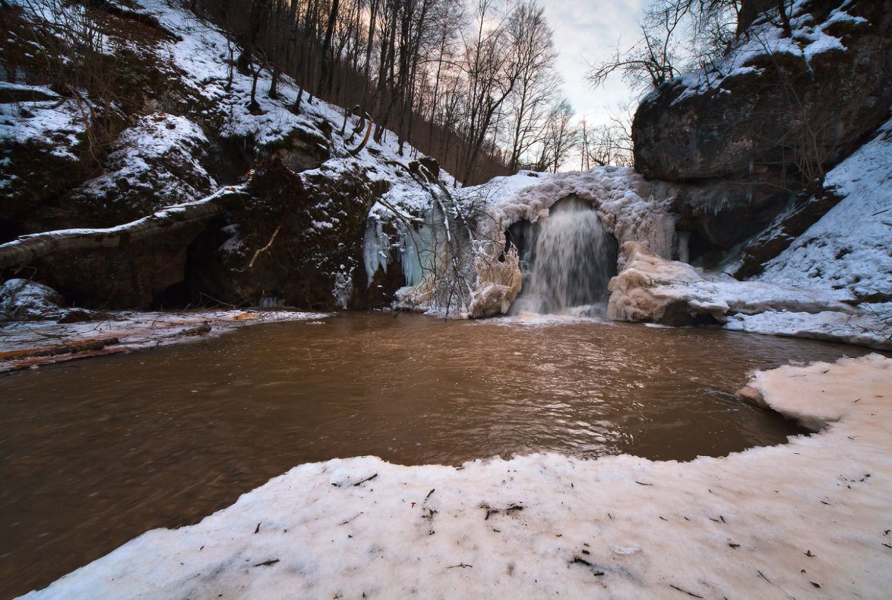
This is where the equipped area for convenient walking ends, which means that to get to the rest of the Rufabgo waterfalls you will have to climb the well-trodden path on your own for about another 900 meters. The reward for those who were able to overcome the difficult climb and were not afraid of the lack of equipment in this area will be the tandem of the picturesque waterfalls “Bowl of Love” and “Maiden Braids”. Streams of crystal clear water flow from a five-meter height along the rocks into an openwork bowl forged by nature itself, forming the “Cup of Love.”
And just 40 meters from it hides another waterfall Rufabgo (Adygea) - “Maiden Braids”. Flowing in thin curves from a nine-meter height, the cool waters of the stream are braided into graceful girlish braids. Next is the Lelkin waterfall, but only a few, the most prepared tourists, get there.
Rufabgo waterfall 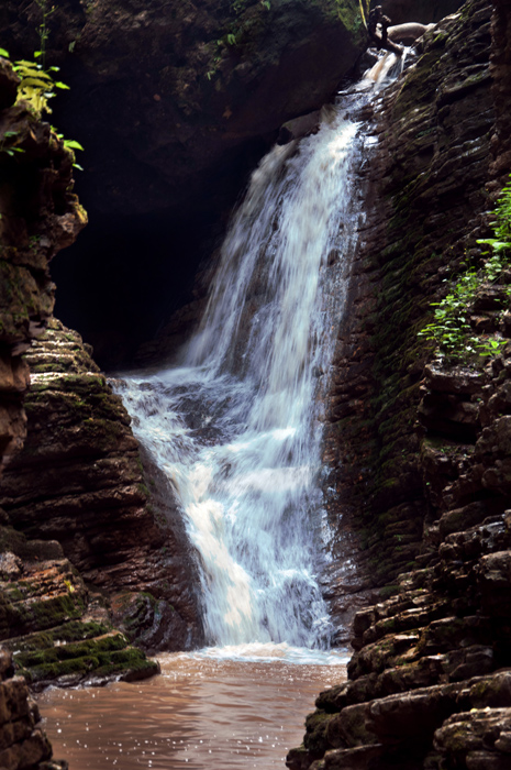
The Legend of Rufabgo and Hadjokh
Like any tourist attraction, Rufabgo waterfalls (Adygea) have their own beautiful legend. It says that in former times the valley of the Belaya River was chosen by an evil giant named Rufabgo, who possessed considerable physical and witchcraft strength. There lived a giant sorcerer in the Skvoznaya cave, located not far from the first waterfall. Here he drew his strength and maintained contact with evil spirits, thanks to which he managed to enslave many settlements in the Belaya River valley. From each village, the evil giant Rufabgo took away the most beautiful girl, and he brutally dealt with the young men who tried to free them. So in one of the villages there lived a brave and slender young man Khadzhokh, who had a beloved girl. Khadzhokh knew that very soon Rufabgo would come for her.
To avoid this, the young man went to the mountains of Adygea in search of the good wizard Mezmay. Having found him, Khadzhokh learned that there is only one way to defeat the evil giant: by approaching the sorcerer from the windward side, you need to pour out the powder, the cloud that forms from it disorients the giant for a moment, and at that moment you need to take the heart out of his chest and throw it as far as possible. After listening carefully to the old man, the young man went to Rufabgo’s lair. Having found the giant, the hero invited him to fight, but the giant, hearing this, only laughed. Having ridden into the valley on his horse, the ferocious Rufabgo wanted to attack Khadzhokh, but got stuck in the ground, thoroughly saturated with heavy spring downpours. At that moment, the young man poured out the powder and immediately a cloud enveloped the giant. Without hesitating for a minute, the Adyghe youth cut open the villain’s chest, took out his heart and threw it as far as possible. Having fallen into the gorge, the heart of the evil giant Rufabgo turned into a huge stone, blocking the path of the fast-flowing stream. And the waterfall that was formed as a result began to be called Rufabgo waterfall.
After heavy spring rains, the stream instantly transforms: the water becomes cloudy and acquires a reddish tint due to deposits of red clay in the upper reaches of the stream, creating the impression that scarlet blood is gushing from Rufabgo’s heart in an endless stream.
Granite Canyon, Granite Gorge (Adygea)
River and gorge Meshoko (Mishoko)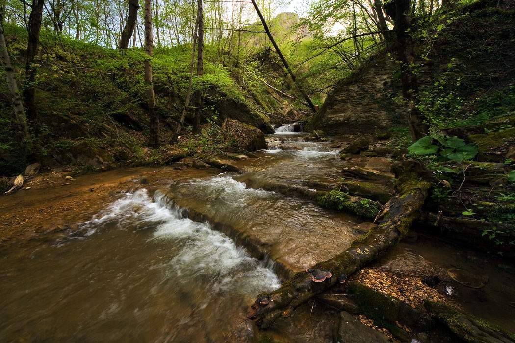
The Meshoko river and gorge amaze tourists with their unique, mysterious beauty. The beauty of the gorge is multifaceted; new features, waterfalls and grottoes are discovered every time.
The Meshoko Gorge is located in the vicinity of the village of Khadzhokha, or Kamennomostsky. The Meshoko River, cutting through the rocky ridge of the Una-Koz Mountains, forms an amazingly beautiful canyon, the height of the rocks reaching 70 meters, and grottoes, caves, waterfalls and rock overhangs only emphasize its beauty.
Another popular name for this area is “Mishoko Gorge”; it is located away from the most famous hiking trails, and, nevertheless, has beautiful caves and grottoes, mesmerizing waterfalls. The gorge is surrounded by beech and chestnut forests. In Circassian, Meshoko means “bear valley”.
Man settled on the banks of the Meshoko River about four thousand years ago, which is confirmed archaeological excavations HELL. Stolyar and the archaeological expedition of the Hermitage. In the cliffs hanging over the rock, ancient settlements were discovered that were over 120 thousand years old, and in the gorge itself the remains of defensive fortifications of the Stone and Bronze Ages were found. The main occupation of the people who inhabited the Mishoko River canyon was cattle breeding; they were also engaged in farming, as indicated by the finds of grain grinders and silicon inserts for sickles. The inhabitants of these places also made pottery, flint tips and bone products.
In the gorge there are burial mounds of the Zikh and Kasozh periods, the Meotosarmatian and Scythian eras, carefully preserving the secrets of these peoples.
The Meshoko Gorge attracts tourists and simply curious vacationers throughout the year. Getting into the gorge is not at all difficult; there are several paths of varying difficulty leading into it.
One of the paths runs through a long-abandoned quarry where limestone was once mined. Near the quarry there is a multi-tiered section of a huge rock, at the bottom of which a lake was formed from spring sources, named Red for the special pinkish glow running along the surface of the water from the rock. In just ten minutes you can walk from the outskirts of the village to the confluence of the Meshoko River and the Belaya River.
In this place, the Una-Koz ridge is cut by a deep gorge. From pine forest the path goes up, under the steep cliffs and leads to a large grotto, and behind the turn of the rock, on a small terrace, there is a drip spring that fills a bowl carved into the rock with its life-giving moisture.
The rocks in the Meshoko area are suitable for climbing. The jagged and blocky rock walls often serve as training and competition sites for climbers. The rocks that have risen to the top can be viewed from a flat platform. amazing view gorges.
And going down to the Mishoko River, you can see waterfalls: behind the large waterfall, one after another there are low overflows and waterfalls. Overflowing one into another, they quickly fall down. From the waterfalls you can go to the caves located on the terraces. There are many caves here and they are varied. Some are small depressions in the rocks, others are completely difficult to access. Many thousands of years ago ancient people lived here.
But the path does not end here and leads further to a large overhanging rock. The cascade of waterfalls begins here and goes down the Meshoko gorge. Two springs emerge from rock fractures near the waterfalls. Spring water is cold, but tasty and very clean.
The river bed, blocked by a rocky ledge, ends up in a bowl-shaped reservoir. Water falls into it along a winding stone chute, polished by jets of water to a shine.
Immediately behind this waterfall, the Meshoko River was squeezed into its vice by the damp grottoes located on its right bank. On the left bank there is a terrace for relaxation. The stone grip of the river closes with a beautiful waterfall across the entire width of the riverbed. You can get close to the waterfall, which is made possible by stone steps.
Walking up the river, the traveler comes to three waterfalls, after which the Meshoko gorge cuts through a mountain forest, in which there are many giant stones and interesting rocks.
The river bed, smooth and clean, is surrounded on both banks by grottoes that were once inhabited by people. Here tourists find bone products, ancient tools, and the remains of fire pits.
The route along the river and Meshoko gorge will be of interest to mountaineers and rock climbers, tourists and archaeologists, forest gatherers, photographers and artists. Anyone, even a child, can follow the route due to the short length of the path, its ease and safety.
Sakhray waterfalls, Sakhray river
Famous and remarkable places of the Sakhray River are located along this river between the villages of Novoprokhladnoye and Ust-Sakhray. In the valleys of the Sakhray and Dakh rivers, which merge in front of the village of Ust-Sakhray, a beautiful view of the Pshekish, Azish-Tau, Slesarny and Una-Koz mountain ranges opens up; here in the valley there are lakes, mounds and dolmens and the famous Sakhray waterfalls. The valley of the Sahrai River is the most suitable place for relaxation, the area is clean, the routes are safe, and in the summer you can enjoy swimming in the warm, clean waters of the Sahrai. It is rarely crowded, although the Sakhray River is popular with tourists.
The valley of the Sahrai River is not only beautiful and unique in its own way, but also easily accessible for tourists, since a gravel road runs along the Sahrai riverbed.
The Sakhray River begins at mountain range Thach continues to flow between high mountain ranges overgrown with dense forest. Waterfalls, cascades, creeks and stone bowls replace each other. The Sakhray waterfalls are beautiful and always full of water, although for the most part they are low: Mankin Shum, Mamryuk, Soldatsky, Razlom, Canyon, Triple Fault. The Sakhray waterfalls do not have clear names, and even residents of local villages can confuse them, so we will name only a few of them, opinions about which most often converge.
The most easily accessible of the Sakhrai waterfalls, which is also the very first, is located on the right side of the road just six kilometers from the village of Ust-Sakhrai. But you can drive through the waterfall, because... The road level in this place is much higher than the river level, and in addition, the crowns of trees hide the waterfall from prying eyes. The waterfall is several meters high, under it there is a bowl where you can swim and even stand under the streams of the waterfall.
Seven kilometers from the first waterfall is the next, most visited Sakhray waterfall. Getting to the second waterfall is not difficult, you can drive part of the way, but the path to the waterfall is blocked by a huge puddle, which only trucks and jeeps can overcome. The flat area located in front of the waterfall is occupied by wooden gazebos, and local tenants have organized a paid passage to the waterfall. Although nothing prevents you from leaving the road a little earlier and, leaving the car in a small area, taking a walk to the waterfall.
This waterfall, most often called the Rift, is the highest. You can also swim in the deep lake formed at its foot, but it is better not to swim close to the waterfall.
The next Sakhrai waterfall is Mamryuk, which originates from the Mamryuk stream, which flows into Sakhrai. Mamryuk waterfall impresses with its beauty, grace, unique stone architecture, but not in height. From a height of only 3 meters, a turbulent stream of water falls into a deep bowl formed as a result of many years of efforts by the stream. Through a narrow chute, water rolls from the first stone bowl into a deeper one. This bowl is especially beautiful when the rays of the sun hit the water.
Further, upstream the Sahrai, there is a small but unique canyon. The riverbed noisily screws into a small rocky chute resembling a neck; water flows from bowl to bowl, forming a five-meter waterfall, amazing many.
At a distance of two kilometers, even higher upstream of the Sahrai, there is a pedestrian bridge across the river.
And nearby there is another waterfall. This waterfall is small, resembling several strong cascades bound in a curved, narrow trench. This Sahrai waterfall is most often called the Triple Fault or Mankin Noise. One legend-story is connected with the origin of the waterfall, which happened to a resident of the village of Novoprokhladny - Maria.
The road goes to the village of Novoprokhladnoye, about a kilometer later the road crosses the river ford and from this place downstream the Sahrai the next less deep canyon. The canyon begins with small cascades, after which the river flows into a large and beautiful canyon, where another waterfall is located at the confluence of the Sahrai and the Bzhebs stream. The small waterfall, like the rest of the Sakhray waterfalls, attracts tourists with its enchanting beauty.
Khadzhokh Gorge 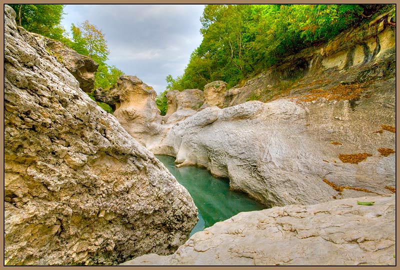
Most tourist routes begin from the village of Kamennomostsky (Khadzhokh). By a happy coincidence, this settlement is surrounded by numerous attractions of Adygea: Sahrai waterfalls, the Lago-Naki plateau and Mount Fisht, Rufabgo waterfalls and others. But business card the village is different interesting object- Khadzhokh Gorge, which is the end of the Great Khadzhokh Canyon. Every resident of Khadzhokh knows the history of the formation of this miracle of nature.
The Khadzhokhskaya Gorge is located in the southwest of the village of Kamennomostsky and is a winding rocky gap on the Belaya River, 400 meters long and about 40 meters deep. Curving, it either expands to 6-7 meters, then narrows to 2 meters.
The narrow part of the Khadzhokh Gorge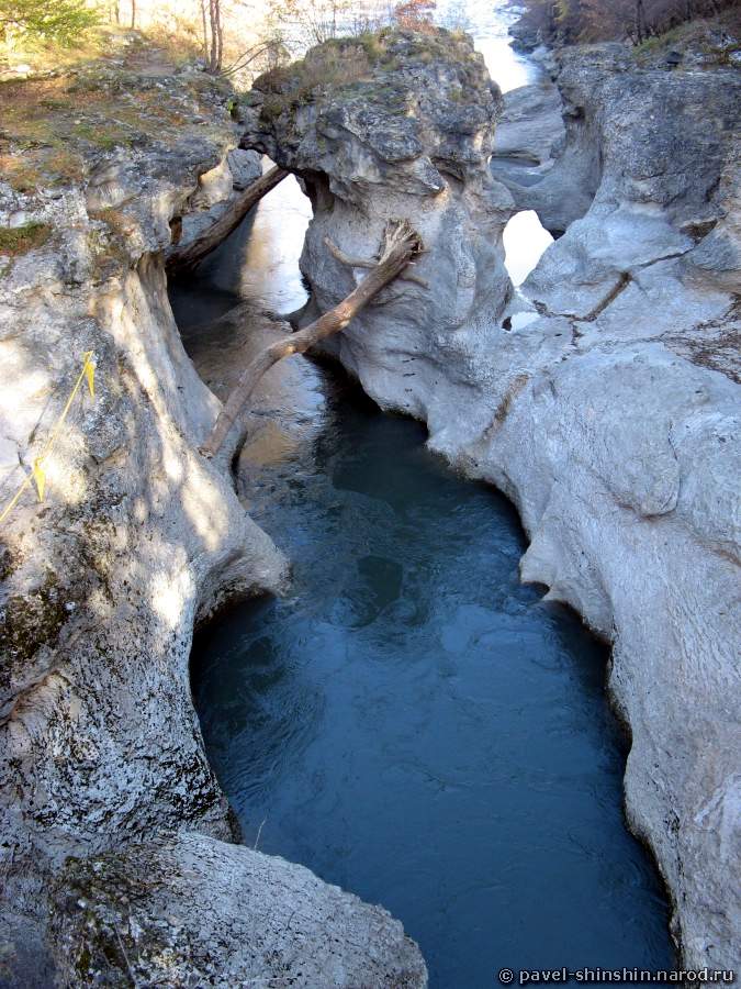
Among the people, the Khadzhokh Gorge also has another name - Shum. Perhaps this is due to the fact that in this place the Belaya River creates a lot of noise, overcoming numerous rapids and stone ledges. Another common name is the Tuapch Canyon or the Tuapch River Canyon.
For several years now, the Khadzhokh Gorge has been an equipped excursion site. Located at the entrance cozy cafe, ticket office and equipped parking for cars, and a little further there is a public toilet. It should be noted that there is an entrance fee to this site. To the right of the ticket office, in the old bed of the Belaya River, the original cafe is hidden from prying eyes. On the territory of the Khadzhokh Gorge itself there are special fences that protect against accidental falls into the canyon, and equipped observation platforms from which you can take beautiful landscape photographs.
IN dark time During the day, numerous spotlights and lanterns light up in the gorge, favorably emphasizing the relief of the rocks and allowing you to visit the Khadzhokh gorge in the evening.
At the very beginning of the gorge, the river is still calm, but when it enters a narrower space with high rapids, the Belaya literally boils and foams, showering centuries-old boulders with a scattering of spray. Previously it was possible to see here amazing phenomenon- a stone bridge that was cut down over many millennia river flows in the rock. The width of the canyon in this place reaches 5 meters. Before the Khadzhokh Gorge was equipped as a tourist site, the bridge was used by villagers, and local children jumped into the water from the bridge, for which they received a small monetary reward from enthusiastic tourists.
On the right side of the canyon (where the Khadzhokh Gorge begins) there are numerous observation platforms that offer views of the narrow part of the gorge.
Previously, the Belaya River forked in this place, and in the middle of the river there was the island of the Three-Headed Dragon. Now one of the channels has been filled up and a Dry Canyon (or dry channel) has been formed. On the right side of the Khadzhokh Gorge, this territory is occupied by a restaurant, and on the left, in the place where both canyons converge, there is a high Observation deck, breaking off over the abyss - Amin's platform (or Amin's judgment seat, Amin's throne). During the Caucasian War (19th century), in this place, Shamil’s governor, Mohamed Amin, carried out reprisals against the mountaineers: the guilty were thrown from the platform into the abyss, and those who managed to cope with the seething streams of the river and get out of the water trap were pardoned. Another name for this place is the Bell Tower rock.
Having examined the gorge from beginning to end, do not rush to leave this place and visit the local menagerie: enclosures with bears and ostriches, cages with birds and otters are scattered throughout the site.
Coordinates: N44 9.816 E40 8.478.
To the south of the village of Dakhovskaya there is the well-known Granite Canyon in Adygea. The length of the gorge is approximately 4 km, depth - 200 meters. For many centuries, rapid water flows The Belaya River cut the rock mass and thus the picturesque Granite Canyon gradually emerged. This place is also known under other names: Granite Gorge and Blockhouse Gorge.
The Maikop - Guzeripl highway runs along one of the edges of the canyon. Particular attention is drawn to the walls of the Granite Gorge, painted by nature itself in a fiery red color. On the rocky hills overhanging the abyss are lush forests of beech, barberry, pine and chestnut trees. And in the south of the canyon there is Mount Trident - high rock towers, which are often called the “Three Gendarmes” or “Three Crosses”.
Belaya river in a stone canyon 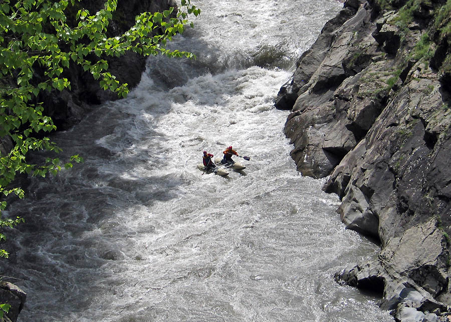
Approximately in the same place, on the right bank of the Granite Canyon (Adygea) there is a Zolotoy spring with the purest water, from which a stream, also called Zolotoy, originates. As a result, the stream ends with a beautiful 40-meter waterfall and flows into the Belaya River. The name of the stream is easily explained - the fact is that earlier local residents they mined gold from river sand in the Granite Gorge, and the place under the waterfall was very successful and often rewarded diligent gold miners.
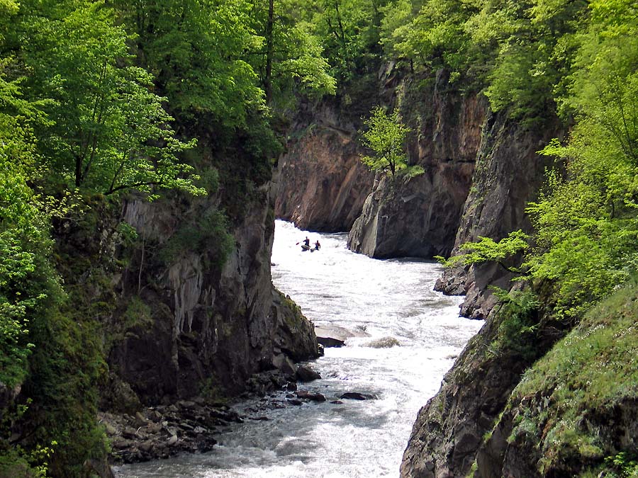
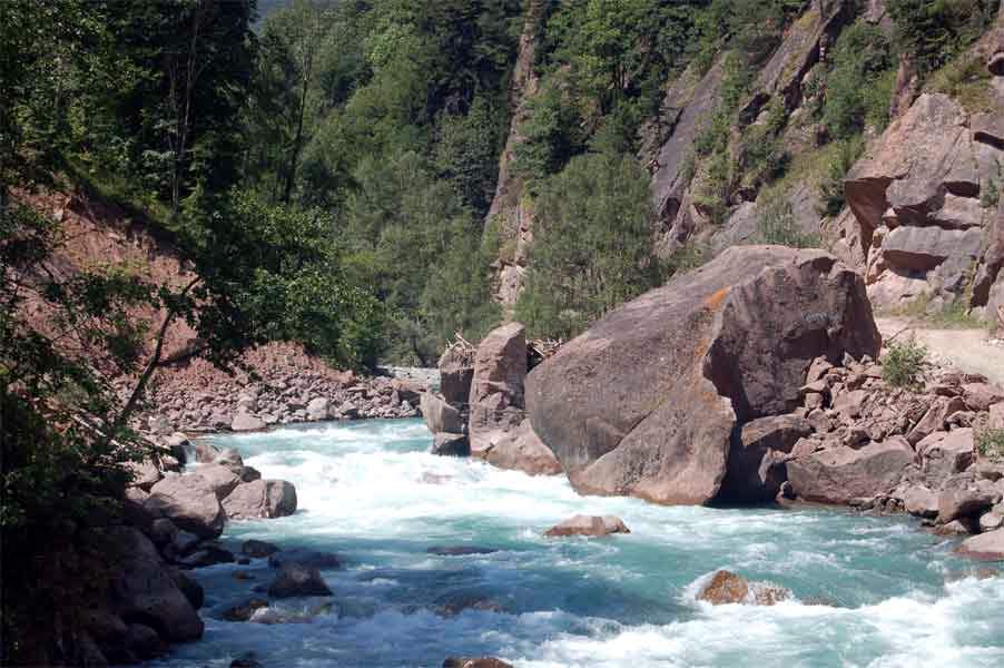
In places where Granite Canyon narrows, powerful river flows form high rapids and small waterfalls. Areas with rapids are found very often in the Granite Gorge, and therefore this place is ideal for rafting. Hundreds of tourists who come to Adygea take advantage of the opportunity to independently overcome the unruly and strong river.
Belaya River (Adygea) 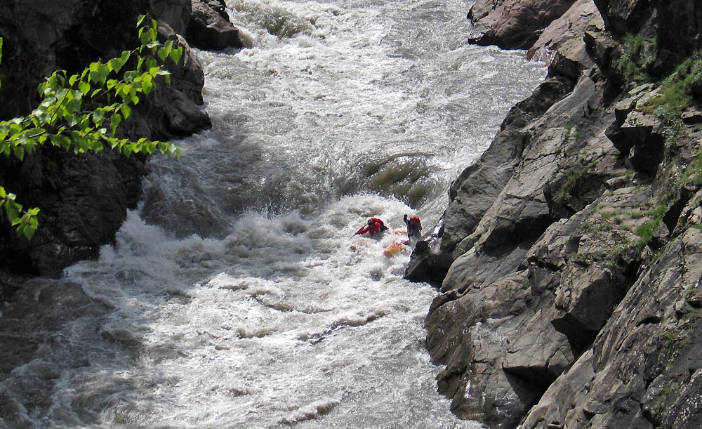
Coordinates: N44 13.782 E40 11.43.
The Belaya River (Adygea) is the largest aquifer in the region and is one of the most powerful left-bank tributaries of the Kuban. The length of the river is more than 260 kilometers. The total drop, that is, the difference between the absolute height of the mouth and the source, is 2283 meters, and the drop per 1 kilometer is 840 cm (for comparison: the Danube is 24 cm, and the Volga is 7 cm). The upper reaches of the Belaya River are fed by mountain streams and springs of Fisht, Oshten and Abago. On its way, the waters of the Belaya River receive 3,460 tributaries, the largest of which are Dakh, Kishi, Pshekha and Kurdzhips.
The Belaya River in Adygea originates from the snowy peaks of Fisht and Oshten, breaking out of the rocky depths, it rushes southeast to the top of Mount Chugush, from the slopes of which the first tributary of the Belaya, the Berezovaya River, descends.
Merging with its first tributary at an angle of 180°, the Belaya River turns at an angle of 90° to the left, bending around the eastern slopes of the Circassian Range, and receives the waters of the second tributary - the Chessu River. From this point the Belaya River makes another turn to the left and flows directly to the northwest.
Not far from Andreevskaya Balka, the first major tributary, the Kishi River, flows into the Belaya River. From its sources to the village of Khamyshki, the Belaya flows through deep and narrow gorges, crossing the Dakhovsky granite massif. One of the places in Adygea between the village of Khamyshki and the village of Dakhovskaya is called the Granite Canyon. At the village of Dakhovskaya, the Belaya River receives a second large tributary - the Dakh River; through a narrow Belaya gorge it makes its way north to the village of Kamennomostsky, where its bed decreases tenfold: from 40-60 meters to 4-6 meters.
Coming out of the Khadzhokh gorge, which is 350-400 meters long, the river finds itself in a valley and the mountainous character of the river gives way to a calmer, flat one. This is where the Valley of Ammonites is located. Passing the village of Abadzekhskaya, the village of Tula, the city of Maykop (the center of Adygea) and Belorechensk, the waters of the Belaya River flow into the Krasnodar reservoir.
Floods on the Belaya River (Adygea) occur in the warm season, but the river often floods at any time of the year, with the only exception being winter. The causes of spring floods are melting snow, summer floods are caused by the melting of the Fisht and Oshten glaciers, and autumn floods are caused by rains. In winter, part of the water is spent on the formation of glaciers, but the winter low-water period is unstable and short-lived, which is explained by frequent thaws and rains in winter.
It is worth noting that Russian name rivers - Belaya, Adyghe - Shkhaguash. Each of the names of the river has its own beautiful legend. One of the legends explaining the name of the river - Belaya, says that the Abadzekh prince once lived in these places. From another military campaign, the prince brought a captive Georgian woman, a beauty named Bella. The prince wanted to make Bella his wife, but the girl refused to obey the prince. Having lost hope of winning Bella's love, the prince decided to take her by force. Trying to defend herself, Bella stabbed the prince and ran away. The prince's servants chased after her, the chase was getting closer, but there was nowhere to run: ahead was only a formidable river, blocking the path. Bella rushed into the waters of Shaguash, the waters of the river closed over the girl’s head. Since then, the river in Adygea received a second name - Bella, which over time was replaced by a more euphonious one - Belaya.
There is another, but partly similar legend about the origin of the Adyghe name for Belaya - Shkhaguash. Many years ago, an old prince lived in the upper reaches of the river; he was fabulously rich, but above his wealth he put his beautiful daughter, Shyyguashe (which means “mistress of the deer”). Rumor spread stories about her beauty far beyond the borders of Adygea. But time passed, and the time came to give my daughter away in marriage. The prince began to look for suitors for her, but the beautiful princess did not want to hear about marriage. The prince reconciled for a while, but soon began searching for suitors again. And the prince decided to organize a competition of young horsemen, and the most dexterous and brave of them would become his son-in-law.
The Adyghe horsemen competed for a long time. They exhausted the horses and were tired themselves, but the prince’s daughter remained silent. None of the young horsemen won the princess’s heart. This saddened the prince, and he began to think about how to awaken his daughter’s heart from sleep. But then one night the prince heard the howling of dogs, went out into the yard and couldn’t believe his eyes: Shyyguash was standing and quietly, by the fence, talking to his shepherd!
The prince became angry and became angry with the shepherd and his beloved daughter. The prince ordered the lovers to be sewn into a bag and thrown into the stormy waters of the Adyghe river. However, the servants, while sewing up the bag, quietly put a knife in it.
The bag of lovers floated along the river for a long time until it landed on the shore. The shepherd cut the bag with a knife, and the lovers went ashore. The shepherd and the princess settled in the forest: he fished, and the prince's daughter, having tamed the deer, milked them.
Time passed, and one day strangers came to the hut looking for reindeer milk for the old prince. Having talked in the princess's room, the strangers said that in his delirium, the dying prince often remembers his rebellious daughter... Together with the strangers, the princess and the shepherd went to the prince. Seeing his daughter alive, the prince was delighted and blessed her marriage.
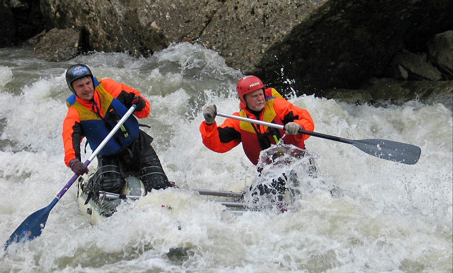
The Belaya River is popular among tourists coming to Adygea, as famous place for rafting. For several years now, summer one-day rafting tours have been held on the Belaya River. Tourists have the opportunity not only to raft from the village of Guzeripl to the mouth of the Kishi River, where rafting competitions were held in the spring for several years, but also to visit the natural attractions of Adygea: the Khadzhokh Gorge, the Rufabgo waterfalls, and visit the Big Azish Cave. Some rafting routes on the Belaya River (Adygea) are among the most extreme big water. From a sporting point of view, the rafting route along the Belaya is difficult even during periods of low and medium water. Several serious rapids are concentrated in a small section of the river: Toporiki, Teatralny, Topori, Kisha-1 and Kisha-2. Moreover, the last three rapids have category V difficulty. In the summer, when the water in the river subsides, the Topora rapids become completely impassable, the participants of rafting tours finish their movement before it, or they carry rafts along the shore and, with the organization of additional insurance, pass the Kisha-2 rapids.
rafting on the white river
At the same time, the Belaya River (Adygea) is also suitable for simple rafting, for example, the section from the Granite Gorge to the village of Dakhovskaya is accessible to beginners who are taking up the oars for the first time.
Kishi River (Kisha), Kishinskie rapids
The Kishi River is covered in rumors and legends, capricious and scary, attractive and ruthless, attracting tourists to its waters. In Circassian, Kisha means “bride”.
The length of the Kishi River is 90 kilometers. The river originates on the slopes of the Assara and Chugush mountains and flows north, sometimes along wide valleys, sometimes compressed in the grip of rocks, it rushes to deep gorges. IN downstream The Kisha River, bending to the west, flows into the Belaya River. It is interesting that the waters of the Kishi are much cleaner than the waters of the Belaya and for some time the flows of the two rivers run parallel without mixing. A rocky gorge has formed at the confluence of two rivers, and the river bed is cluttered with boulders. The Belaya River flows down in a powerful cascade, forming the rapids “Kisha-1” and “Kisha-2”.
mouth of the Kishi River, Belaya River 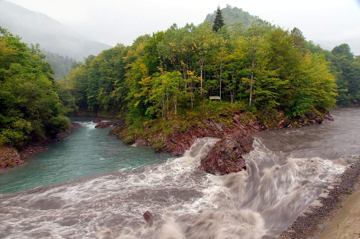
The flow of water on the Kishinsky rapids seems to be seething with rage, shaking the rocks, with a roar and roar, the water overcomes one obstacle and rushes to the next, leaving behind only water vapor.
At the confluence of the Kisha and Belaya rivers, the territory of the Caucasian State Natural Biosphere Reserve begins.
In the upper part of the Kishi River basin, relief elevations of up to 3 kilometers are characteristic; in this part of the river basin, the mountainous nature of the fauna is clearly expressed, however, due to the inaccessibility of movement in this area, it remained unexplored for a long time. And only in the summer of 1933, the Hunting Station of the State Caucasian Nature Reserve conducted a study of this area. A herd of aurochs, deer, a group of chamois, turkeys, bears, a dead midge, a bumblebee and butterflies, spiders and lizards, and mole holes were found here.
Every year, in May, on the rapids of the Kishi River, international and All-Russian competitions are held on national rafting means: catamarans, rafts and kayaks; Also, rafting rafting trips are held annually on the Chisinsky rapids - “Interrali Belaya”.
![]()
Fars River
The Fars River in Adyghe means “spilling”, “rolling”, and it can only be seen like this on flood days, when its waters overflow their banks and rush headlong into the unknown. But the river also had another name - “Sosurkai”, after the Makhoshevsky aul of the same name, the center of the Circassian tribe. Sometimes another name for the Fars River was found - “Yamansu Sosrukay”, which translated from Turkic means bad water.
The Fars River, a left tributary of the Laba River, flows along Krasnodar region and Adygea. The length of the river is more than 190 kilometers, and there are large villages on it: Makhoshevskaya, Dondukovskaya, Novosvobodnaya, Yaroslavskaya and the village of Khakurinokhabl.
The Fars River originates from a spring near one of the caves on the northern slope of the Rocky Range, a few kilometers from the village of Pobeda. Breaking through limestone rocks, the river flows to the village of Novosvobodnaya, then to the north to Makhoshevskaya and Yaroslavskaya, where it receives the waters of the right tributary - the Psefir River. Then the river continues its path to the village of Kartseva, where it receives the waters of the left tributary - the Seral River; near the village of Druzhba, the Fars River turns to the northwest and two and a half kilometers from the village of Vozdvizhenskaya flows into the Laba.
In the upper reaches of the Fars River, traces of the “Turkish Wall” have been preserved, where during the Caucasian War there was a line of defense of the Circassians; in the river valley there is the famous Bogatyrskaya Valley, on which there are megalithic buildings - dolmens.
It is curious that in the upper reaches the Fars River has a mountainous character, while in the lower reaches it is already a flat river. In the summer, when there is no rain, the river becomes very shallow, and during floods Fars overflows its banks.
A path leads from the Romantika camp site to the valley of the Fars River; it passes through glades where the monastery vineyards once grew, there were vegetable greenhouses, and not far from them there was a monastery apiary and pasture. During the Great Patriotic War, battles with German troops took place in the clearings of the Fars Valley.
The entrance to the canyon of the Fars River begins from the springs gushing from the rocky shore. The canyon is not exposed to sunlight, which makes it seem mysterious and damp, and the pungent smell of a snake-like worm that has filled the gorge gives it an unpleasant gloominess.
The canyon contains a large number of grottoes and waterfalls, rocks hanging over the river. The height of the rocks is only 30-40 meters, but they are very picturesque. After just a few hundred meters, the rocks disappear and the terrain becomes more level. Not far from the old logging trail, a spring with warm water flows into the river, heating the general flow of the river for several tens of meters, preventing it from freezing even at -20.
![]()
150 meters from the spring, the river cuts through the rock, exposing high rocks, in the deep grottoes of which beautiful curtains of icicles freeze in winter.
Further, the Fars River emerges onto flat ground several times, but then goes into a canyon, forming waterfalls and water holes that can easily be bypassed. Grottoes are often found here, some of them are inhabited by pious people or travelers, among them there is also a rather unusual grotto with an entrance upstream of Fars.
The canyon ends with a huge rock hanging over the river. Behind the rock there is a path; in the summer the path along it is relatively safe, but in winter along the steep descent you can slip and fall into the river on sharp stones. You can get here along the path from the St. Michael's Monastery or the village of Pobeda.
Along the way you will come across a waterfall, nicknamed the Turkish Bath. The stream of water falls from a height of two and a half meters, and there is no way to overcome it, since it is sandwiched on the right and left by sheer cliffs
High white stone walls frame the valley of the Fars River, but suddenly the river makes a sharp turn and leads tourists to an extraordinary place. The path of the river in this place is blocked by huge round stones supporting each other. Through this stone wall, thundering and pulsating, the river makes its way like a waterfall.
After climbing up the stone cascade, a picturesque picture opens before your eyes. A huge powerful rock hung over the gorge, covering the river bed. The stone blocks scattered nearby seem small and insignificant against its background. Hanging high from the cliff is a decoration created by nature itself - an evergreen yew tree, the trunk of which is twisted into a bizarre spiral, and coniferous branches are spread over the stone columns of the grotto, as if inviting you to visit this place.
The Fars River falls from a two-meter cliff into a deep water bowl. Behind the waterfalls another canyon begins with its own waterfalls and grottoes. The waterfall of this canyon is unusual and bears little resemblance to other waterfalls on the river. Its wide and long streams roll smoothly and quietly along stone gutters. Behind this waterfall begins a series of small grottoes, going deeper into the rock one after another. Taking a bizarre turn, the river leads to another waterfall.
It seems that there are countless waterfalls in Fars... One more is visible ahead, but the gorge is becoming narrower and narrower, high stone walls squeeze Fars, and there is no further way. Climbing up the forest slope you can observe other waterfalls in Fars.
The Fars River and its natural attractions are beautiful, diverse and accessible to everyone.
Dakh River, Adygea 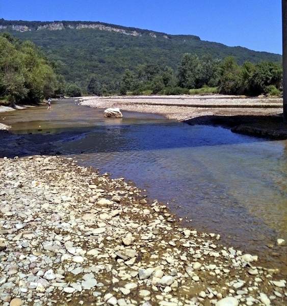
Coordinates: N44 14.292 E40 12.186.
The Dakh River, or Dahe, is the right tributary of the Belaya River. According to one version, the name of the river comes from the Circassian word “Dakhe”, which means “beautiful”. According to another version, the name of the river comes from the Adyghe family Dakh, who once owned these places.
The length of the Dakh River is 23 kilometers. Its main tributaries are Shushuk and Sakhray. There are 2 large settlements: the village of Ust-Sakhray (10 kilometers from the source) and the village of Dakhovskaya (at the mouth of the river, where it flows into the Belaya River).
The journey to the Dakh River valley begins at the ancient stone Dakhovsky Bridge, erected by the Cossacks of the Urup Regiment at the beginning of the 20th century. There are legends about the strength of this bridge, because egg whites collected by the entire village were added to the solution on which the bridge was built.
In the Dakh valley, rocky steep banks give way to gentle forest slopes. Among the crumbling steep banks, the Dakh River winds strongly, and forms a huge bend at the confluence with the Sahrai. The people called the elevated place at the confluence of two rivers Bukreeva Gorka. There are about fifteen dolmens on Bukreeva Gorka, and the village of Ust-Sakhray can be seen from the edge of the dolmen field. Antiquity hunters, black diggers, dug up the dolmens as best they could in search of curiosities.
There is a beautiful legend about the origin of the name of the Dakh River. Many centuries ago, in the vicinity of the village of Dakhovskaya, on a high rock there was a castle where the local prince Dakho lived. Incited by his quarrelsome and cruel mother Physiabgo, the prince often raided his neighbors. One day his warriors went to the lands of Gurjistan (Georgia), where the prince captured a beautiful young girl - Bela.
Prince Daho fell in love with his captive and asked to become his wife, but the proud beauty did not give an answer and every day she thought about a plan of revenge. And then one day Bela was able to get a dagger. Having hidden the dagger in the folds of her dress, Bela went to the prince’s chambers... Daho was glad, because Bela agreed to become his wife, but at the moment when he tried to hug her, the girl plunged the dagger into his heart...
Bela tried to escape from Fiziabgo's revenge, but the chase overtook her at a steep cliff, which did not stop the girl: she rushed down. From then on, the river where the girl died was called the Bela River. Prince Daho was buried on the bank of another river, and from then on the river began to be called by the name of the prince.
The Dakh River often has waters as muddy as the life of the murdered prince. And after the confluence with the Belaya River, the waters of the two rivers do not mix for a long time, and you can see how the clean streams of the Belaya and the dirty waters of the Dakh flow side by side.
Polkovnitskaya River, Polkovnitskaya Beam
The Polkovnitskaya River, also known as the Polkovnitskaya Balka or Polkovnitskaya Balka, is a left tributary of the Belaya River. The Polkovnitskaya gully flows into the waters of the Belaya 300 meters below the Lesnaya Skazka health sanatorium, located on the right bank of the river slightly north of the village of Kamennomostsky.
It is not known for certain whether the name of the river is connected with military events or not. During the Great Patriotic War, the defensive line of troops under the command of General K.I. Provalov passed here. In August 1942, the 383rd Infantry Division blocked the movement of the Wehrmacht here, which was striving for Tuapse and Apsheronsky. Battles of more distant years also took place in Polkovnitskaya Balka.
It is known that during the Caucasian War the Dakhovskaya Hollow and the Kamenny Bridge tract were inaccessible to the Russian army. Here stubborn battles were fought with the Ubykhs, Abadzekhs and Bisleneites. And at the confluence of the Polkovnitskaya and Belaya rivers, regiments of the Russian army of the Abadzekh defensive line stood at the forward post.
However, the Polkovnitskaya gully is famous not only for military events, but also for a large accumulation of unique marine mollusks - ammonites and belemnites. Ammonites cover not only the shores of Belaya, but also Semiyablonka and Polkovnitskaya.
Millions of years ago, modern Adygea was the bottom of the huge Tethys Ocean. Herds of wild animals roamed the rocky islands, and giant clams slowly rolled along the beaches of the ocean. Time passed, the earth's surface rose from the ocean, and mountains formed. The ocean retreated, cold weather came to the earth, the mountains were covered with ice and eternal snow. Eternal ice retreated with the onset of warmth. Snow melted by the sun ran in streams into the plain, revealing the secrets of the ancient Tethys Ocean.
On the steep banks of the Polkovnitskaya gully, protruding veins of gray-red iron ore are visible. Coastal boulders are encased in tree roots, like the clawed paws of giants.
In the rocky bed of Polkovnitskaya there are dark, deep, stone bowls. The extraordinary transparency of the water allows you to see the bottom and all the pebbles in these “ladles”.
The land along the river exudes healing mineral hydrogen sulfide springs with reddish streaks that emit a pungent and unpleasant smell of sulfur. People believe in healing power sources, come to them in order to be cured of various ailments. A bath was placed at one source, where invaluable natural medicine was collected for medicinal baths.
The river and the Polkovnitskaya gully are known as a place for the growth of plants such as beech and hornbeam, pedunculate oak, alder, dogwood, hazel and edible chestnut, which is not typical for the northern macroslope of the Caucasus.
Aminovka River, Aminovskoye Gorge 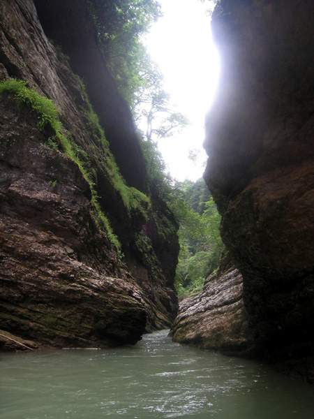
The Aminovka River is a left tributary of the Belaya River, it begins at the watershed ridge of Kurdzhips and Belaya, from where it flows in the direction of the village of Kamennomostsky, to the confluence with the Belaya. The length of the river is more than 9 kilometers, and 8 of them the river flows through a place known as the Aminovsky Gorge, and the remaining path of the Aminovsky River runs through the village of Kamennomostsky, to the place where it flows into the Belaya River.
The river, like the gorge, got its name from Naib Muhammad Amin, Shamil’s comrade-in-arms. During the Caucasian War, Naib Muhammad Amin held the defense here against the advancing Russian troops. Despite the inaccessibility and well-fortified walls of the village, which was once on the site of the village of Kamennomostsky, despite the convenient location of the troops of Muhammad Amin and the well-fortified Mount Batareinaya, the forces of the opponents were not equal, the Circassian troops of Naib Muhammad Amin retreated. According to legend, during the retreat, the naib left a treasure somewhere in the Aminovsky Gorge.
The Aminovskoye Gorge has picturesque waterfalls, mysterious caves and grottoes, rocky outcrops and huge piles of stones. Tourists rarely come here; the usual tourist camps with fire pits cannot be found in the gorge; the trunks of chestnuts and beeches growing here are not covered with all sorts of inscriptions. The path to the gorge begins at a small, barely noticeable path, which gradually disappears completely. Therefore, the further path runs along a rocky river bed, polished by water. An attentive traveler walking along the trail will be able to find on the banks of the river the fossilized remains of ancient mollusks - ammonites.
In the Aminovsky Gorge, here and there there are small waterfalls and water slides. In total, the Aminovskoye Gorge has 15 waterfalls of various sizes, and each waterfall seems to have its own unique character. One waterfall, the width of the river bed, calmly rolls down. Another rapidly falls down in multi-stage cascades, and the third, noisily splashing and foaming, falls into a stone bowl. Most large waterfalls The gorges are formed by the relief of Aminovka, and out of 15 waterfalls, only 5 are large.
The rock outcrops of the Aminovsky Gorge are also unique. Along with limestones, there are many outcrops of sandstone, blue, yellow, red and light yellow clay in the gorge.
The grottoes of the Aminovsky Gorge are rarely visited by tourists, although its underground world is rich, as evidenced by the considerable number of karst sinkholes. There are enough caves in the gorge, many of them are nameless and unexplored. In May 2012, the already known caves of Dukhan, Saxophone and Flute were joined by a new discovered cave - “Olgina Cave”. She was found by a 12-year-old girl, Olya Karpenko. Together with her parents, she walked more than 500 meters and reached an underground mine that fell down. The entrance to Olga's Cave is narrow, but after it begins a large gallery, the arch of which only occasionally lowers. The cave has several halls and a large number of amazing sinter formations. Perhaps, in terms of the richness of sinter formations, it will be able to compete even with the Great Azish Cave.
Especially picturesque landscapes open at the sources of the Aminovka River. The central source of the river is a cauldron cluttered with large stones, into which a waterfall flows. The right middle source originates in the Dukhan cave, the most popular among tourists. The right extreme source of Aminovka originates in the Saxophone cave, located in the rock, from where it falls into a waterfall.
The entire forest area near the sources of the Aminovka River is strewn with karst sinkholes various diameters and depths resulting from erosion of rock by groundwater.
The slopes of the Aminovsky Gorge are rocky and difficult to pass, but in some places where there are gentle slopes and no rocks, you can find traces of wild animals (deer, chamois, wild boars or jackals).
The Aminovka River and the Aminovskoe Gorge can become a wonderful place for relaxation or a weekend route for anyone who wants to escape from the bustle of the city in the cool gorges of the mountains.
Laba (Adyghe and Kabardian-Cherk. Labezh) is a river in the North Caucasus, a left tributary of the Kuban River.
One of the most significant rivers of the Western Caucasus, the left tributary of the Kuban. The Adygs call her “Labe”.
A popular river among all water tourists in Russia!
There is no consensus on the origin of the hydronym. The most popular are two opinions. One thing connects the name with the Iranian-language ancient term “alb” (“alb”) - white.
The other is with the Iranian-language topoelement “lab” (“lav”), which in Persian means shore.
It is formed by the confluence of the Bolshaya Laba and Malaya Laba, which originate from glaciers on the northern slope of the Main Range of the Greater Caucasus.
The length (together with the Bolshaya Laba) is 347 km, from the confluence with the Malaya Laba - 214 km, the basin area is 12,500 km². In the upper reaches of the Laba and its tributaries there are turbulent mountain rivers flowing in deep gorges.
In the lower reaches of the river the banks are gentle and the flow is calm. The river is fed by mixed sources: snow, glaciers and rain. The average flow rate near the mouth is 95.7 m³/sec. The laba freezes at the end of December, but not every year; it opens at the end of February - beginning of March. Used for irrigation.
On its flat part, the Laba receives many tributaries, most of them are regulated, their flow consists of strings of ponds (from the Krasnodar side) or irrigation canals (from the Adyghe side).
At the same time, the rice paddies built in the lower reaches of the Laba in the 70s of the 20th century are currently not in use.
_____________________________________________________________________________________________________
SOURCE OF INFORMATION AND PHOTO:
Team Nomads
Gold North Caucasus// Bulletin of the gold miner, 07.19.2010
http://www.photosight.ru/
Zikhi // Great Soviet Encyclopedia / Ch. editor A. M. Prokhorov. — 3rd edition. - Moscow: "Soviet Encyclopedia", 1973. - 629 thousand copies.
http://budetinteresno.info/lagonaki.htm
http://www.adygheya.ru
Wikipedia website.
Nature of Adygea.
http://lagonaki-adygeya.ru/
- 18934 views
The Rufabgo waterfalls are located - one of the most picturesque and famous attractions of the Republic of Adygea. A few kilometers from here stands the village of Kamennomostsky, also known as Khadzhokh. This is where most of the republic’s tourist routes originate.
On the way to the Heart of Rufabgo waterfall Maiden's Spit, view from above the waterfall, March Maiden's Spit waterfall, March Noise waterfall, March At the end of the gorge - the Heart of Rufabgo waterfall
The section of the Rufabgo River that flows through a deep gorge surrounded by rocky slopes, which become inaccessible cliffs as the height increases, is extremely popular among tourists. There are a dozen waterfalls here, the most picturesque of which are such waterfalls as Lace, Bowl of Love, Heart of Rufabgo, Maiden Braids, Noise and Cascade.
There are two ways to get to Rufabgo waterfalls. Free, runs along the Belaya River starting not far from. Or pay to cross the bridge, which offers a wonderful view of a small waterfall called the Three Brothers. It is sometimes called Rufabgo Zero Falls. Behind this waterfall there is a cozy clearing with gazebos, souvenir shops, cafes and attractions.
Waterfall "Noise"
Shum Waterfall, March Shum Waterfall, March Shum Waterfall, July
After passing through the clearing, you will see the first of the ten main waterfalls - the “Noise” waterfall.
Cascade Waterfall
Kaskadny Waterfall, March Kaskadny Waterfall, July Kaskadny Waterfall, February
As you continue walking, you will soon hear a continuous stream of water falling from the slope, and then you will see the picture itself. This is a small but extremely beautiful Cascade waterfall, consisting of several small steps.
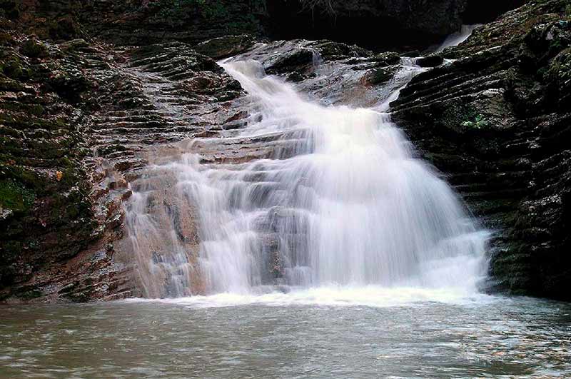
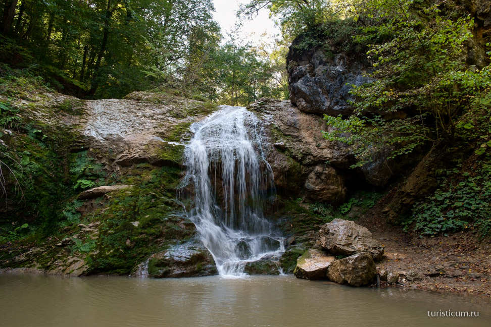
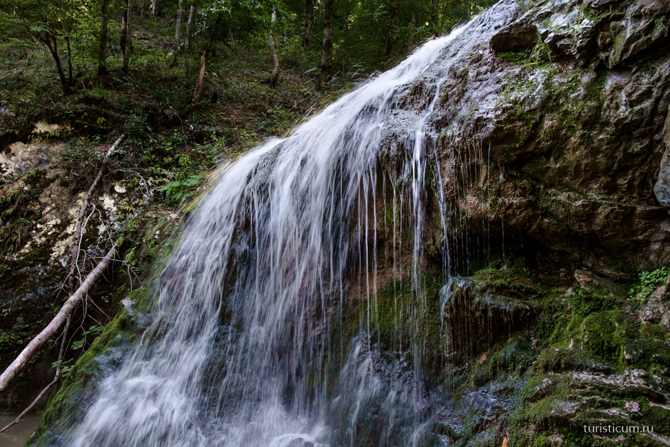
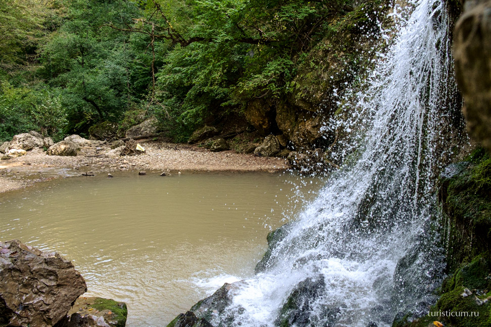
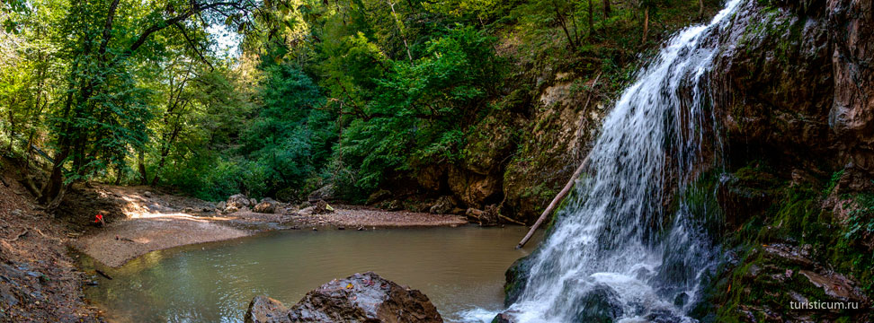
Waterfall "Heart of Rufabgo"
At the end of the gorge - the Heart of Rufabgo waterfall On the way to the Heart of Rufabgo waterfall
Undoubtedly, the most majestic of all the Rufabgo waterfalls is the third waterfall of the gorge, called the “Heart of Rufabgo”. It received this name for the shape of the rock, from under which a huge stream of cold water falls.
Waterfall "Maiden's Braid"
Maiden's Spit waterfall, July View from the Maiden's Spit waterfall, July View from the Maiden's Spit waterfall, July Maiden's Spit waterfall, March Maiden's Spit waterfall, March Maiden's Spit waterfall, March Maiden's Spit waterfall, top view of the waterfall, March
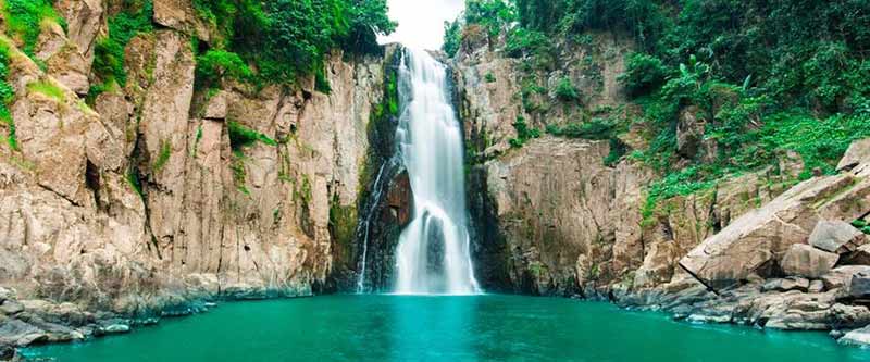
After the “Heart of Rufabgo”, the highest of the Rufabgo waterfalls will appear before your eyes - “Maiden’s Braid” (another name is “Lace”), the height of which is about 20 meters.
Here the section of the trail equipped for visitors ends and to see the rest of the waterfalls, you will have to climb 900 meters along a not so convenient trail. For those who overcome the difficult climb, the reward will be two waterfalls at once - “Maiden Braids” and “Cup of Love”. In this place, streams of the purest water flow from a height of five meters from the rocks into a bowl created by nature itself. And literally 40 meters from the “Chalice”, flowing in gentle curves, the waters of the river intertwine into the beautiful “Maiden Braids”.
Picturesque bridge
Bridge on Rufabgo Falls Trail, February
Legend
Any beautiful tourist site necessarily has its own legend. And Rufabgo waterfalls are no exception. There is a legend about the evil giant sorcerer Rufabgo and the beautiful young man Khadzhokh. According to legend, Rufabgo once lived in Here he performed secret rituals, maintaining contact with evil spirits who granted Rufabgo remarkable strength and magical abilities. Thanks to these forces, many surrounding villages were enslaved by him. In each captured village, the evil Rufabgo took the most beautiful girl, and brutally dealt with those who tried to defend the peasants. In one of the settlements there lived a beautiful girl who loved the slender young man Khadzhokh. Hadjoh knew about Rufabgo and was afraid that one day he would come for his beloved.
To prevent this, the young man decided to find a kind sorcerer named Mezmay, who lived somewhere in the mountains of Adygea. When Khadzhokh came to the wizard, Mezmay told him that there was only one way to defeat the evil Rufabgo. To do this, you need to drive up to it from the leeward side and scatter the miraculous powder, from which a cloud is formed that disorients the giant. At this moment, you should cut out the heart from his chest and throw it away. Hadjokh thanked Mezmay, took the magic powder from him and went to the cave where Rufabgo lived. There Khadzhokh challenged the giant to a duel. Hearing this, Rufabgo laughed, because he had already defeated many such brave men. The opponents drove into the valley. But the overweight Rufabgo got stuck in the ground, soaked by the recent rain. Then Khadzhokh jumped up to the giant and poured out the powder, which immediately disoriented him. Without wasting a minute, the young man raised his sword, cut open the chest of his enemy, tore out a huge heart from there and threw it as fast as he could into the distance. The heart fell into a gorge in the path of a fast mountain stream, blocking its path. Over time, it petrified, and the resulting waterfall was called the Heart of Rufabgo. Since then, when spring showers erode the surrounding clay and the water takes on a reddish tint, local residents say that it is the greedy heart of the giant Rufabgo that is bleeding.
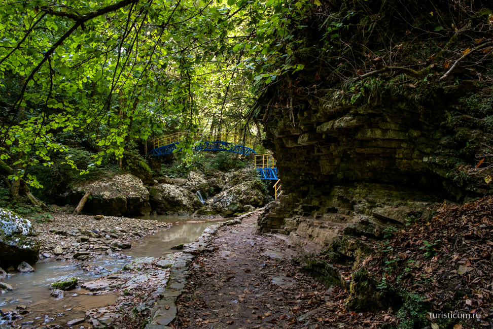
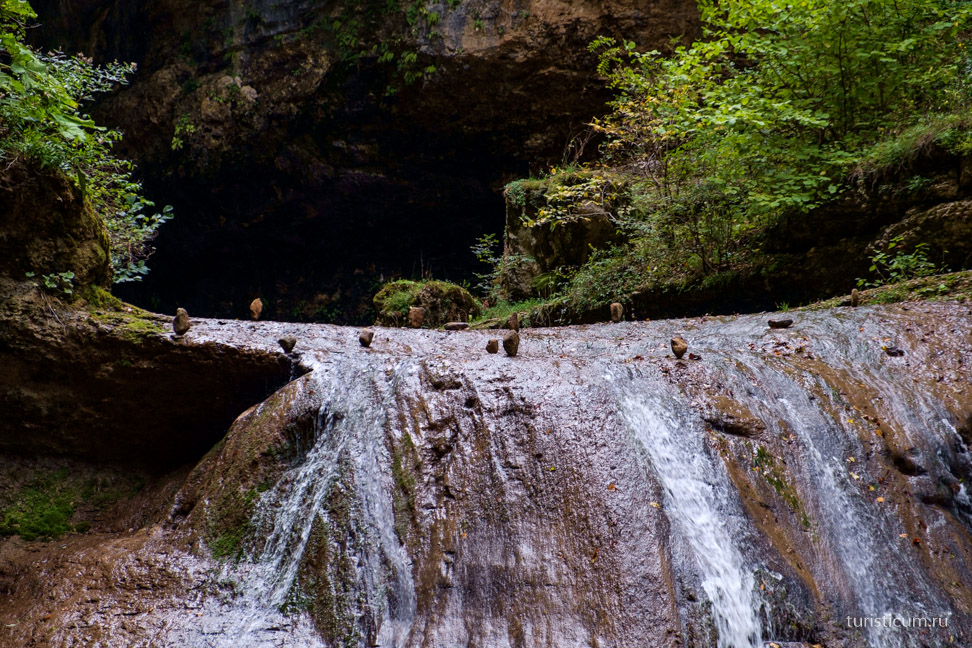
Cave "Through"
Near the descent to the Shum waterfall, the path leads up, this is the path to the Skvoznoy cave.