What is the name of the highest peak of the African mountains. Mount Kilimanjaro in Tanzania
- Location: northeast Tanzania
- Mountain system: East African rift valley
- Ridge or massif: East African plateau
- Volcano Shape: Stratovolcano
- Top height: 5895 m
- First ascent: 1889 (Hans Meyer, Ludwig Purtscheller)
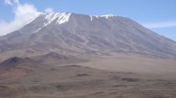
In the northeastern part, rising above the Masai plateau, is the highest point of the entire African continent - Mount Kilimanjaro.
Kilimanjaro is a dormant stratovolcano that consists of numerous layers of tephra, solidified lava and ash. Scientists believe that the Kilimanjaro volcano was formed more than a million years ago, but the date of discovery is considered to be May 11, 1848, when the German pastor Johannes Rebmann first saw it.
Historians have not recorded the eruption of Mount Kilimanjaro, but, according to local legends, it still happened about 200 years ago. According to the results of studies carried out in 2003, lava was discovered in the crater at a depth of 400 meters, but it does not pose any danger; much more concern is caused by gas emissions that could lead to the destruction and subsequent eruption of Mount Kilimanjaro.
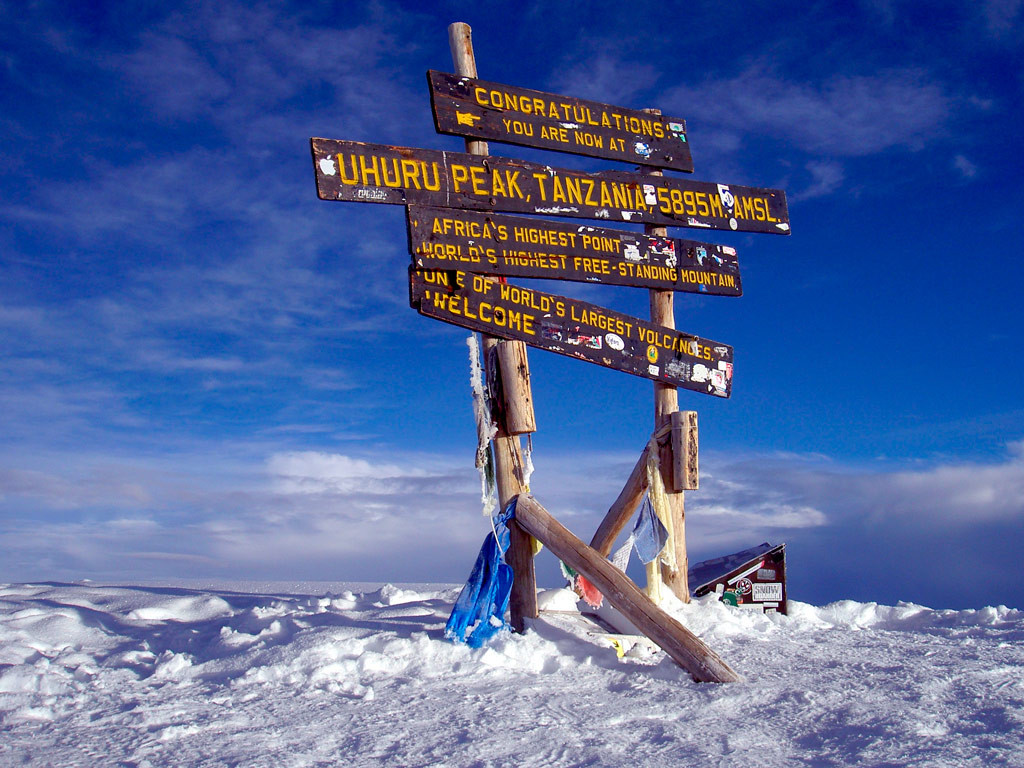
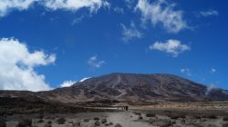
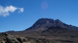
DescriptionMount Kilimanjaro consists of 3 peaks: in the west - Shira, whose height is 3962 meters above sea level; in the east - Mawenzi (5149 m) and in the central part - Kibo with Uhuru Peak, which is the most high point Mount Kilimanjaro and all of Africa - its height is 5895 meters above sea level.
The top of Kilimanjaro is covered with snow, which shimmers in the bright African sun, perhaps that is why the mountain has such a name: Kilimanjaro - the sparkling mountain. Local ancient tribes mistook white snow for silver, but for a long time they did not dare to conquer the peak because of fear of the many legends associated with Mount Kilimanjaro, but one day the leader of the tribe ordered his bravest warriors to go to the top of Kilimanjaro for silver. Imagine their surprise when the “silver” began to melt in their hands! Since then, Mount Kilimanjaro has received another name - “The Abode of the God of Cold.”
An interesting feature of the mountain is the change of all types of climate in the world when climbing to the top - you will start your journey in a humid tropical climate and an average daily air temperature of +30°C, and end your journey on the snowy peaks of the mountain, where the daytime air temperature barely reaches +5°C , and at night it drops below zero. You can climb to the top of Kilimanjaro at any time of the year, but the most successful periods are considered to be the periods from August to October and from January to March.
Climbing Kilimanjaro
Most popular tourist routes The following trails for climbing Kilimanjaro are:
- Lemosho route- starts in the west and passes through the Shira plateau. The travel time will be 8-9 days, the route is considered the smoothest and one of the easiest ways to the top of Kilimanjaro, in addition, it is one of the most expensive routes– the price of a tour for this route starts from approximately 2 to 7-10 thousand dollars per person.
- Machame– the second most popular route, starting from the southwest. The route usually takes 8 days and has positive statistics for climbing to the top of Kilimanjaro, because... due to the sufficient number of days and good passability of the trails, it is one of the easiest routes. The approximate cost of a tour on this route starts from $1,500 per person.
- Marangu route, or Coca Cola way. The easiest, and therefore the most popular route to climb Uhuro Peak. The journey will take 5-6 days, along the way you will meet three mountain lodges: Mandara hut, located at an altitude of 2700 meters above sea level, Horombo hut (3700 m) and Kibo hut (4700 m). The approximate cost of this tour is $1,400 per person.
- Rongai Route. This is a little-known route that starts from the north of Kilimanjaro, from the town of Loitokitok. The tour lasts 5-6 days, suitable for people who are not used to crowds of people. Since this route is not the most popular among tourists, there is a chance that you will encounter herds of wild African animals along the way. Costs start from approximately US$1,700 per person.
- Umbwe route. The most difficult route with steep slopes and barely passable jungle, the travel time is 5-6 days, during which you will have the opportunity to test your strength and endurance more than once. Suitable for people with above-average physical fitness who are accustomed to an individual approach and working in a small, close-knit team. The cost of the route starts from 1550 US dollars per person.
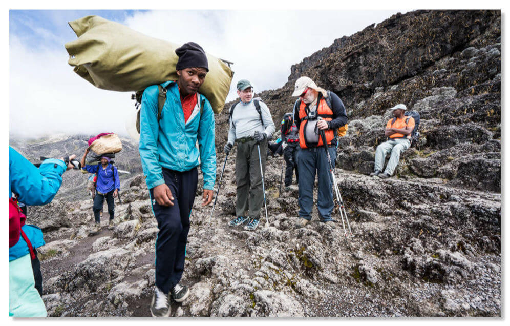
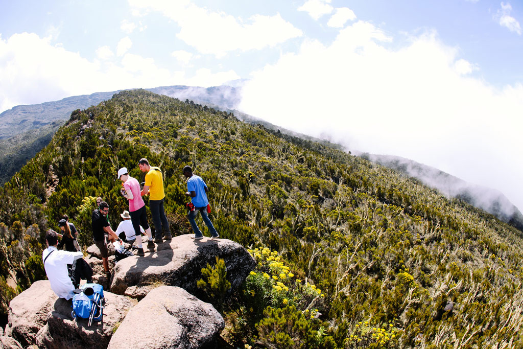
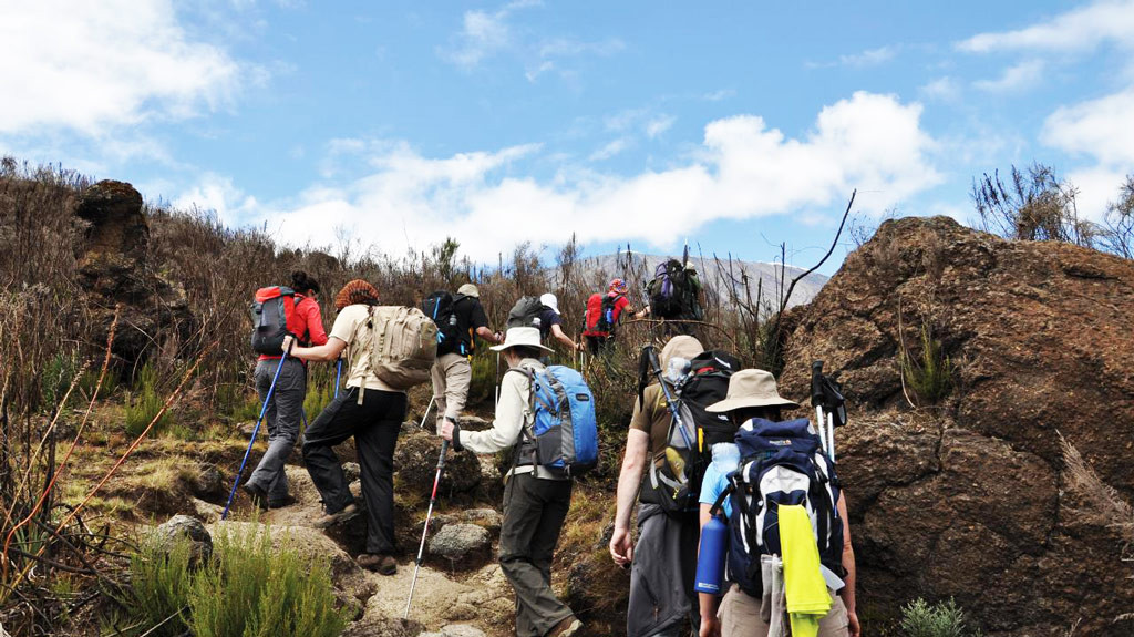
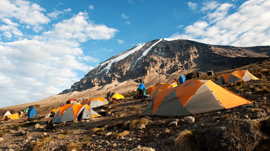
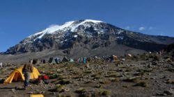
Tours for climbing Kilimanjaro can be purchased in the nearest town of Moshi at travel agencies. The most common are hikes lasting 5-6 days - on this journey, if desired and for a fee, you can be accompanied not only by local but also by English-speaking guides. The difficulties of walking on foot are more than compensated by the sights seen: eternal ice, volcanic activity with the release of ash and gas, landscapes and the famous 7 trails to the top of Kilimanjaro, along which tourists descend and ascend. Which route to choose depends only on your physical and financial capabilities. Each tour has a cook and porters; the tourist will only have to carry essentials.
Kilimanjaro - this word, unusual for the Russian language, has become attractive to most Russians since childhood, and many, like Hemingway’s heroes, have a dream of visiting these wonderful places and, perhaps, even climbing the “Crown of Tanzania.” This is what they call the highest mountain in Africa (literal translation from Swahili - sparkling mountain).
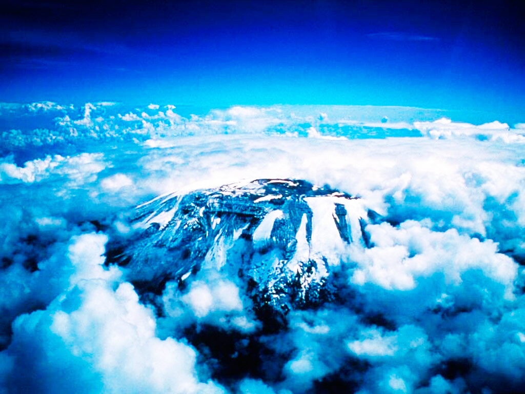
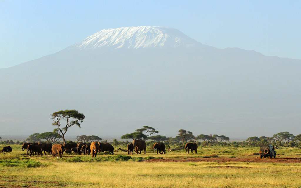
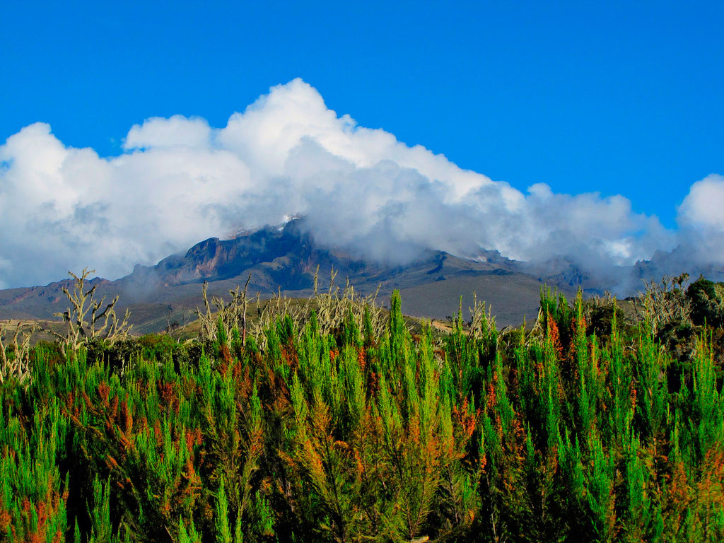
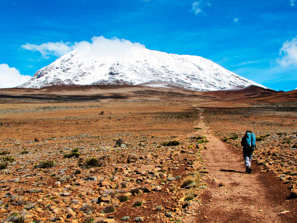
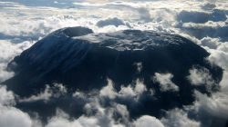
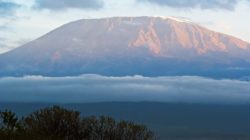
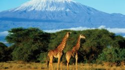
The snow-white top of Kilimanjaro, like the mountain itself - a symbol of the country, rising above the savannah, is visible from afar. Its height is 5895 m, and its base diameter is 60 km. In hot weather, the bluish tint of the base of the mountain merges with the surrounding landscape, and it seems that the upper part is hanging in the air. This feeling intensifies if there is some cloudiness: clouds usually cover the lower part of the mountain, leaving only the snowy top visible.
Mount Kilimanjaro is so huge that its own special climate forms at its foot. The wind, encountering such a large obstacle, throws off moisture particles in the form of rain or snow. Good soil irrigation is known to promote diversity flora. Therefore, the flora on Kilimanjaro is much richer than on the surrounding plain. Tropical plants grow in the lower part of the mountain (in particular, corn, coffee), further - up to an altitude of about 3000 m - the mountain is covered with jungle, and even higher - lichens and mosses.
Crown of Tanzania
Back in the Middle Ages, travelers used Kilimanjaro as a landmark, and the first written mentions of this volcano (and this is a volcano with a flat top and a crater) date back to the 13th century. Kilimanjaro was first described by Chinese sailors who found themselves off the African coast. They talked about a white peak rising to the sky from the depths of the continent.
However, medieval memories of a snowy mountain were for a long time perceived by the compatriots of the pioneers as fiction: no one could believe that there could be an ice peak almost at the equator (3 degrees south latitude). Only in the 19th century - after an expedition undertaken by Europeans in 1889 - was it marked on geographical maps.
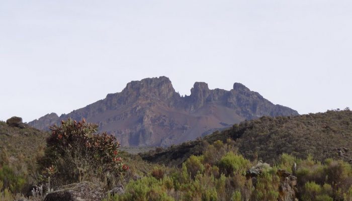
Now the territory near Mount Kilimanjaro has been declared a national park, the area of which is 7500 sq.m. This status was given to the land in 1961 after Tanzania became independent country. Kilimanjaro National Park has been included in the UNESCO list since 1987. By the way, Kilimanjaro is a mountain formed from three separate volcanoes. Over many years of numerous eruptions, they seemed to have stuck together into a single formation, but individual parts are still distinguishable. The oldest volcano Shira is West Side main mountain. According to scientists, it was originally much higher, but they believe it collapsed as a result of a particularly strong eruption. Now its height is 3810 m.
A younger volcano - Mawenzi - is adjacent to the base from the east and now looks like a peak with a height of 5334 m. The final appearance of Kilimanjaro was formed by the newest and highest volcano - Kibo. It was he who gave the peak its characteristic flat shape with eternal ice on the surface.
However, every year the snow mass decreases. A number of experts call the cause of this process the heating of the volcano; others believe global warming is to blame. Be that as it may, they all admit that Kilimanjaro’s snow cap has become much smaller than it was in the last century, and they do not rule out that in 200 years it will completely disappear.
How to conquer Kilimanjaro
Thousands of tourists come to Tanzania every year to attempt to climb Africa's most famous peak. You can climb it on foot, which makes the mountain attractive not only for climbers, but also for ordinary mountain travel lovers. However, not everyone succeeds in this: during the ascent there are places (although not often) that are difficult to overcome: you have to lean on all your limbs at once.
The Mawenzi volcano is considered the most difficult to climb: to conquer this part of Kilimanjaro you need skills in climbing rocks, ice and snow. It is not very difficult to climb to the highest point, Uhuru Peak (Kibo Volcano), but in this case it will take time for acclimatization. By the way, it is the height that is the main obstacle for the majority, since at a certain moment (for some earlier, for others later), it becomes difficult for conquerors to breathe, headaches and nausea appear. This is what tourists call the most difficult test, but this is also why hikes are designed for several days.
Uhuru Peak was first climbed in 1889 by Hans Mayer of the first European expedition. The centenary of this event was celebrated on a grand scale in Tanzania. Surprisingly, the very first guide was present at the celebration, who helped the first climbers. In 1989 he was 118 years old. Now about half of the travelers starting from below reach the top of Uhuru, two-thirds manage to reach a height of 5681 meters (the height of Gilmand).
For less prepared people, local travel agencies have prepared very easy routes: Marangu, Rongai and Mashame.
The oldest and most popular is the Marangu route (also called the “Coca-Cola route”). On this hike - the only one of all - tourists do not need to take tents with them, since there are already places to rest along the way. These are 3 mountain huts (lodges), the first of which (Mandara) is located at an altitude of 2700 m, the second (Horombo) - at an altitude of 3700 m and the third (Kibo) - at an altitude of 4700 m. The huts are rooms for recreation (Mandara is designed for 80 people, others - smaller) and a dining area. The conditions are not particularly comfortable. The journey takes 5-6 days. The Mashame route lasts 6-7 days, it is considered more difficult than Marangu, but is also accessible to ordinary people.
Rongai route – to this moment least known, but very interesting. It passes along the northern slope of Kilimanjaro, where the local flora and fauna are most widely represented. Here you can see many animals characteristic of this place. Takes 5-6 days.
Each route has its own characteristics and rules that must be strictly followed. For example, there are paths along which you can only go up - going down is strictly prohibited. There are five such paths on Kilimanjaro. Three trails are descending only, and only one, Marangu, is used for both ascent and descent.
At the 4 km mark, the trails of all routes end at the so-called Kibo Ring (as the name suggests, this trail encircles the entire mountain), from where the ascent begins directly to the very top and crater of the Kibo volcano. At this point, there are also three options to choose from: the Glacier Spit Trail (or Western Gap Trail), the Barafu Trail, and another unnamed trail leading to Gilmand Heights and the volcano crater.
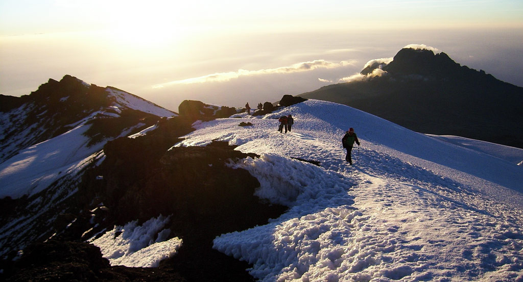
Here tourists finally find themselves at their destination: they rise above the clouds, touch the eternal ice, look inside the volcano, which is still showing signs of activity (smoke and the characteristic smell of sulfur). At this moment, everyone who has conquered Kilimanjaro is unanimous in their feelings: the difficulties of walking are immediately forgotten, only the delight of the surrounding beauty remains.
They will tell you which route to choose local guides. It should be remembered that climbing Kilimanjaro without a guide is strictly prohibited. In the town of Moshi, closest to the volcano, there are a huge number of travel agencies offering their services. The cost of travel depends on the number of people in the group, but on average it is approximately $1000 per person. Local residents are ready not only to accompany tourists on the journey, but also to carry their things, as well as prepare food - it all depends on the desires and financial capabilities of the travelers.
Travel agencies operate all year round. Accordingly, you can go hiking whenever you want, but don’t forget about weather conditions: There is a rainy season in Tanzania. Many admit that best time for travel – July and August. At this time, as a rule, there are no tropical showers, and the heat is easily tolerated. In principle, travelers cannot go wrong if they come here during the periods from August to October and from January to March. But even at this time, you need to remember that on Kilimanjaro you can find yourself in both tropical and almost polar conditions: if at the foot of the mountain the average annual temperature is +30 °C, then at an altitude of 3000 m - only +5...15 °C , and at night the thermometer can drop below zero. Thus, at the beginning of the journey it will be very comfortable in shorts and a T-shirt, but at altitude you will need completely different clothes. Don't forget about this when getting ready to travel. Your suitcase must have room for warm socks, gloves, warm waterproof trousers and a jacket.
What else to do on Kilimanjaro?
For those who do not want to go on a multi-day mountain hike, we offer day trips up the mountain: you won’t have to climb very high, but you’ll get an idea of the “crown of Tanzania.” There are many other entertainments:
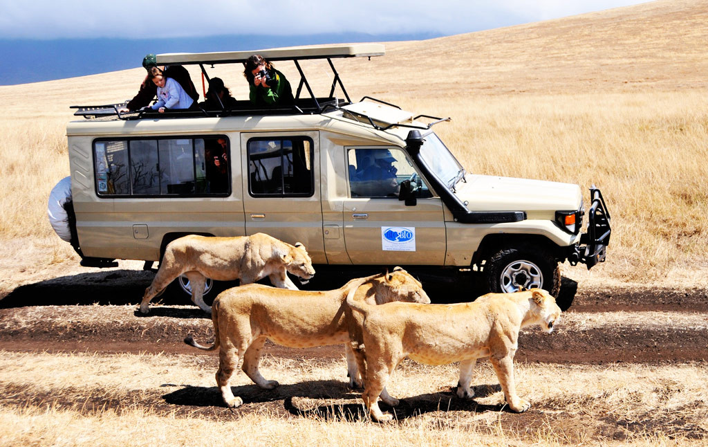
- visiting the Serengeti and Tarangire National Parks - the largest reserves of colorful African nature; parks are located near Kilimanjaro
- jeep safari through the savannah and jungle (vehicles have lifting hatches and equipment for video and photography)
- a trip to the village of the Chagga tribe, where you can get acquainted with the life of the local residents, as well as look at the coffee and banana plantations
In ancient times, the tribes who lived at the foot of Kilimanjaro had never seen snow, so they were convinced that the top of the volcano was covered with silver. But for a long time they did not dare to test this hypothesis, since a huge number of myths were associated with the mountain, telling about demons that lived above, guarding treasures.
One day, the local leader made up his mind and sent several warriors on reconnaissance. When they reached the top, they immediately grabbed the silver in their hands, and it melted. And then the aborigines, feeling the cold of the silvery cap of the volcano, called it “The Abode of the God of Cold” and began to use this name no less often than the previous one - “Kilimanjaro” or “Sparkling Mountain”.
The Kilimanjaro volcano is so huge that its height is 5899 m, its length is 97 km, and its width is 64 km. The African continent is located at a slight distance from the main East African ridge, which stretches from east to west through the northern part of Tanzania. Kilimanjaro is located right on the border between this country and Kenya, and you can find it on the map using the following geographical coordinates Latitude 3° 4’ 32″ (3° 4’ 54) south and longitude 37° 21’ 11″ (37° 21’ 19) east.
Although the active volcanic activity of Kilimanjaro is not officially documented anywhere, there is information that the last strong eruption occurred quite recently - about two centuries ago. Currently, the mountain is considered, although an active, but inactive volcano, which can become active at any moment. At the top, emissions of sulfur and greenhouse gases have recently been recorded, and studies have shown that the lava is located some four hundred meters from earth's surface, under Uhuru Peak.
What Kilimanjaro looks like
The highest mountain in Africa was formed more than a million years ago due to excessively active volcanic activity and has quite characteristic contours: its gentle slopes rise to an elongated flat top. It consists of three separate volcanoes, which once united into one.

Shira
The oldest volcano, Shira, is located on the western side, and at the foot there is a fairly flat plateau with an area of 6.2 hectares. Nowadays, the height of Shira is 3810 meters above, whereas in earlier times, it was much higher and was destroyed during a strong eruption.
Mawenzi
It is located on the eastern side and currently represents a peak whose height is 5334 m. From the west, Mawenzi ends abruptly with a whole complex of rocks and gorges, and the height of the volcano on the eastern side is a little more than a kilometer.
Deep radial valleys can be seen at the base of the mountain. And between it and Kibo is the largest high-mountain treeless zone of the African continent - the huge Sedlo plateau, the area of which exceeds 3.5 thousand hectares.
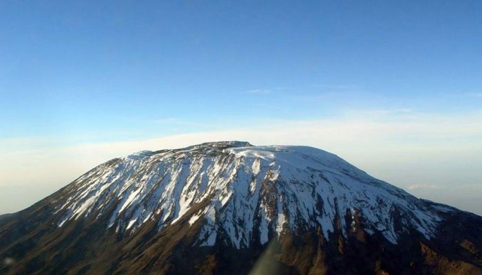
Kibo
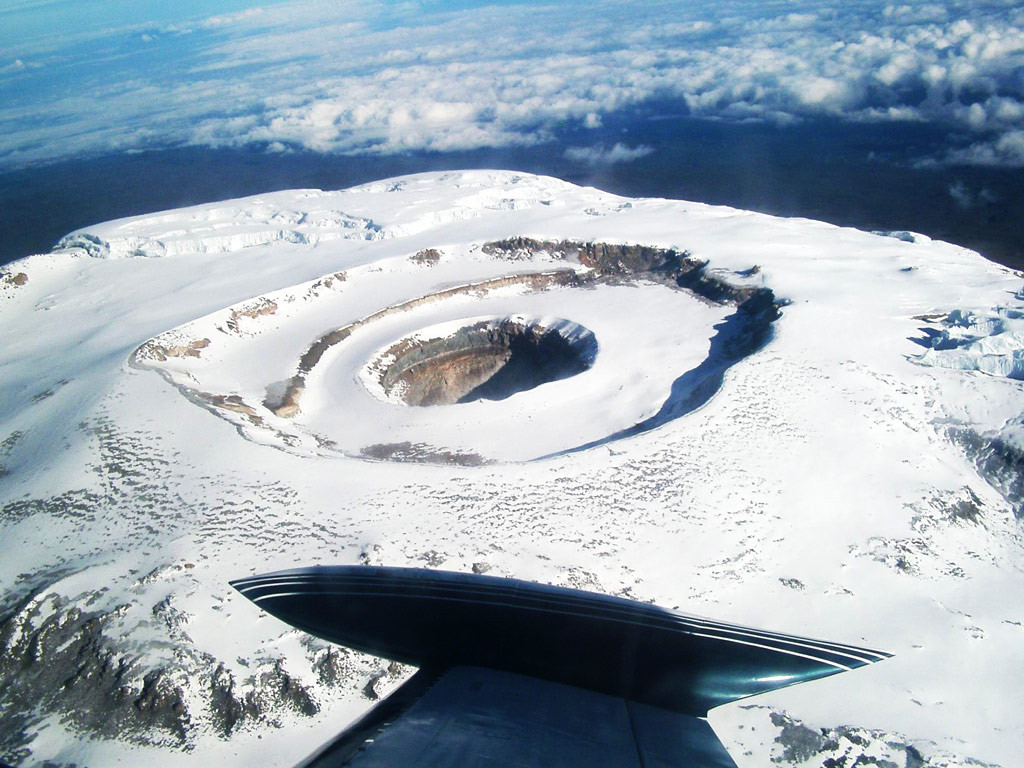
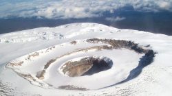
Kibo, the youngest volcano (it is considered active and the most dangerous of the three), was formed during several extremely strong eruptions in a row, resulting in the size of its caldera being 2.4 km wide and 3.6 km long. After some time, during the next volcanic activity, first one volcanic cone with a crater 900 m in diameter appeared inside the basin, then an ash cone with a diameter of 200 meters formed in the middle of this crater.
Over time, the Kibo caldera formed a flat, snowy peak on Kilimanjaro (even though, according to the coordinates of the mountain, it is located only a few degrees south of the equator). Snow can be seen not only on the top of the mountain, but also on its upper northern and southern slopes. Uhuru Peak is also located here, with a height of 5895 meters, which is the highest point on the African continent.
Kilimanjaro Climate
The huge size of the volcano gives it the opportunity not only to actively influence, but also to shape the climate around itself. Moist air masses from outside Indian Ocean moving towards a huge mountain. Having stumbled upon a volcano, they crash and are forced to prematurely give up all the moisture they have in the form of rain or snow. At the same time, much less precipitation falls at the foot of the mountain than on the slopes:
- At the foot – from 500 to 900 mm per year;
- On slopes - about 3 thousand mm per year;
- At the top - about 200 mm per year.
Thus, a lot of precipitation falls near Kilimanjaro, which has a positive effect on the local vegetation (especially at the foot of the mountain). Small streams and rivers formed due to precipitation at the top of the mountain and flowing down carry life-giving moisture down to the pastures and fields.
![]()
They also fill the two major rivers that flow in this region. At the same time, 90% of precipitation does not leave the mountains (it is retained by the forest), and, having saturated the soil, most of water (2/3) evaporates and returns to the atmosphere. Recently, the amount of precipitation has been gradually decreasing, which is one of the reasons for the decrease in snow cover.
Flora and fauna of Kilimanjaro
The climate itself high volcano unique in the world, because due to the fact that the mountain is very close to the equator, and winter reigns on the top of Kilimanjaro, a person, when climbing up, crosses absolutely all the climatic zones of our planet (there are seven in total), each of which is distinguished by its own animal and vegetable world.
In the south - up to 1 thousand m, in the north - up to 1.6 thousand m
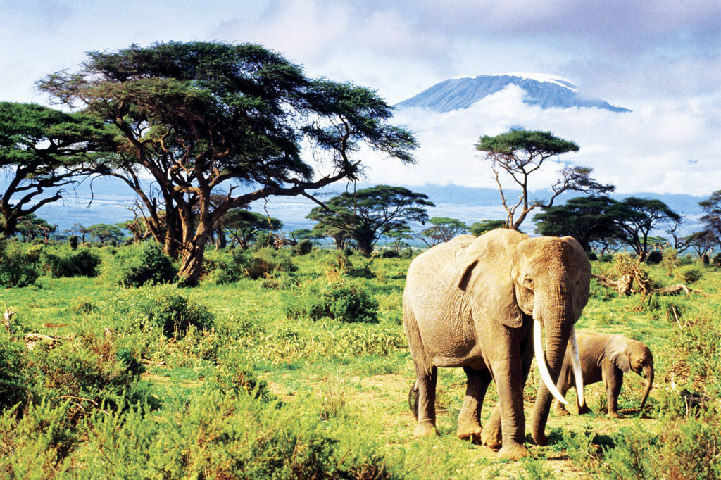
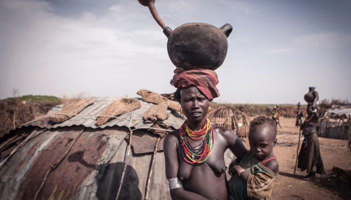
At the foot of Kilimanjaro, Africans actively grow maize, beans, peanuts, sunflowers, rice, coffee, and corn. There are also sugar and banana plantations. The land here is abundantly covered with herbaceous vegetation, shrubs and a few low-growing trees characteristic of the savannah. You can often see monkeys, leopards, servals, and honey badgers here.
1100–1800 m
This area of the mountain is densely populated (500 people/km2). Representatives of the Chagga tribe built a network of irrigation canals here, and they grow, graze livestock, and keep apiaries.
The natives use natural resources (mainly foothill and mountain forests) very irrationally: many trees were cut down for arable land and used for fuel. Trees grow only in hollows or gorges.
1800 m – 4000 m
Here also local residents They are actively cutting down forests for timber and fuel. There are also a lot of forest plantations - huge plantations of cypresses, eucalyptus, pine trees, and in their shade vegetables are grown, and livestock are grazed in the meadows and near reservoirs.
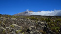
The soil is thin, poor, clayey. The mountain forest zone begins at this altitude, the maximum rainfall is about 2 thousand mm per year, and temperatures range from 20°C to 28°C. At an altitude exceeding 2.4 thousand meters, a thick layer of clouds often forms, which are another important and additional source of moisture.
Rainforest at an altitude of about three thousand meters gradually disappears, but alpine heather shrubs appear. The soil becomes porous, so water penetrates well through it, there is little precipitation (from 760 to 1 thousand mm) - therefore, a huge number of cereals and bulbous plants can be found here.
4000 m – 4600 m
On the slopes of the mountain at an altitude of 3 to 4 thousand meters you can often see mountain swamps and meadows covered with bright flowers. Giraffes, elephants, lions, and some species of rodents live at this altitude.


4500 – 5000 m
An arid highland desert with little precipitation (about 200 mm per year) and little vegetation. The daily temperature difference here is about 40°C. The air at this altitude is thin and there is very strong solar radiation.
From 5000 m
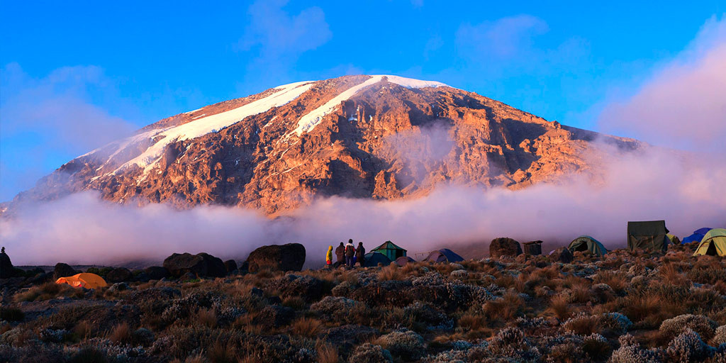
And even higher, at the top of Kibo, snow, cold stone and eternal ice begin, covering the top of the mountain for 11 thousand years after the ice age ended. There are several glaciers in this area, each of them has its own name and thickness (this is primarily due to the fact that precipitation falls unevenly).
Kilimanjaro Ice Cap
It is the snows of the Kibo peak that have recently attracted the attention of researchers. The fact is that they are melting - and they are doing it extremely quickly: over the last century, according to scientists, snow cover has decreased by 80%.
The figures they give are impressive: at the beginning of the 21st century, the area occupied by snow was 2 km², while a hundred years ago this figure was 12.1 km². In the second half of the 20th century, the thickness of the snow cover decreased by an average of 17 meters and, apparently, continues to actively melt further. Many experts predict that snow on Kilimanjaro may soon disappear completely.
It is believed that this situation was caused not so much by a change in temperature as by active deforestation, due to which the amount of water vapor that rises into the sky and falls on the top of Kibo has decreased.
Another reason for the catastrophically rapid melting of snow is the volcano itself: its dark-colored volcanic rocks absorb heat and heat the glaciers below, which is why the glaciers melt and collapse, freeing the surface from snow and thus increasing the area of the territory capable of absorbing the sun's rays.
Best time to go
Experienced tourists advise climbing the mountain from December to March, when there is no rainy season and the air temperature is optimal for humans - about 28-30 degrees. Although a seasoned climber can reach the top in less than a day, many people need adaptation to get used to the climate and avoid altitude sickness. Therefore, the trek to the top usually takes from 5 to 7 days.
Climb Kilimanjaro
The first Europeans climbed to the top of the high mountain Africa only in 1889. It is noteworthy that when the anniversary of this event was celebrated a hundred years later, the guest of honor of the holiday was precisely the guide who accompanied the white people during the ascent - at that moment he was 18 years old.
Nowadays, you can only climb Kilimanjaro from Tanzania - there are special agreements in this regard between this country and Kenya, so the Kenyans do not even have a developed infrastructure in this direction, and along the mountain there are police posts that make sure that there is no unauthorized lifts.
At the same time, the territory of Kilimanjaro in Tanzania received the status national park and was included in the UNESCO list. Six routes of varying difficulty have been specially developed for tourists, so almost anyone can climb, despite the enormous height; for example, Bernard Gusen, being in a wheelchair, did it twice.
![]()
Another positive thing about climbing the mountain is that it can be done lightly: there is a unique service from local residents - for five dollars a day they will carry your luggage to the very top, holding it on their heads.
View from the top
Despite the ease of ascent, only 40% of the number of climbers who started the climb reach the top. A magnificent landscape opens up before tourists who climb the mountain: below, under their feet, clouds are visible, and around the volcano, illuminated by the gentle rays of the bright daylight, lies a huge savannah, golden desert sands and nature untouched by people.
Kilimanjaro is a word familiar to us from childhood, also known from the stories of the writer Hemingway. Every tourist and traveler dreams of seeing with his own eyes the “crown of Tanzania” at least once in his life, and maybe even climbing to its top, to an unreal height, into the kingdom of eternal snow (by the way, it is she who appears in “The Lion King”). Let's take a little closer look at Tanzania's most famous landmark, the... high mountain Africa, which locals call the "sparkling peak", with Kilimanjaro.
Location of Mount Kilimanjaro
Mount Kilimanjaro is not really a mountain, as many people believe, it is a dormant volcano, it was formed from a huge number of layers of tephra, frozen lava flows and ash. According to scientists, Kilimanjaro was formed as a result of the movement of layers earth's crust millions of years ago. So, it is located in Tanzania, in the territory East Africa and rises above sea level to 5895 meters.
Animals of Kilimanjaro
The enormous size of this volcano has created a unique and amazing climate that cannot be found anywhere else on the planet. Here you can see many small rivers and streams; they are formed when glaciers melt. In the lower part there is a spacious savannah, here you can find funny monkeys, a family of leopards and lions, servals, funny and slightly clumsy honey badgers, huge elephants, giraffes, zebras and many small rodents. In addition to the diverse animal world, Mount Kilimanjaro boasts mountain swamps and endless meadows, which are strewn with flowers and lush herbs, and a little up the mountains, a real African desert begins, where only lichens, moss and cacti reign.
Kilimanjaro weather and climate
Since the mountain is located almost on the equator of our globe, there is almost always good weather, so nothing will interfere with your ascent, with the exception of the rainy season, when quite a lot of precipitation falls in the area. Experienced travelers say that the best time for climbing is from August to October, and from January to March, when the weather is warm and clear.
The peculiarity of Mount Kilimanjaro is that in its example you can see all types of climate on our planet, at the base you will be greeted by the humid tropics, and as you climb an arid desert, a dank hill with endless cold winds and, finally, a snow-capped peak where it never melts snow. Therefore, if you still decide to climb the mountain, prepare for sudden changes in temperature: from + 30, to +15, 0 and minus temperatures, it all depends on the level of ascent, time of year and route.
Tours to Mount Kilimanjaro
If you decide to visit Kilimanjaro National Reserve, the first thing you need to do is find the town of Moshi, it is the closest to the reserve. There you can easily find a travel agency that cooperates with the reserve and buy a tour. A professional guide, personal porter and cook will gladly accompany you on your adventure. As they say, every whim is for your money. But the sensations and incredible views that await you at the top are worth your money, your work, and several days of travel. You will be able to see the inner crater of the volcano, eternal ice, and also enjoy the stunning scenery of the valley and the reserve. In addition, the tourist will be able to easily see the seven trails along which the climb to the most unique attraction of Tanzania occurs.
Video: Climbing Mount Kilimanjaro
The most interesting routes to climb Mount Kilimanjaro
The first conquerors of Kilimanjaro were Hans Meyer and Ludwig Purtscheller, this happened more than 100 years ago in 1889. Since then, experienced climbers have laid out more than a dozen routes, which differ in the complexity of the climb and the level of mountaineering training; there are trails for beginners and real pros. If you still decide to conquer this peak, then the total time, which includes ascent and descent, will take approximately 5 to 9 days. And now we present to your attention the most interesting and popular routes for climbing Kilimanjaro. 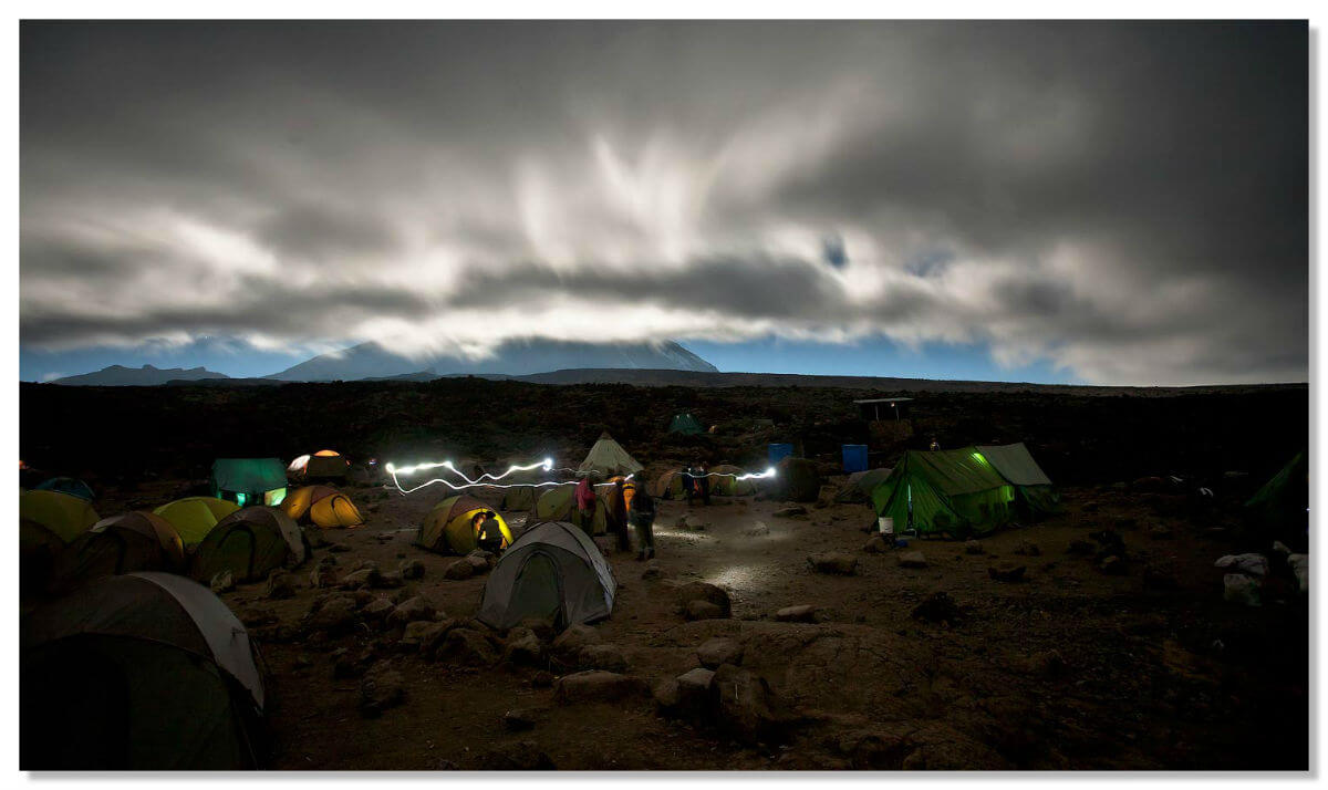
Lemosho Trail
Lemosho is located on the western part of the mountain, it is considered the most suitable for acclimatization of tourists in the area. Climbing this route costs more than usual, so you won’t find a huge number of tourist groups. The high cost is more than compensated by the amazingly beautiful views, because Lemosho is considered one of the most picturesque trails on Kilimanjaro.
Marangu Trail
Many people know this route under another name: the Coca-Cola route. It received this name during the first trips to the mountain, when tourists simply threw garbage along the side of the road, and most often it was plastic bottles of a well-known drink. Now the route is carefully monitored, garbage is systematically removed, sprinkled with gravel, and where the path passes through deep streams, small bridges have been built. The trail is located in the southeast of the mountain and is the most popular among tourists due to the ease of climbing. Moreover, this is the only 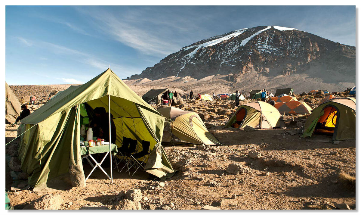 route trail, where stationary camps for overnight stays are located at various levels of ascent, where there are all the benefits of civilization: electricity, a toilet, a small canteen, a medical and rescue center.
Machame Trail
Machame is located on the western part of the mountain and is considered one of the most difficult to climb, with frequent ascents and descents, so it is popular only with experienced travelers and climbers. If you come to the Kilimanjaro Nature Reserve during the rainy season, it is better to use another trail, as the route is very eroded and dangerous for climbing.
Rongai Trail
Rongai is the only one northern route, a narrow path leads to Kibo (the central volcano of Kilimanjaro), through one of mountain peaks– Mawenzi. This is perhaps the least crowded route, but it is recommended for climbing during the rainy season, since this area has minimal precipitation and there is no strong wind.
Umbwe Trail
Umbwe passes through south side and is rightfully considered the most difficult route to climb. This is a short, winding and straight trail starting from Camp Barranco. The descent takes place along another trail - Mweka. Due to the rather sharp ascent, steep descents and dense jungle, you will have absolutely no time for acclimatization, so the route is intended only for strong travelers who are confident in their strength and body. Climbing Umbwe takes 5-6 days, but if you want to enjoy incredible views and wonderful nature, then spend 7-8 days on the route. 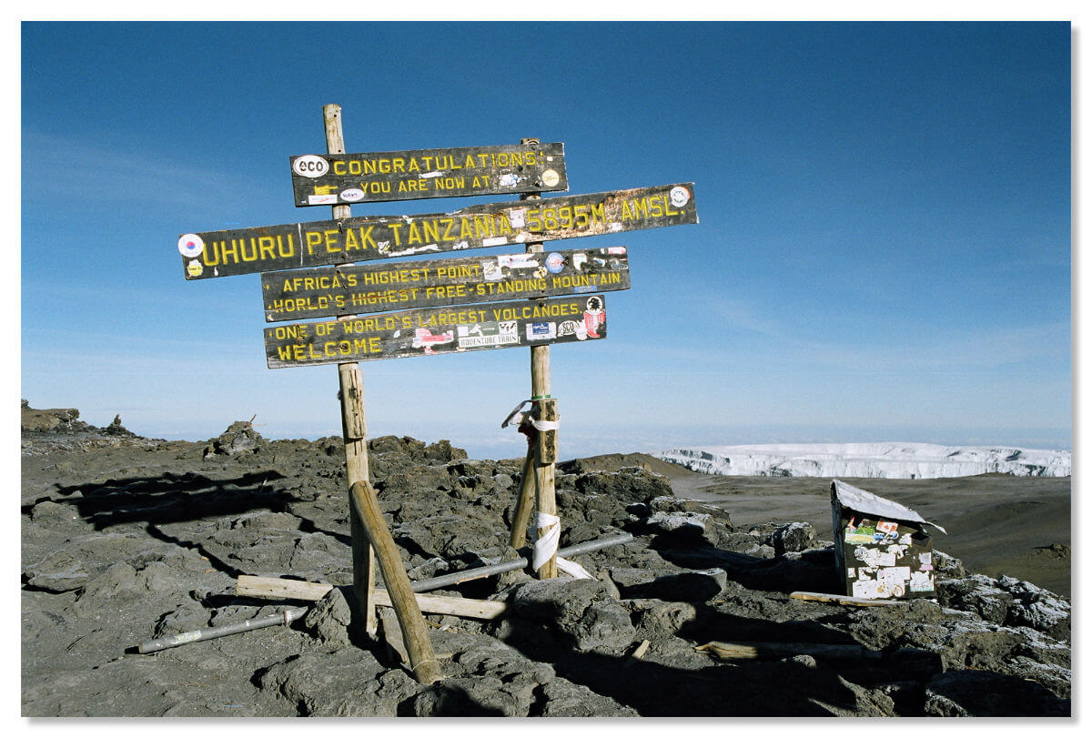
Mount Kilimanjaro is the heart of Africa, it is a stone giant, it is a real treasury of Tanzania. If you are ever lucky enough to travel around this African country, then do not miss the chance to take part in what is probably the most incredible and exciting adventure of your life, to appreciate the majestic thousand-year-old volcano and wild, untouched nature.