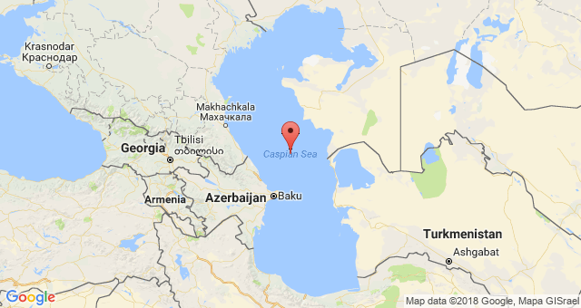
Rivers flowing into the Caspian Sea: list, description, characteristics. Caspian Sea, map Caspian Lake on the map
The Caspian Sea is located between Asia and Europe. This is the largest salt sea-lake, located on the territory of Kazakhstan, Russia, Azerbaijan, Iran and Turkmenistan. Currently, its level is 28 meters below the level of the World Ocean. The depth of the Caspian Sea is quite large. The area of the reservoir is 371 thousand square kilometers.
Story
About five million years ago, the sea divided into small bodies of water, including the Black and Caspian seas. After these events they united and separated. About two million years ago, the Caspian Lake was cut off from the World Ocean. This period is considered the beginning of its formation. Throughout history, the reservoir has changed its contours several times, and the depth of the Caspian Sea has also changed.
Now the Caspian is the largest inland body of water, containing about 44% of the planet’s lake waters. Despite the changes taking place, the depth of the Caspian Sea did not change very much.
Once it was called Khvalian and Khazar, and the tribes of horse breeders gave it another name - Caspian. This is the name of the tribe living on the southwestern shore of the reservoir. In total, during its existence the lake had more than seventy names, here are some of them:
- Abeskunskoe.
- Derbent.
- Saraiskoe.
- Xihai.
- Dzhurdzhanskoe.
- Hyrcanian.
Depth and relief
The relief and features of the hydrological regime divide the sea-lake into northern, middle and southern parts. Over the entire area of the Caspian Sea, the depth is on average 180-200 m, but the relief in different parts is different.
The northern part of the reservoir is shallow. Here the depth of the Caspian Sea-lake is approximately 25 meters. In the middle part of the Caspian there are very deep depressions, continental slopes, and shelves. Here the average depth is 192 meters, and in the Derbent depression - about 788 meters.
The greatest depth of the Caspian Sea is in the South Caspian depression (1025 meters). Its bottom is flat, and in the northern part of the depression there are several ridges. It is here that the maximum depth of the Caspian Sea is noted.

Coastline Features
Its length is seven thousand kilometers. The northern part of the coastline is lowland, there are mountains on the south and west, and hills on the east. The spurs of Elbrus and the Caucasus Mountains approach the shores of the sea.
The Caspian has large bays: Kazakh, Kizlyar, Mangyshlak, Kara-Bogaz-Gol, Krasnovodsk.
If you go on a cruise from north to south, the length of the route will be 1200 kilometers. In this direction, the reservoir has an elongated shape, and from west to east the width of the sea is different. At its narrowest point it is 195 kilometers, and at its widest it is 435 kilometers. The average width of the reservoir is 315 km.
The sea has several peninsulas: Mangyshlak, Buzachi, Miankale and others. There are also several islands here. The largest are Chygyl, Kur-Dashi, Gum, Dash, and Tyuleni Islands.

Pond food
About one hundred and thirty rivers flow into the Caspian Sea. Most of them flow in the north and west. The main river flowing into the sea is the Volga. Approximately ninety percent of the volume of runoff comes from three large rivers: the Volga (80%), Kura (6%) and Ural (5%). Five percent are from Terek, Sulak and Samur, and the remaining four are brought by small rivers and streams of Iran.
Resources of the Caspian Sea
The reservoir has amazing beauty, a variety of ecosystems and a rich supply of natural resources. When there are frosts in its northern part, magnolias and apricots bloom in the south.
Relict flora and fauna have been preserved in the Caspian Sea, including the largest school of sturgeon fish. As it evolved, the marine flora changed more than once, adapting to salinity and desalination. As a result, these waters became rich in freshwater species, but few in marine species.
After the Volga-Don Canal was built, new species of algae appeared in the reservoir, which were previously found in the Black and Azov Seas. Now in the Caspian Sea there are 854 species of animals, of which 79 are vertebrates, and over 500 species of plants. This unique sea-lake produces up to 80% of the catch of all sturgeon in the world and approximately 95% of black caviar.
Five species of sturgeon are found in the Caspian Sea: stellate sturgeon, thorn, sterlet, beluga and sturgeon. Beluga is the largest representative of the species. Its weight can reach a ton, and its length can be five meters. In addition to sturgeon, herring, salmon, kutum, roach, asp and other types of fish are caught in the sea.
Of the mammals in the Caspian Sea, only the local seal is found, which is not found in other bodies of water in the world. It is considered the smallest on the planet. Its weight is about a hundred kilograms, and its length is 160 centimeters. The Caspian region is a major route for bird migration between Asia, the Middle East and Europe. Every year, approximately 12 million birds fly over the sea during migration (south in spring and north in autumn). In addition, another 5 million remain in these places for the winter.

The greatest wealth of the Caspian Sea is its huge reserves of oil and gas. Geological exploration in the region has discovered large deposits of these minerals. Their potential puts local reserves in second place in the world after
Caspian Sea or Caspian Lake?
This amazing body of water located at the junction of Europe and Asia is called the Caspian Sea. Today it is not difficult to find on a geographical map, since its waters wash the shores of 5 states at once. Although not everyone agrees that this is the sea. Many experts claim that this lake is huge in size. Indeed, the Caspian Sea does not have direct access to the World Ocean, but is connected to it only through the Volga River.
However, some time ago, the Sarmatian Sea was located on this territory, which disappeared due to climatic conditions, and in its place smaller seas appeared, including the Caspian. The waters of the Caspian Sea are quite deep, and its bottom is the earth's crust. This is another argument for calling this body of water a sea.
Depth and temperature
The Caspian Sea is heterogeneous in its depth and different depth indicators can be observed here at different times. It all depends on the season. According to scientific research, the recorded sea depth is 1025 meters. Those scientists who classify the Caspian Sea as a lake in depth put it in fourth place in the world.
Washing the shores of Russia, Iran, Kazakhstan, Azerbaijan and Turkmenistan, the lake-sea is becoming more and more popular among tourists. The lake almost never freezes. The water temperature in the Caspian Sea reaches 28 degrees, and in places where the depth is shallower, the water can warm up to 32 degrees.
Climate
The waters of the Caspian Sea are located in three different climatic zones. Subtropical in the south, temperate in the middle and continental in the north. Depending on the climate zone, temperature fluctuations are observed. On average, the temperature reaches 26-27 degrees, but in the south the air temperature may rise to 44 degrees.
Inhabitants of the Caspian Sea
The inner world of the Caspian Sea is very rich, inhabited by various plants, mammals and hundreds of species of fish. It is believed that some types of algae that predominate in the Caspian Sea got there from the outside. The most famous species of fish living in the Caspian Sea belong to the sturgeon family.
The largest part of all black caviar is mined in the Caspian Sea.
The Caspian Sea is also famous for such an inhabitant as the albino beluga, which spawns very rarely, about once every hundred years, so its caviar is considered the most expensive in the world. Today, the countries that own the Caspian waters are extremely interested in preserving the sturgeon population. For this purpose, restrictions have been introduced on the export of this type of fish. A special place in the preservation of the famous species of fish is the fight against poaching; for this, various measures have also been developed to combat illegal fishing.
Resorts of the Caspian Sea
The Caspian Sea is an amazing place to relax, and those who decide to spend their vacation on the shores of the Caspian Sea will not regret it. The Caspian Sea will be able to attract everyone who comes here with its beauty, landscapes, air and its mild climate. Well-equipped beaches will complement the experience of nature and the sea.
And quite affordable prices will be a pleasant bonus for those who choose the Caspian coast as their vacation spot. Russian cities - ports that are located on the shores of the Caspian Sea are the capital of Dagestan and the city. The distance from the port city of Astrakhan to the northern coast of the Caspian Sea is 60 kilometers.
The Caspian Sea is simultaneously considered both an endorheic lake and a full-fledged sea. The reasons for this confusion are brackish waters and a hydrological regime similar to the sea.
The Caspian Sea is located on the border of Asia and Europe. Its area is about 370 thousand km 2, its maximum depth is just over one kilometer. The Caspian Sea is conventionally divided into three almost equal parts: Southern (39% of the area), Middle (36%) and Northern (25%).
The sea washes simultaneously the Russian, Kazakh, Azerbaijani, Turkmen and Iranian shores.
Shore of the Caspian Sea(Caspian Sea) has a length of approximately 7 thousand kilometers, if you count it together with the islands. In the north, the low seashore is covered with swamps and thickets, and has multiple water channels. The eastern and western coasts of the Caspian Sea have a winding shape; in some places the shores are covered with limestone.
There are many islands in the Caspian Sea: Dash-Zira, Kur Dashi, Dzhambaisky, Boyuk-Zira, Gum, Chigil, Here-Zira, Zenbil, Ogurchinsky, Tyuleniy, Ashur-Ada, etc. Peninsulas: Mangyshlak, Tyub-Karagan, Absheron and Miankale. Their total area is approximately 400 km 2.
Flows into the Caspian Sea more than a hundred different rivers, the most significant are the Ural, Terek, Volga, Atrek, Emba, Samur. Almost all of them provide 85–95% of the annual water flow to the sea.
The largest bays of the Caspian Sea: Kaydak, Agrakhansky, Kazakh, Dead Kultuk, Turkmenbashi, Mangyshlaksky, Gyzlar, Girkan, Kaydak.

Climate of the Caspian Sea
The Caspian Sea is located in three climatic zones: subtropical climate in the south, continental in the north and temperate in the middle. In winter, the average temperature varies from -10 to +10 degrees, while in summer the air warms up to about +25 degrees. During the year, precipitation ranges from 110 mm in the east to 1500 mm in the west.
The average wind speed is 3–7 m/s, but in autumn and winter it often increases to 35 m/s. The most windy areas are the coastal areas of Makhachkala, Derbent and the Absheron Peninsula.
Water temperature in the Caspian Sea fluctuates from zero to +10 degrees in winter, and from 23 to 28 degrees in the summer months. In some coastal shallow waters the water can warm up to 35-40 degrees.
Only the northern part of the sea is subject to freezing, but in especially cold winters the coastal zones of the middle part are added to it. Ice cover appears in November and disappears only in March.

Problems of the Caspian region
Water pollution is one of the main environmental problems of the Caspian Sea. Oil production, various harmful substances from flowing rivers, waste from nearby cities - all this negatively affects the condition of sea water. Additional troubles are created by poachers, whose actions reduce the number of fish of certain species found in the Caspian Sea.
Rising sea levels are also causing serious financial harm to all Caspian countries.
According to conservative estimates, restoring destroyed buildings and taking comprehensive measures to protect the coast from flooding costs tens of millions of dollars.

Cities and resorts on the Caspian Sea
The largest city and port washed by the waters of the Caspian Sea is Baku. Other settlements in Azerbaijan located in close proximity to the sea include Sumgayit and Lenkoran. On the eastern shores is the city of Turkmenbashi, and about ten kilometers from it by the sea is the large Turkmen resort of Avaza.
On the Russian side, on the seashore there are the following cities: Makhachkala, Izberbash, Derbent, Lagan and Kaspiysk. Astrakhan is often called a port city, although it is located approximately 65 kilometers from the northern shores of the Caspian Sea.

Astrakhan
There are no beach holidays in this region: along the sea coast there are only continuous reed thickets. However, tourists go to Astrakhan not for lounging on the beach, but for fishing and various types of outdoor activities: diving, catamaran riding, jet skiing, etc. In July and August, excursion ships ply along the Caspian Sea.

Dagestan
For a classic seaside holiday, it is better to go to Makhachkala, Kaspiysk or Izberbash - this is where not only good sandy beaches are located, but also decent recreation centers. The range of entertainment on the seashore on the Dagestan side is quite wide: swimming, healing mud springs, windsurfing, kiting, rock climbing and paragliding.
The only disadvantage of this direction is the underdeveloped infrastructure.
In addition, among some Russian tourists there is an opinion that Dagestan is far from the most peaceful territory that is part of the North Caucasus Federal District.

Kazakhstan
A much calmer environment can be found in the Kazakh resorts of Kuryk, Atyrau and Aktau. The latter is the most popular tourist city in Kazakhstan: there are many good entertainment venues and well-maintained beaches. In summer, the temperature here is very high, reaching up to +40 degrees during the daytime, and dropping only to +30 at night.
The disadvantages of Kazakhstan as a tourist country are the same poor infrastructure and rudimentary transport links between regions.

Azerbaijan
The best places to relax on the Caspian coast are Baku, Nabran, Lankaran and other Azerbaijani resorts. Fortunately, everything is fine with the infrastructure in this country: for example, several modern comfortable hotels with swimming pools and beaches have been built in the Absheron Peninsula area.
However, in order to enjoy a holiday on the Caspian Sea in Azerbaijan, you need to spend a lot of money. In addition, you can only get to Baku quickly enough by plane - trains rarely run, and the journey from Russia itself takes two to three days.
Tourists should not forget that Dagestan and Azerbaijan are Islamic countries, so all “non-believers” need to adapt their usual behavior to local customs.
If you follow simple rules of stay, nothing will spoil your vacation on the Caspian Sea.
The Caspian Sea is one of the most amazing closed bodies of water on Earth.
Over the centuries, the sea has changed more than 70 names. The modern one came from the Caspians - tribes inhabiting the central and southeastern part of Transcaucasia 2 thousand years BC.
Geography of the Caspian Sea
The Caspian Sea is located at the junction of Europe and Asia and, according to its geographical location, is divided into the South, North and Middle Caspian. The middle and northern part of the sea belongs to Russia, the southern to Iran, the eastern to Turkmenistan and Kazakhstan, and the southwestern to Azerbaijan. For many years, the Caspian states have been dividing the Caspian waters among themselves, and quite sharply at that.

Lake or sea?
In fact, the Caspian Sea is the world's largest lake, but has a number of marine characteristics. These include: a large body of water, strong storms with high waves, high and low tides. But the Caspian does not have a natural connection with the World Ocean, which makes it impossible to call it a sea. At the same time, thanks to the Volga and artificially created channels, such a connection appeared. The salinity of the Caspian Sea is 3 times lower than the usual sea salinity, which does not allow the reservoir to be classified as a sea.
There were times when the Caspian Sea was truly part of the World Ocean. Several tens of thousands of years ago the Caspian Sea was connected to the Sea of Azov, and through it to the Black and Mediterranean. As a result of long-term processes occurring in the earth's crust, the Caucasus Mountains were formed, which isolated the reservoir. The connection between the Caspian and Black Seas was carried out for a long time through the strait (Kuma-Manych depression) and gradually ceased.
Physical quantities
Area, volume, depth
The area, volume and depth of the Caspian Sea are not constant and directly depend on the water level. On average, the area of the reservoir is 371,000 km², the volume is 78,648 km³ (44% of all world lake water reserves).

(The depth of the Caspian Sea in comparison with lakes Baikal and Tanganyika)
The average depth of the Caspian Sea is 208 m; the northern part of the sea is considered the shallowest. The maximum depth is 1025 m, noted in the South Caspian depression. In terms of depth, the Caspian Sea is second only to Baikal and Tanganyika.
The length of the lake from north to south is about 1200 km, from west to east on average 315 km. The length of the coastline is 6600 km, with islands - about 7 thousand km.
Shores

Basically, the coast of the Caspian Sea is low-lying and smooth. In the northern part it is heavily indented by the river channels of the Urals and Volga. The swampy shores here are located very low. The eastern shores adjoin semi-desert zones and deserts and are covered with limestone deposits. The most winding shores are in the west in the area of the Absheron Peninsula, and in the east in the area of the Kazakh Bay and Kara-Bogaz-Gol.
Sea water temperature

(Temperature of the Caspian Sea at different times of the year)
The average winter water temperature in the Caspian Sea ranges from 0 °C in the northern part to +10 °C in the southern part. In Iranian waters, the temperature does not drop below +13 °C. With the onset of cold weather, the shallow northern part of the lake is covered with ice, which lasts for 2-3 months. The thickness of the ice cover is 25-60 cm, at especially low temperatures it can reach 130 cm. In late autumn and winter, drifting ice floes can be observed in the north.
In summer, the average sea surface temperature is + 24 °C. In most parts the sea warms up to +25 °C…+30 °C. Warm water and beautiful sandy, occasionally shell and pebble beaches create excellent conditions for a good beach holiday. In the eastern part of the Caspian Sea, near the city of Begdash, abnormally low water temperatures remain in the summer months.
Nature of the Caspian Sea
Islands, peninsulas, bays, rivers
The Caspian Sea includes about 50 large and medium-sized islands, with a total area of 350 km². The largest of them are: Ashur-Ada, Garasu, Gum, Dash and Boyuk-Zira. The largest peninsulas are: Agrakhansky, Absheronsky, Buzachi, Mangyshlak, Miankale and Tyub-Karagan.

(Tyuleniy Island in the Caspian Sea, part of the Dagestan Nature Reserve)
The largest bays of the Caspian include: Agrakhansky, Kazakhsky, Kizlyarsky, Dead Kultuk and Mangyshlaksky. In the east is the salt lake Kara-Bogaz-Gol, which was previously a lagoon connected to the sea by a strait. In 1980, a dam was built on it, through which water from the Caspian goes to Kara-Bogaz-Gol, where it then evaporates.
130 rivers flow into the Caspian Sea, located mainly in its northern part. The largest of them are: Volga, Terek, Sulak, Samur and Ural. The average annual drainage of the Volga is 220 km³. 9 rivers have delta-shaped mouths.
Flora and fauna
The Caspian Sea is home to about 450 species of phytoplankton, including algae, aquatic and flowering plants. Of the 400 species of invertebrates, worms, crustaceans and molluscs predominate. There are a lot of small shrimp in the sea, which are the object of fishing.

More than 120 species of fish live in the Caspian Sea and its delta. Fishing objects include sprat (“Kilkin fleet”), catfish, pike, bream, pike perch, kutum, mullet, roach, rudd, herring, white fish, pike perch, goby, grass carp, burbot, asp and pike perch. Stocks of sturgeon and salmon are currently depleted, however, the sea is the largest supplier of black caviar in the world.
Fishing in the Caspian Sea is allowed all year round, with the exception of the period from late April to late June. There are many fishing bases with all amenities on the coast. Fishing in the Caspian Sea is a great pleasure. In any part of it, including in large cities, the catch is unusually rich.

The lake is famous for its wide variety of waterfowl. Geese, ducks, loons, gulls, waders, eagles, geese, swans and many others fly to the Caspian Sea during the migration or nesting period. The largest number of birds - over 600 thousand individuals - is observed at the mouths of the Volga and Ural, in the Turkmenbashi and Kyzylagach bays. During the hunting season, a huge number of fishermen come here not only from Russia, but also from countries near and far abroad.

The Caspian Sea is home to the only mammal. This is the Caspian seal or seal. Until recently, seals swam close to the beaches, everyone could admire the amazing animal with round black eyes, and the seals behaved very friendly. Now the seal is on the verge of extinction.
Cities on the Caspian Sea
The largest city on the Caspian Sea coast is Baku. The population of one of the most beautiful cities in the world is over 2.5 million people. Baku is located on the picturesque Absheron Peninsula and is surrounded on three sides by the waters of the warm and oil-rich Caspian Sea. Smaller cities: the capital of Dagestan - Makhachkala, Kazakh Aktau, Turkmen Turkmenbashi and Iranian Bender-Anzeli.

(Baku Bay, Baku - a city on the Caspian Sea)
Interesting Facts
Scientists are still arguing about whether to call a body of water a sea or a lake. The level of the Caspian Sea is gradually decreasing. The Volga delivers most of the water to the Caspian Sea. 90% of black caviar is mined in the Caspian Sea. Among them, the most expensive is the albino beluga caviar “Almas” ($2 thousand per 100 g).
Companies from 21 countries are taking part in the development of oil fields in the Caspian Sea. According to Russian estimates, hydrocarbon reserves in the sea amount to 12 billion tons. American scientists claim that a fifth of the world's hydrocarbon reserves are concentrated in the depths of the Caspian Sea. This is more than the combined reserves of oil-producing countries such as Kuwait and Iraq.
The Caspian Sea is located at the junction of two parts of the Eurasian continent - Europe and Asia. The Caspian Sea is shaped like the Latin letter S, the length of the Caspian Sea from north to south is approximately 1200 kilometers (36°34" - 47°13" N), from west to east - from 195 to 435 kilometers, on average 310-320 kilometers (46° - 56° E).
The Caspian Sea is conventionally divided according to physical and geographical conditions into 3 parts - the Northern Caspian, the Middle Caspian and the Southern Caspian. The conditional border between the Northern and Middle Caspian Seas passes along the Chechen line (island)- Tyub-Karagansky Cape, between the Middle and Southern Caspian Seas - along the Zhilaya line (island)- Gan-Gulu (Cape). The area of the Northern, Middle and Southern Caspian Sea is 25, 36, 39 percent, respectively.
According to one hypothesis, the Caspian Sea received its name in honor of the ancient tribes of horse breeders - the Caspians, who lived BC on the southwestern coast of the Caspian Sea. Throughout the history of its existence, the Caspian Sea had about 70 names among different tribes and peoples: the Hyrcanian Sea; The Khvalyn Sea or the Khvalis Sea is an ancient Russian name, derived from the name of the inhabitants of Khorezm who traded in the Caspian Sea - Khvalis; Khazar Sea - name in Arabic (Bahr al-Khazar), Persian (Darya-e Khazar), Turkish and Azerbaijani (Khazar denizi) languages; Abeskun Sea; Sarayskoye Sea; Derbent Sea; Xihai and other names. In Iran, the Caspian Sea is still called the Khazar or Mazandaran Sea. (after the name of the people inhabiting the coastal province of Iran of the same name).
The coastline of the Caspian Sea is estimated at approximately 6,500 - 6,700 kilometers, with islands - up to 7,000 kilometers. The shores of the Caspian Sea in most of its territory are low-lying and smooth. In the northern part, the coastline is indented by water streams and islands of the Volga and Ural deltas, the banks are low and swampy, and the water surface in many places is covered with thickets. The east coast is dominated by limestone shores adjacent to semi-deserts and deserts. The most winding shores are on the western coast in the area of the Absheron Peninsula and on the eastern coast in the area of the Kazakh Gulf and Kara-Bogaz-Gol.
Large peninsulas of the Caspian Sea: Agrakhan Peninsula, Absheron Peninsula, Buzachi, Mangyshlak, Miankale, Tub-Karagan.
There are about 50 large and medium-sized islands in the Caspian Sea with a total area of approximately 350 square kilometers. The largest islands: Ashur-Ada, Garasu, Gum, Dash, Zira (island), Zyanbil, Kur Dashi, Khara-Zira, Sengi-Mugan, Chechen (island), Chygyl.
Large bays of the Caspian Sea: Agrakhansky Bay, Komsomolets (bay) (formerly Dead Kultuk, formerly Tsesarevich Bay), Kaydak, Mangyshlak, Kazakh (bay), Turkmenbashi (bay) (formerly Krasnovodsk), Turkmen (bay), Gizilagach, Astrakhan (bay), Gyzlar, Girkan (formerly Astarabad) and Anzeli (formerly Pahlavi).
On the eastern coast is the salt lake Kara Bogaz Gol, which until 1980 was a bay-lagoon of the Caspian Sea, connected to it by a narrow strait. In 1980, a dam was built separating Kara-Bogaz-Gol from the Caspian Sea, and in 1984 a culvert was built, after which the level of Kara-Bogaz-Gol dropped by several meters. In 1992, the strait was restored, through which water flows from the Caspian Sea to Kara-Bogaz-Gol and evaporates there. Every year, 8 - 10 cubic kilometers of water flow from the Caspian Sea to Kara-Bogaz-Gol (according to other sources - 25 thousand kilometers) and about 150 thousand tons of salt.
130 rivers flow into the Caspian Sea, of which 9 rivers have a delta-shaped mouth. Large rivers flowing into the Caspian Sea - Volga, Terek (Russia), Ural, Emba (Kazakhstan), Kura (Azerbaijan), Samur (Russian border with Azerbaijan), Atrek (Turkmenistan) and others. The largest river flowing into the Caspian Sea is the Volga, its average annual flow is 215-224 cubic kilometers. The Volga, Ural, Terek and Emba provide up to 88 - 90% of the annual runoff of the Caspian Sea.
The area of the Caspian Sea basin is approximately 3.1 - 3.5 million square kilometers, which is approximately 10 percent of the world's closed water basin area. The length of the Caspian Sea basin from north to south is about 2500 kilometers, from west to east - about 1000 kilometers. The Caspian Sea basin covers 9 states - Azerbaijan, Armenia, Georgia, Iran, Kazakhstan, Russia, Uzbekistan, Turkey and Turkmenistan.
The Caspian Sea washes the shores of five coastal states:
- Russia (Dagestan, Kalmykia and Astrakhan region)- in the trap and north-west, the length of the coastline is 695 kilometers
- Kazakhstan - in the north, northeast and east, the length of the coastline is 2320 kilometers
- Turkmenistan - in the southeast, the length of the coastline is 1200 kilometers
- Iran - in the south, coastline length - 724 kilometers
- Azerbaijan - in the southwest, the length of the coastline is 955 kilometers
The largest city and port on the Caspian Sea is Baku, the capital of Azerbaijan, which is located in the southern part of the Absheron Peninsula and has a population of 2,070 thousand people. (2003) . Other major Azerbaijani Caspian cities are Sumgait, which is located in the northern part of the Absheron Peninsula, and Lankaran, which is located near the southern border of Azerbaijan. To the southeast of the Absheron Peninsula, there is an oil workers’ settlement called Neftyanye Kamni, whose structures are located on artificial islands, overpasses and technological sites.
Large Russian cities - the capital of Dagestan, Makhachkala, and the southernmost city of Russia, Derbent - are located on the western coast of the Caspian Sea. Astrakhan is also considered a port city of the Caspian Sea, which, however, is not located on the shores of the Caspian Sea, but in the Volga delta, 60 kilometers from the northern coast of the Caspian Sea.
On the eastern shore of the Caspian Sea there is a Kazakh city - the port of Aktau, in the north in the Ural delta, 20 km from the sea, the city of Atyrau is located, south of Kara-Bogaz-Gol on the northern shore of the Krasnovodsk Bay - the Turkmen city of Turkmenbashi, former Krasnovodsk. Several Caspian cities are located in the southern (Iranian) coast, the largest of them is Anzeli.
The area and volume of water of the Caspian Sea varies significantly depending on fluctuations in water levels. At a water level of −26.75 m, the area was approximately 392,600 square kilometers, the volume of water was 78,648 cubic kilometers, which is approximately 44 percent of the world's lake water reserves. The maximum depth of the Caspian Sea is in the South Caspian depression, 1025 meters from its surface level. In terms of maximum depth, the Caspian Sea is second only to Lake Baikal (1620 m.) and Tanganyika (1435 m.). The average depth of the Caspian Sea, calculated from the bathygraphic curve, is 208 meters. At the same time, the northern part of the Caspian Sea is shallow, its maximum depth does not exceed 25 meters, and the average depth is 4 meters.
The water level in the Caspian Sea is subject to significant fluctuations. According to modern science, over the past 3 thousand years the amplitude of changes in the water level of the Caspian Sea has been 15 meters. Instrumental measurements of the level of the Caspian Sea and systematic observations of its fluctuations have been carried out since 1837, during which time the highest water level was recorded in 1882 (-25.2 m.), lowest - in 1977 (-29.0 m.), since 1978 the water level has risen and in 1995 reached −26.7 m; since 1996, a downward trend has emerged again. Scientists associate the reasons for changes in the water level of the Caspian Sea with climatic, geological and anthropogenic factors.
Water temperature is subject to significant latitudinal changes, most clearly expressed in winter, when the temperature varies from 0 - 0.5 °C at the ice edge in the north of the sea to 10 - 11 °C in the south, that is, the difference in water temperature is about 10 °C. For shallow water areas with depths less than 25 m, the annual amplitude can reach 25 - 26 °C. On average, the water temperature off the west coast is 1 - 2 °C higher than that on the east, and in the open sea the water temperature is 2 - 4 °C higher than on the coasts. Based on the nature of the horizontal structure of the temperature field in the annual cycle of variability, three time periods can be distinguished in the upper 2-meter layer. From October to March, the water temperature increases in the southern and eastern regions, which is especially clearly visible in the Middle Caspian. Two stable quasi-latitudinal zones can be distinguished, where temperature gradients are increased. This is, firstly, the border between the Northern and Middle Caspian, and, secondly, between the Middle and Southern. At the ice edge, in the northern frontal zone, the temperature in February-March increases from 0 to 5 °C, in the southern frontal zone, in the area of the Absheron threshold, from 7 to 10 °C. During this period, the least cooled waters are in the center of the South Caspian Sea, which form a quasi-stationary core. In April-May, the area of minimum temperatures moves to the Middle Caspian Sea, which is associated with faster heating of waters in the shallow northern part of the sea. True, at the beginning of the season in the northern part of the sea a large amount of heat is spent on melting ice, but already in May the temperature here rises to 16 - 17 °C. In the middle part the temperature at this time is 13 - 15 °C, and in the south it increases to 17 - 18 °C. Spring warming of water evens out horizontal gradients, and the temperature difference between coastal areas and the open sea does not exceed 0.5 °C. Warming of the surface layer, which begins in March, disrupts the uniformity of temperature distribution with depth. In June-September, horizontal uniformity in the temperature distribution in the surface layer is observed. In August, which is the month of greatest warming, the water temperature throughout the sea is 24 - 26 °C, and in the southern regions it rises to 28 °C. In August, the water temperature in shallow bays, for example, in Krasnovodsk, can reach 32 °C. The main feature of the water temperature field at this time is upwelling. It is observed annually along the entire eastern coast of the Middle Caspian and partially penetrates even into the Southern Caspian. The rise of cold deep waters occurs with varying intensity as a result of the influence of northwest winds prevailing in the summer season. The wind in this direction causes the outflow of warm surface waters from the coast and the rise of colder waters from the intermediate layers. Upwelling begins in June, but it reaches its greatest intensity in July-August. As a result, a decrease in temperature is observed on the water surface (7 - 15 °C). Horizontal temperature gradients reach 2.3 °C on the surface and 4.2 °C at a depth of 20 m. The source of upwelling gradually shifts from 41 - 42° N. in June to 43 - 45° N. in September. Summer upwelling is of great importance for the Caspian Sea, radically changing the dynamic processes in the deep-water area. In open areas of the sea, at the end of May - beginning of June, the formation of a temperature jump layer begins, which is most clearly expressed in August. Most often it is located between horizons of 20 and 30 m in the middle part of the sea and 30 and 40 m in the southern part. Vertical temperature gradients in the shock layer are very significant and can reach several degrees per meter. In the middle part of the sea, due to the surge off the eastern coast, the shock layer rises close to the surface. Since in the Caspian Sea there is no stable baroclinic layer with a large reserve of potential energy similar to the main thermocline of the World Ocean, then with the cessation of the prevailing winds causing upwelling and with the beginning of autumn-winter convection in October-November, a rapid restructuring of temperature fields to the winter regime occurs. In the open sea, the water temperature in the surface layer drops in the middle part to 12 - 13 °C, in the southern part to 16 - 17 °C. In the vertical structure, the shock layer is eroded due to convective mixing and disappears by the end of November.
The salt composition of the waters of the closed Caspian Sea differs from the oceanic one. There are significant differences in the ratios of concentrations of salt-forming ions, especially for waters in areas directly influenced by continental runoff. The process of metamorphization of sea waters under the influence of continental runoff leads to a decrease in the relative content of chlorides in the total amount of salts of sea waters, an increase in the relative amount of carbonates, sulfates, calcium, which are the main components in the chemical composition of river waters. The most conservative ions are potassium, sodium, chlorine and magnesium. The least conservative are calcium and bicarbonate ions. In the Caspian Sea, the content of calcium and magnesium cations is almost two times higher than in the Sea of Azov, and the sulfate anion is three times higher. Water salinity changes especially sharply in the northern part of the sea: from 0.1 units. psu in the mouth areas of the Volga and Ural up to 10 - 11 units. psu on the border with the Middle Caspian. Mineralization in shallow salty bays-kultuks can reach 60 - 100 g/kg. In the Northern Caspian, during the entire ice-free period from April to November, a salinity front of a quasi-latitudinal location is observed. The greatest desalination, associated with the spread of river flow across the sea, is observed in June. The formation of the salinity field in the Northern Caspian Sea is greatly influenced by the wind field. In the middle and southern parts of the sea, salinity fluctuations are small. Basically it is 11.2 - 12.8 units. psu, increasing in the southern and eastern directions. Salinity increases slightly with depth (by 0.1 - 0.2 psu units). In the deep-sea part of the Caspian Sea, in the vertical profile of salinity, characteristic deflections of isohalines and local extrema are observed in the area of the eastern continental slope, which indicate the processes of bottom sliding of waters salinizing in the eastern shallow waters of the South Caspian. The salinity value also strongly depends on sea level and (which is related) on the volume of continental runoff.
The relief of the northern part of the Caspian Sea is a shallow undulating plain with banks and accumulative islands, the average depth of the Northern Caspian Sea is about 4 - 8 meters, the maximum does not exceed 25 meters. The Mangyshlak threshold separates the Northern Caspian from the Middle Caspian. The Middle Caspian is quite deep, the water depth in the Derbent depression reaches 788 meters. The Absheron threshold separates the Middle and Southern Caspian Seas. The Southern Caspian is considered deep-sea; the water depth in the South Caspian depression reaches 1025 meters from the surface of the Caspian Sea. Shell sands are widespread on the Caspian shelf, deep-sea areas are covered with silty sediments, and in some areas there is an outcrop of bedrock.
The climate of the Caspian Sea is continental in the northern part, temperate in the middle and subtropical in the southern part. In winter, the average monthly temperature of the Caspian Sea varies from −8 −10 in the northern part to +8 - +10 in the southern part, in summer - from +24 - +25 in the northern part to +26 - +27 in the southern part. The maximum temperature recorded on the east coast was 44 degrees.
The average annual precipitation is 200 millimeters per year, ranging from 90-100 millimeters in the arid eastern part to 1,700 millimeters along the southwestern subtropical coast. Evaporation of water from the surface of the Caspian Sea is about 1000 millimeters per year, the most intense evaporation in the area of the Absheron Peninsula and in the eastern part of the South Caspian Sea is up to 1400 millimeters per year.
On the territory of the Caspian Sea, winds often blow, their average annual speed is 3-7 meters per second, and northern winds predominate in the wind rose. In the autumn and winter months, winds become stronger, with wind speeds often reaching 35-40 meters per second. The most windy areas are the Absheron Peninsula and the environs of Makhachkala - Derbent, where the highest wave was recorded - 11 meters.
Water circulation in the Caspian Sea is related to runoff and winds. Since most of the drainage occurs in the Northern Caspian Sea, northern currents predominate. An intense northern current carries water from the Northern Caspian along the western coast to the Absheron Peninsula, where the current divides into two branches, one of which moves further along the western coast, the other goes to the Eastern Caspian.
The fauna of the Caspian Sea is represented by 1810 species, of which 415 are vertebrates. 101 species of fish are registered in the Caspian world, where most of the world's sturgeon reserves are concentrated, as well as freshwater fish such as roach, carp, and pike perch. The Caspian Sea is the habitat of fish such as carp, mullet, sprat, kutum, bream, salmon, perch, and pike. The Caspian Sea is also home to a marine mammal - the Caspian seal. Since March 31, 2008, 363 dead seals have been found on the coast of the Caspian Sea in Kazakhstan.
The flora of the Caspian Sea and its coast is represented by 728 species. Among the plants in the Caspian Sea, the predominant algae are blue-green, diatoms, red, brown, characeae and others, and among the flowering plants - zoster and ruppia. In origin, the flora is predominantly of Neogene age, but some plants were brought into the Caspian Sea by humans deliberately or on the bottoms of ships.